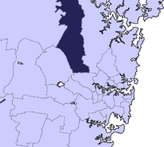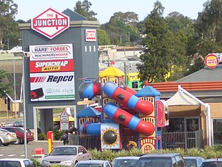
Richmond is a historic town northwest of Sydney, New South Wales, Australia. Richmond is in the local government area of the City of Hawkesbury and is part of the Sydney metropolitan area. It is located 19 metres above sea level on the alluvial Hawkesbury River flats, at the foot of the Blue Mountains. It is about 62 km by road from Sydney, 22 km from Penrith, 25 km from Blacktown, 39 km from Parramatta, 78 km from Lithgow and 7 km from Windsor. Richmond is now part of the Sydney urban area, with access to various amenities.

Windsor is a historic town north-west of Sydney, New South Wales, Australia. It is the council seat of the Hawkesbury local government area. The town sits on the Hawkesbury River, enveloped by farmland and Australian bush. Many of the oldest surviving European buildings in Australia are located at Windsor. It is 56 km (35 mi) north-west of the Sydney CBD, on the fringes of urban sprawl.

Greater Western Sydney (GWS) is a large region of the metropolitan area of Greater Sydney, New South Wales (NSW), Australia that generally embraces the north-west, south-west, central-west, far western and the Blue Mountains sub-regions within Sydney's metropolitan area and encompasses 11 local government areas: Blacktown, Blue Mountains, Camden, Campbelltown, Cumberland, Fairfield, Hawkesbury, Liverpool, Parramatta, Penrith and Wollondilly. It includes Western Sydney, which has a number of different definitions, although the one consistently used is the region composed of ten local government authorities, most of which are members of the Western Sydney Regional Organisation of Councils (WSROC). The NSW Government's Office of Western Sydney calls the region "Greater Western Sydney".

The Hills Shire is a local government area in the Greater Sydney region of Sydney, New South Wales, Australia. The area is north-west of the Sydney central business district, and encompasses 401 square kilometres (155 sq mi) stretching from the M2 Hills Motorway in the south to Wisemans Ferry on the Hawkesbury River in the north. The Hills Shire had a population of 191,876 as of the 2021 census.

Northmead is a suburb of Greater Western Sydney, in the state of New South Wales, Australia. Northmead is located 26 kilometres west of the Sydney central business district, in the local government area of the City of Parramatta.

Hornsby Shire is a local government area situated on the Upper North Shore as well as parts of the Hills District, of Sydney in the state of New South Wales, Australia. The shire stretches from the M2 Hills Motorway in the south to the Hawkesbury River town of Wisemans Ferry, some 53 kilometres (33 mi) to the north, making it the largest local government council in the Greater Sydney Metropolitan region by total area. As of the 2016 census the shire had an estimated population of 142,667.

The Great North Road is a historic road that was built to link early Sydney, in the Colony of New South Wales, now Australia, with the fertile Hunter Valley to the north. Built by convicts between 1825 and 1836, it traverses over 260 kilometres (162 mi) of the rugged terrain that hindered early agricultural expansion.
Wilberforce is a small town in New South Wales, Australia, in the local government area of the City of Hawkesbury. It is just beyond the outer suburbs of north-west Sydney and lies on the western bank of the Hawkesbury River.

Old Windsor Road is a notable and historic road in Sydney, Australia. It starts from Kellyville, New South Wales and ends at Northmead, New South Wales, just north of Parramatta, and acts as part of a main arterial between Parramatta and Windsor. A section at its southeastern end is a constituent part of Cumberland Highway.

Loder House is a heritage-listed residence at 126 George Street, Windsor, City of Hawkesbury, New South Wales, Australia. It was built in 1834. It has been used at times for various other purposes: as a bank, multiple restaurants, a guesthouse and a bookshop. It was added to the New South Wales State Heritage Register on 2 April 1999.
The Great Drain is a heritage-listed former farm and farm cottage and now motorcycle track, overnight accommodation and reserve located on the Wisemans Ferry Road, South Maroota in The Hills Shire local government area of New South Wales, Australia. It was built from 1795 to 1820 by probably by William Barren and William Harvey, stonemasons. It is also known as the Great Drain and two house sites. The property is owned by The Hills Shire Council and was added to the New South Wales State Heritage Register on 14 July 2000.

Wilberforce Park is a heritage-listed public parkland at 47 George Road, Wilberforce, City of Hawkesbury, New South Wales, Australia. It was first established in 1810 by Governor Lachlan Macquarie and surveyed by James Meehan in 1811. It is also known as Great Square, Reserved Square and the Recreation Ground. It was added to the New South Wales State Heritage Register on 18 November 2011.

Government Cottage Archaeological Site is the heritage-listed site of a cottage which served alternately as the base for the Colony of New South Wales' commandant of the Hawkesbury district, house of the district's magistrate and an "informal official residence" for the Governor of New South Wales when in the district. It is located at 41 George Street, Windsor, City of Hawkesbury, New South Wales, Australia. The original house was built from 1796 to 1815 and demolished c. 1920-21. It was also known as Commandant's House and Government House. It was added to the New South Wales State Heritage Register on 4 February 2011.

Macquarie Arms Hotel is a heritage-listed hotel at Thompson Square in Windsor, New South Wales, Australia. It is also known as the Royal Hotel. It was added to the New South Wales State Heritage Register on 2 April 1999.

McQuade Park is a heritage-listed park and sporting venue at 361 George Street, Windsor, City of Hawkesbury, New South Wales, Australia. The park was set aside by Governor Lachlan Macquarie in 1810, first surveyed by James Meehan in 1811, and re-surveyed and significantly expanded by G. B. White in 1827. It is also known as The Great Square, Church Green and Windsor Park. The property is owned by Hawkesbury City Council. It was added to the New South Wales State Heritage Register on 14 January 2011.

Mountain View is a heritage-listed residence at 22 Inalls Lane, Richmond, City of Hawkesbury, New South Wales, Australia. It was built from 1804 to 1870 by Lewis Jones and James Vincent. It is also known as Dight's Farm. It was added to the New South Wales State Heritage Register on 2 April 1999.

Windsor Uniting Church and Hall is a heritage-listed church precinct at Macquarie Street, Windsor, City of Hawkesbury, New South Wales, Australia. The church was built in 1875–76 following the destruction of the original church in a fire, while the Church Hall, which survived the fire, dates from 1861. Originally a Methodist church, it became part of the Uniting Church in Australia following the Methodist Church's amalgamation in 1977. It was added to the New South Wales State Heritage Register on 2 April 1999.

Windsor Court House is a heritage-listed courthouse at Court and Pitt Streets, Windsor, City of Hawkesbury, New South Wales, Australia. It was designed by Francis Greenway with a later extension by James Barnet and built from 1821 to 1822 by William Cox. It was added to the New South Wales State Heritage Register on 2 April 1999.
The North Street residences are a group of individually heritage-listed residences in North Street, Windsor, City of Hawkesbury, New South Wales, Australia. It is also known as the North Street Group. The cottages were added to the New South Wales State Heritage Register on 2 April 1999. They are often grouped with the adjacent former Court House Hotel building. The residence, along with the hotel, had previously been listed both jointly and individually on the former Register of the National Estate on 21 March 1978.
White Hart Inn Archaeological Site is a heritage-listed inn and archaeological site at Windsor Road, Beaumont Hills in The Hills Shire local government area of New South Wales, Australia. It was built from 1827 to. The property is owned by NSW Department of Planning, Industry and Environment, a department of the Government of New South Wales. The site was added to the New South Wales State Heritage Register on 24 August 2018.


