El Paso County is the westernmost county in the U.S. state of Texas. As of the 2020 census, the population was 865,657, making it the ninth-most populous county in the state of Texas. Its seat is the city of El Paso, the sixth-most populous city in Texas and the 22nd-most populous city in the United States. The county was created in 1850 and later organized in 1871.

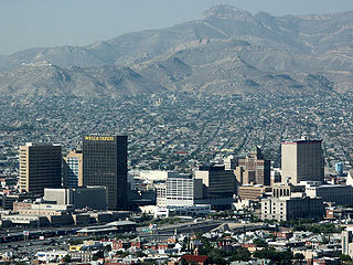
El Paso is a city in and the seat of El Paso County in the western corner of the U.S. state of Texas. The 2020 population of the city from the U.S. Census Bureau was 678,815, making it the 23rd-largest city in the U.S., the sixth-largest city in Texas, and the second-largest city in the Southwestern United States behind Phoenix, Arizona. The city is also the second-largest majority-Hispanic city in the U.S., with 81% of its population being Hispanic. Its metropolitan statistical area covers all of El Paso and Hudspeth counties in Texas, and had a population of 868,859 in 2020. El Paso has consistently been ranked as one of the safest large cities in America.
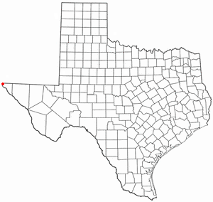
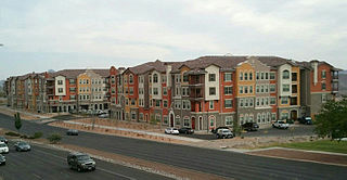
Vinton is a village in El Paso County, Texas, United States. The population was 1,971 at the 2010 census. It is part of the El Paso Metropolitan Statistical Area.
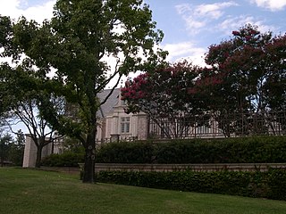
Preston Hollow is a neighborhood in north Dallas, Texas, USA. It is bordered on the south by the city of University Park, Texas.

Franklin Mountains State Park is a Texas state park in El Paso, Texas, in the United States. Park headquarters are located at an elevation of 5,426 feet (1,654 m) with the highest peak reaching 7,192 feet (2,192 m). It is one of the largest urban parks in the nation lying completely within city limits, covering 24,247.56 acres (9,813 ha). Franklin Mountains State Park is open year-round for recreational hiking, mountain biking, picnicking and scenic driving and vistas.

The El Paso Independent School District is the largest school district serving El Paso, Texas (USA). Originally organized in 1883, it is currently the largest district in the Texas Education Agency's Educational Service Center (ESC) Region 19, as well as the largest district within the city of El Paso and El Paso County. The EPISD also provides public education to the children of U.S. Army soldiers stationed at Fort Bliss. The district headquarters are located in El Paso.

Loop 375 is a beltway that partially encircles the city of El Paso, Texas. The beltway is mostly a freeway, except for its northern section, which includes at-grade intersections. The highway passes through various areas of El Paso, funneling traffic within and around the city. The road is known locally under different names, as Woodrow Bean Transmountain Drive in the northern section, Purple Heart Memorial Freeway in the northeastern section, Joe Battle Boulevard in the eastern section, the César Chávez Border Highway in the southern section, and the Border West Expressway on the southwest section.

Northeast El Paso is part of the city of El Paso, Texas and is located north of Central El Paso, and east of the Franklin Mountains. Its southern boundary is variously given as Fred Wilson Boulevard or Cassidy Road and Van Buren Avenue, and it extends northward to the New Mexico state line; some portions of this region lie outside the city limits, including parts of Franklin Mountains State Park and areas of Fort Bliss: the Logan area of Fort Bliss around Chapin High School and Castner Range, an old firing range northwest of Hondo Pass Avenue and Gateway South Boulevard. Development of Northeast El Paso, which had begun before the Second World War around the Logan area, started in earnest during the 1950s, when many homes were demolished in the process of the construction of Interstate 10. It is one of the more ethnically diverse areas of town due to a high concentration of enlisted military families. Northeast El Paso has historically not developed at a rate comparable to East El Paso and Northwest El Paso, but in recent years, it has seen an increase in development. It is expected that the population in Northeast El Paso will grow more rapidly as a result of the troop increase for Fort Bliss in the coming years. Northeast El Paso has gained recognition throughout the city for schools like Parkland, Irvin, Andress and Chapin because of their outstanding athletic programs.

East El Paso is an area of El Paso, Texas, United States, that is located north of Interstate 10, east of Airway Blvd., and south of Montana Ave. East El Paso is the fastest growing area of town. With a population of over 150,000, east El Paso is also the largest area of town. Its neighborhoods are mainly middle-class, but east El Paso does have a considerable number of affluent neighborhoods. East El Paso is noted also for its ridges and cliffs which offer desirable views of the Lower Valley, Ciudad Juárez, the Franklin Mountains, and Downtown El Paso. It also possesses the greatest number of entertainment venues in the city.

Franklin High School is a public high school located on the west side of El Paso, Texas, which is part of the El Paso Independent School District. It opened in 1993. Its name refers to the nearby Franklin Mountains. The student population of the school is between 2,000 and 3,000 annually. Since 2022, the principal has been Amanda Bowser.
Coronado High School in El Paso, Texas, United States is located on the west side of El Paso near the intersection of North Mesa Street and Resler Drive. It serves the southern part of west El Paso: east of Interstate 10, from the vicinity of Executive Center Boulevard north approximately three miles to around Coronado Arroyo, a normally dry stream bed running west down from the Franklin Mountains just north of Escondido Drive; and the portion of the Upper Valley which lies south of Country Club Road. Most of the Coronado attendance zone is zoned to Morehead Middle School for grades six to eight. The elementary schools in the Coronado feeder pattern include Dr. Green, L.B Johnson, Putnam, Carlos Rivera, Western Hills, and Zach White. The Upper Valley portion of the Coronado attendance area is zoned to Zach White Elementary and Lincoln Middle School, except for the Buena Vista neighborhood around Interstate 10 and West Paisano Drive, which is zoned to Johnson and Morehead. Dr. Green, L.B Johnson, Putnam, Carlos Rivera and Western Hills elementary schools all graduate into Morehead Middle School.
Canutillo Independent School District (CISD) is a public school district with its headquarters in El Paso, Texas. Dr. Pedro Galaviz is the Superintendent of Schools.

Park Foothills is a neighborhood in Northeast El Paso. It is located west of U.S. 54 to the Franklin Mountains, and from Mountain Ridge Drive and Atlas Avenue north to the boundary of Castner Range at Hondo Pass Avenue, mainly on a hill known as Wingate Point down which Hondo Pass and Hercules Avenue run, which forms part of the eastern foothills of the Franklin Mountains. It encompasses the officially recognized neighborhoods of Park Foothills and Sunrise Acres West, which includes the area east of Echo Street to the Patriot Freeway. Park Foothills is mainly residential and developed piecemeal as part of a slow ongoing process, consisting of apartment complexes of varying sizes and houses of varying styles built either individually or as part of small developments constructed beginning in the early 1950s, with a commercial area along Gateway South Boulevard at its eastern edge and smaller business districts around the intersections of Hercules Avenue and Leo Street, Magnetic Street and Hondo Pass Avenue, and Zion Drive with Alabama Street. Many of Park Foothills' streets are named for minerals or gemstones or have names with an astronomical theme. Sunrise Park at the center of Park Foothills is its only park of any size.

Sunset Heights is a historic area in El Paso, Texas; which has existed since the latter part of the 1890s. Many wealthy residents have had their houses and mansions built on this hill. Although some buildings have been renovated to their former glory, many have been neglected and have deteriorated. An organization, the Sunset Heights Improvement Association helps neighbors on a fixed income to manage home maintenance and also sponsors an annual tour.

El Paso High School is the oldest operating high school in El Paso, Texas, and is part of the El Paso Independent School District. It serves the west-central section of the city, roughly south and west of the Franklin Mountains and north of Interstate 10 to the vicinity of Executive Center Boulevard. It is fed by Wiggs Middle School, into which the three elementary schools in its feeder pattern, Lamar, Mesita, and Vilas, graduate.
North Hills is a residential neighborhood in the Northeast section of El Paso, Texas.
Mountain View is a neighborhood in Northeast El Paso, in the city of El Paso, Texas. Its boundaries are commonly considered to be Dyer Street on the west, Railroad Drive on the east, Hondo Pass Avenue on the north, and on the south, Hercules Avenue and the intersection of Diana Drive and Railroad Drive; this includes the city-designated neighborhoods of Las Sierras and Restlawn as well as Mountain View North and South, which lie east of Diana Drive.
Andress High School is a public high school located on the northeast side of El Paso, Texas. The school serves about 2,000 students in the El Paso Independent School District. It is located in the Sun Valley neighborhood at the intersection of Sun Valley Drive and Mackinaw Street. Andress High is currently the northernmost of EPISD's ten comprehensive high schools, serving the portion of Northeast El Paso between the Franklin Mountains and McCombs Street and north of Woodrow Bean Transmountain Road west of Girl Scout Way and Fairbanks Drive east of it, up to the New Mexico state line. Virtually all of the northern half of the Andress attendance zone, that is, north of Loma Real Avenue, is undeveloped land, most of it slated for future residential development. A new high school, as yet unnamed, which will serve what is now the portion of the Andress attendance zone north of the Patriot Freeway to the New Mexico state line, is in the planning stages, and was originally slated to be built using funding from a 2007 bond issue; however, in 2014 it was decided by the EPISD board of managers that development of the area did not yet justify a new high school and the funds set aside for its construction were reallocated. The money allocated went to Franklin High School.
West central El Paso is part of the city of El Paso, Texas, USA. The area is located north of Interstate 10 and west of the Franklin Mountains. The University of Texas at El Paso is located in the heart of the area. It is part of the El Paso Independent School District.
Canutillo High School is a public high school in Canutillo, Texas. It is the only zoned comprehensive high school in the Canutillo Independent School District.
