Powałkowice is a village in the administrative district of Gmina Osięciny, within Radziejów County, Kuyavian-Pomeranian Voivodeship, in north-central Poland. It lies approximately 6 kilometres (4 mi) south of Osięciny, 14 km (9 mi) south-east of Radziejów, and 51 km (32 mi) south of Toruń.
Trojaczek is a village in the administrative district of Gmina Piotrków Kujawski, within Radziejów County, Kuyavian-Pomeranian Voivodeship, in north-central Poland. It lies approximately 7 kilometres (4 mi) south-east of Piotrków Kujawski, 14 km (9 mi) south of Radziejów, and 58 km (36 mi) south of Toruń.
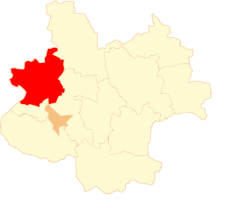
Rzadka Wola is a village in the administrative district of Gmina Brześć Kujawski, within Włocławek County, Kuyavian-Pomeranian Voivodeship, in north-central Poland. It lies approximately 4 kilometres (2 mi) south-west of Brześć Kujawski, 15 km (9 mi) south-west of Włocławek, and 53 km (33 mi) south of Toruń.
Łosośniki is a village in the administrative district of Gmina Mogilno, within Mogilno County, Kuyavian-Pomeranian Voivodeship, in north-central Poland. It lies approximately 9 kilometres (6 mi) south-east of Mogilno, 60 km (37 mi) south of Bydgoszcz, and 65 km (40 mi) south-west of Toruń.
Wronowy is a village in the administrative district of Gmina Strzelno, within Mogilno County, Kuyavian-Pomeranian Voivodeship, in north-central Poland. It lies approximately 7 kilometres (4 mi) south-east of Strzelno, 21 km (13 mi) east of Mogilno, 57 km (35 mi) south-west of Toruń, and 62 km (39 mi) south of Bydgoszcz.
Załusin is a village in the administrative district of Gmina Bedlno, within Kutno County, Łódź Voivodeship, in central Poland. It lies approximately 18 kilometres (11 mi) south-east of Kutno and 42 km (26 mi) north of the regional capital Łódź.
Stare Pieścirogi is a village in the administrative district of Gmina Nasielsk, within Nowy Dwór Mazowiecki County, Masovian Voivodeship, in east-central Poland. It lies approximately 4 kilometres (2 mi) south-west of Nasielsk, 18 km (11 mi) north of Nowy Dwór Mazowiecki, and 45 km (28 mi) north-west of Warsaw.
Smogorzewo Pańskie is a village in the administrative district of Gmina Winnica, within Pułtusk County, Masovian Voivodeship, in east-central Poland. It lies approximately 18 kilometres (11 mi) south-west of Pułtusk and 42 km (26 mi) north of Warsaw.
Smogorzewo Włościańskie is a village in the administrative district of Gmina Winnica, within Pułtusk County, Masovian Voivodeship, in east-central Poland. It lies approximately 18 kilometres (11 mi) south-west of Pułtusk and 42 km (26 mi) north of Warsaw.
Wieruszew is a village in the administrative district of Gmina Kazimierz Biskupi, within Konin County, Greater Poland Voivodeship, in west-central Poland. It lies approximately 6 kilometres (4 mi) south-east of Kazimierz Biskupi, 8 km (5 mi) north of Konin, and 91 km (57 mi) east of the regional capital Poznań.
Wola Łaszczowa is a village in the administrative district of Gmina Kazimierz Biskupi, within Konin County, Greater Poland Voivodeship, in west-central Poland. It lies approximately 7 kilometres (4 mi) south-east of Kazimierz Biskupi, 6 km (4 mi) north of Konin, and 91 km (57 mi) east of the regional capital Poznań.
Sławoszewo is a village in the administrative district of Gmina Kleczew, within Konin County, Greater Poland Voivodeship, in west-central Poland. It lies approximately 5 kilometres (3 mi) east of Kleczew, 19 km (12 mi) north of Konin, and 90 km (56 mi) east of the regional capital Poznań.
Belny is a village in the administrative district of Gmina Sompolno, within Konin County, Greater Poland Voivodeship, in west-central Poland. It lies approximately 6 kilometres (4 mi) east of Sompolno, 31 km (19 mi) north-east of Konin, and 114 km (71 mi) east of the regional capital Poznań.
Dzierawy is a village in the administrative district of Gmina Koło, within Koło County, Greater Poland Voivodeship, in west-central Poland. It lies approximately 4 kilometres (2 mi) north-west of Koło and 116 km (72 mi) east of the regional capital Poznań.
Ruchenna is a village in the administrative district of Gmina Koło, within Koło County, Greater Poland Voivodeship, in west-central Poland. It lies approximately 4 kilometres (2 mi) north of Koło and 118 km (73 mi) east of the regional capital Poznań.
Drzewce is a village in the administrative district of Gmina Osiek Mały, within Koło County, Greater Poland Voivodeship, in west-central Poland. It lies approximately 5 kilometres (3 mi) west of Osiek Mały, 9 km (6 mi) north-west of Koło, and 115 km (71 mi) east of the regional capital Poznań.
Ośno Górne is a village in the administrative district of Gmina Sompolno, within Konin County, Greater Poland Voivodeship, in west-central Poland. It lies approximately 6 kilometres (4 mi) east of Sompolno, 31 km (19 mi) north-east of Konin, and 114 km (71 mi) east of the regional capital Poznań.
Ostrowąż is a village in the administrative district of Gmina Ślesin, within Konin County, Greater Poland Voivodeship, in west-central Poland. It lies approximately 8 kilometres (5 mi) north-west of Ślesin, 23 km (14 mi) north of Konin, and 90 km (56 mi) east of the regional capital Poznań.
Olimpia is a village in the administrative district of Gmina Brudzew, within Turek County, Greater Poland Voivodeship, in west-central Poland. It lies approximately 4 kilometres (2 mi) north of Brudzew, 13 km (8 mi) north-east of Turek, and 118 km (73 mi) east of the regional capital Poznań.
Korytków is a village in the administrative district of Gmina Turek, within Turek County, Greater Poland Voivodeship, in west-central Poland. It lies approximately 6 kilometres (4 mi) east of Turek and 122 km (76 mi) east of the regional capital Poznań.