The Taupo Volcanic Zone (TVZ) is a volcanic area in the North Island of New Zealand that has been active for the past two million years and is still highly active. Mount Ruapehu marks its south-western end and the zone runs north-eastward through the Taupo and Rotorua areas and offshore into the Bay of Plenty. It is part of the larger Central Volcanic Region that extends further westward through the western Bay of Plenty to the eastern side of the Coromandel Peninsula and has been active for four million years. The Taupo Volcanic Zone is widening east–west at the rate of about 8 mm per year. It is named after Lake Taupo, the flooded caldera of the largest volcano in the zone.
The Waioeka River is found in the north of New Zealand's North Island. It flows north for 65 kilometres (40 mi) from Te Urewera National Park to reach the sea at Opotiki. It shares its estuary with the Otara River.
The Otara River is found in the north of New Zealand's North Island. It flows north for 35 kilometres (22 mi), reaching the sea at Opotiki in the eastern Bay of Plenty. It shares its estuary with the Waioeka River.

Te Kaha is a small New Zealand community situated in the Bay of Plenty near Opotiki. It has a population of about 387, up from 306 in 2006. Approximately 85% of whom are of Māori descent.

Taneatua is a small town in the Bay of Plenty region of New Zealand's North Island. The town is located southeast of Pekatahi, a similarly small settlement; Whakatane is the nearest significantly sized town. Just to the southwest of Taneatua, the Whakatane River and Waimana Rivers meet. The Whakatane River itself flows to the west of Taneatua, while the Waimana River is south of the township.

Motu River is a major waterway in the eastern portion of the North Island of New Zealand. It rises on the slopes of Maungahaumi on the southern side of the Raukumara Range south of Opotiki, heads east and cuts its way through the range, where its important tributaries merge with it, and empties into the Bay of Plenty to the north.
Eastern Bay of Plenty is a former New Zealand parliamentary electorate, which existed for one parliamentary term from 1993 to 1996, and was held by National's Tony Ryall.

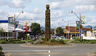
Opotiki College is a state secondary school located in Opotiki, in the Bay of Plenty, North Island, New Zealand.

Raukokore is a small settlement close to the East Cape in the northeastern North Island of New Zealand. It is located on State Highway 35, close to the mouth of the Raukokore River, 40 kilometres to the west of Hicks Bay.
Papatea Bay is one of numerous small bays which lie between the eastern end of the Bay of Plenty and East Cape in the northeast of New Zealand's North Island. a wide, gently curving bay, it lies approximately halfway between East Cape and Opotiki. The small settlement of Raukokore lies on the shore of the bay.
Maungahaumi is a mountain in the Raukumara Range in the northeast of New Zealand's North Island.
Te Karaka is a small settlement inland from Gisborne, in the northeast of New Zealand's North Island. It is located in the valley of the Waipaoa River close to its junction with its tributary, the Waihora River. Te Karaka is located on State Highway 2, and is the largest settlement between Gisborne and Opotiki in the Bay of Plenty.
Matawai is a small inland settlement in the Gisborne Region in the northeast of New Zealand's North Island. It is located on the upper reaches of the Motu River, in the Raukumara Range. It is on State Highway 2 between Gisborne and Opotiki.
The Matahaka River is a river of the Bay of Plenty Region of New Zealand. It is a tributary of the Nukuhou River, which it meets 15 kilometres (9 mi) southwest of Opotiki.
The Takaputahi River is a river of the Gisborne Region of New Zealand's North Island. It has its origins in numerous streams which rise in rough hill country close to the eastern end of the Bay of Plenty, the longest of which is the Rawea Stream. The Takaputahi flows generally east, away from the Bay of Plenty coast, before meeting the Motu River. Much of the river's length is within the Raukumara Forest Park.
The Waiotahe River is a river of the Bay of Plenty Region of New Zealand's North Island. It flows north from its origins west of Oponae to reach the Bay of Plenty 5 kilometres (3 mi) west of Opotiki.

The Bay of Plenty is a large bight in the northern coast of New Zealand's North Island. It stretches from the Coromandel Peninsula in the west to Cape Runaway in the east, a wide stretch of some 259 km of open coastline. The Bay of Plenty Region is situated around this body of water, also incorporating several large islands in the bay. The bay was named by James Cook after he noticed the abundant food supplies at several Māori villages there, in stark contrast to the earlier observations he had made in Poverty Bay.
The Waiaua River is a river of the Bay of Plenty Region of New Zealand's North Island. It flows generally northwest to reach the eastern end of the Bay of Plenty 10 kilometres (6 mi) east of Opotiki.
The Waikare River is a river in the Bay of Plenty Region of New Zealand' North Island. It flows north from its origins between the peaks of Matawhio and Papakai north of Lake Waikaremoana to reach the Whakatane River 25 kilometres (16 mi) east of Murupara.