Nyoni, Tanzania

Last updated
Nyoni
Village
CountryFlag of Tanzania.svg  Tanzania
Region Iringa Region
Time zone EAT (UTC+3)

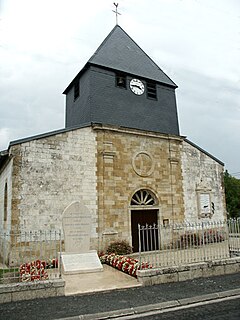
Nyoni is a village in the Iringa Region of the Tanzanian Southern Highlands. It is located along the A19 road. [1]

Iringa Region Region in Southern Highlands, Tanzania

Iringa is one of Tanzania's 31 administrative regions. The regional capital is Iringa. The region's population is 941,238. It is primarily agricultural and boasts the second-highest per-capita GDP in the country.

Tanzania Country in Africa

Tanzania officially the United Republic of Tanzania, is a country in eastern Africa within the African Great Lakes region. It borders Uganda to the north; Kenya to the northeast; Comoro Islands at the Indian Ocean to the east; Mozambique and Malawi to the south; Zambia to the southwest; and Rwanda, Burundi, and the Democratic Republic of the Congo to the west. Mount Kilimanjaro, Africa's highest mountain, is in north-eastern Tanzania.

A19 road (Tanzania) road in Tanzania

The A19 is an important road of southern Tanzania. It connects Mbamba Bay on Lake Malawi in the west with Mtwara on the Indian Ocean coast. En route it passes through some major towns including Songea. Its western point is located near 11°17′42″S34°48′7″E and its eastern point is located near 10°17′40″S40°10′43″E. At Masasi the B5 road forks off towards the northeast. At Mtwara the road runs past Mtwara before finally ending where it joins the B2 road.

Related Research Articles

Edgar County, Illinois County in the United States

Edgar County is a county located in the U.S. state of Illinois. As of the 2010 United States Census, the population was 18,576. Its county seat is Paris.

Google Maps web mapping service by Google

Google Maps is a web mapping service developed by Google. It offers satellite imagery, aerial photography, street maps, 360° panoramic views of streets, real-time traffic conditions, and route planning for traveling by foot, car, bicycle and air, or public transportation.

Google Earth 3D globe-based map program created by Google

Google Earth is a computer program that renders a 3D representation of Earth based primarily on satellite imagery. The program maps the Earth by superimposing satellite images, aerial photography, and GIS data onto a 3D globe, allowing users to see cities and landscapes from various angles. Users can explore the globe by entering addresses and coordinates, or by using a keyboard or mouse. The program can also be downloaded on a smartphone or tablet, using a touch screen or stylus to navigate. Users may use the program to add their own data using Keyhole Markup Language and upload them through various sources, such as forums or blogs. Google Earth is able to show various kinds of images overlaid on the surface of the earth and is also a Web Map Service client.

Google Street View feature of Google Maps which provides views from the street

Google Street View is a technology featured in Google Maps and Google Earth that provides interactive panoramas from positions along many streets in the world. It was launched in 2007 in several cities in the United States, and has since expanded to include cities and rural areas worldwide. Streets with Street View imagery available are shown as blue lines on Google Maps.

B roads in Zone 3 of the Great Britain numbering scheme list of roads in Great Britain

B roads are numbered routes in Great Britain of lesser importance than A roads. See the article Great Britain road numbering scheme for the rationale behind the numbers allocated.

Coole, Marne Commune in Grand Est, France

Coole is a commune in the Marne department in north-eastern France.

Outline of Google Overview of and topical guide to Google

The following outline is provided as an overview of and topical guide to Google:

Coverage of Google Street View timeline

Google Street View was first introduced in the United States on May 25, 2007, and until November 26, 2008, featured camera icon markers, each representing at least one major city or area, and usually the other nearby cities, towns, suburbs, and parks. Many areas that had coverage were represented by icons.

Carnon River river in Cornwall, United Kingdom

The Carnon River is a heavily polluted river in Cornwall, England. It starts in Chacewater. Trewedna Water and River Kennall flow into the Carnon before it merges with Tallack's Creek to become Restronguet Creek, which eventually flows into the English Channel at the mouth of Carrick Roads.

References

  1. Google Maps (Map). Google.