
Childe's Tomb is a granite cross on Dartmoor, Devon, England. Although not in its original form, it is more elaborate than most of the crosses on Dartmoor, being raised upon a constructed base, and it is known that a kistvaen is underneath.
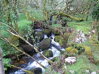
The Wallabrook is a river on Dartmoor, Devon, England.

Dartmeet is a popular tourist spot in the centre of Dartmoor, Devon, England at grid reference SX672731.
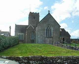
Holne is a village and civil parish on the southeastern slopes of Dartmoor in Devon, England. A community has existed here since at least the 11th century, and today a population of around 250 people is served by a church and a public house, the Church House Inn.

East Portlemouth is a small Devon village situated at the southern end of the Kingsbridge Estuary, on the south Devon Coast. The population of this parish taken at the 2011 census was 162. The village is sited on a hill giving views to the north to Kingsbridge and on a clear day as far as Dartmoor. There is a small ferry that runs to Salcombe in the opposite side of the estuary, and a beach that is popular with holidaymakers.

The Erme is a river in south Devon, England. From its source on Dartmoor it flows in a generally southerly direction past some of the best-preserved archaeological remains on the moor. It leaves the moor at the town of Ivybridge and continues southward, passing the settlements of Ermington, Modbury and Holbeton. Near Holbeton it becomes a ria and empties into the English Channel in Bigbury Bay, between the rivers Yealm and Avon.

The River Lemon is a 9.9 miles river in the county of Devon in southwest England. It is a tributary of the River Teign, starting on Dartmoor by Haytor, and ending in Newton Abbot. It rises on the south-east side of Dartmoor near Haytor, joins with the River Sig and the Langworthy Brook at Sigford, then passes the village of Bickington. Lower down, it is joined by the Kestor Brook and it then flows through the woods in Bradley Valley, past the manor house of Bradley, and through the town of Newton Abbot where it flows through a 440-yard-long tunnel below the town centre. Just below the town, the river joins the River Teign at 50.517°N 3.607°W, near the head of its estuary.

Great Rock Mine is a disused micaceous haematite mine about 3 km north of the town of Bovey Tracey in Devon, England. It was worked from the nineteenth century until 1969, and was the last active mine in the Dartmoor National Park area.

Wistman's Wood is one of three remote high-altitude oakwoods on Dartmoor, Devon, England.

Combeinteignhead or Combe-in-Teignhead is a village in Teignbridge, South Devon, England. It lies within the civil parish of Haccombe with Combe, between Newton Abbot and Shaldon, about half a mile (1 km) inland from the estuary of the River Teign.
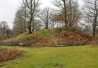
Hembury Castle is an Iron Age hillfort about a mile north-west of the village of Buckfast on the south-eastern edge of Dartmoor in Devon, England. The fort is about 178 metres above sea level on a promontory between the River Dart on the east and the Holy Brook, south-west. The slope down to the River Dart is very steep and is covered by Hembury Woods which is now a Site of Special Scientific Interest.
Burrator is a grouped parish council in the English county of Devon. It is entirely within the boundaries of the Dartmoor National Park and was formed in 1973 as a result of the Local Government Act 1972 from the older councils of Meavy, Sheepstor and Walkhampton.
Nymet Rowland is a small village, and civil parish of the same name, in central Devon, England, north of Dartmoor. It takes part of its name from "Nymet", the old name for the nearby River Yeo. It is located just to the west of Lapford and south of Nymet Bridge, within the Mid Devon local authority area. Historically it formed part of Winkleigh Hundred; today the North Tawton hundred. It falls within the Cadbury Deanery for ecclesiastical purposes.

Canonteign Falls is a waterfall in the historic tything of Canonteign in the Teign Valley and Dartmoor National Park near Chudleigh, South Devon, England.

Yarner Wood & Trendlebere Down in Dartmoor, Devon, England is a woodland managed by Natural England. The woodland is part of the East Dartmoor Woods and Heaths National Nature Reserve. The entire area is 777 acres (3.14 km2) while Yarner Wood is 365 acres (1.48 km2). Since 1985 the site has been designated a Site of Special Scientific Interest. Many types of tree grow in Yarner Wood including oak, birch, scots pine, larch and beech. It is home to buzzards, sparrow hawks, nightjars and pied flycatchers.
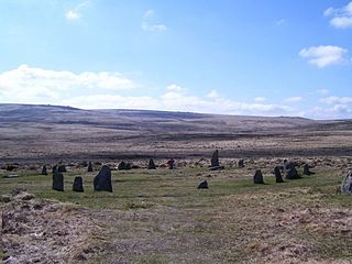
ScorhillStone Circle is now the commonly known name for Gidleigh Stone Circle or Steep Hill Stone Circle, one of Devon's biggest and most intact stone circles, situated on Gidleigh Common near the village of Gidleigh in the north east of Dartmoor, in the United Kingdom. It is an English Heritage scheduled monument and has been described as Devon's finest stone circle.

Dendles Wood is an area of protected oak-beech woodland located on the southern edge of Dartmoor, in the English county of Devon. Forming part of the Dartmoor Special Area of Conservation, the wood is also a Site of Special Scientific Interest, and 30 hectares of it has been designated a national nature reserve. It is one of five woodlands within Dartmoor that have been protected as national nature reserves. Dendles Wood and the adjacent Hawns Wood are sometimes known collectively as Hawns and Dendles. The wood supports a variety of flora and fauna, representative of upland oakwoods. In particular, it has a rich variety of moss and lichen, and several breeding bird species.

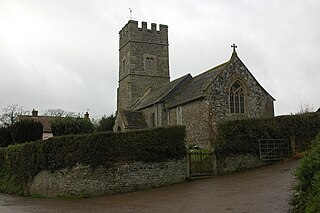
North Bovey is a village and civil parish situated on the south-eastern side of Dartmoor National Park, Devon, England, about 11 miles WSW of the city of Exeter and 1.5 miles SSW of Moretonhampstead. The village lies above the eastern bank of the River Bovey from which it takes its name. In 2001 the population of the parish was 274, compared to 418 in 1901 and 519 in 1801.

West Buckfastleigh is a small civil parish on the eastern border of Dartmoor in Devon, England. Situated within the parish are the village of Scorriton and the hamlets of Michelcombe and Combe.

Holy Brook is a tributary of the River Dart in Devon, England. It rises on the eastern flank of the 495 m (1,624 ft)-high hill of Snowdon on Dartmoor, at grid reference SX678687. It was once a much longer stream, but its headwaters were long ago captured by the River Mardle, and the physical evidence of this stream capture is clear when viewed from higher up the side of Snowdon.

