
The Challenger Deep is the deepest known point of the seabed of Earth, located in the western Pacific Ocean at the southern end of the Mariana Trench, in the ocean territory of the Federated States of Micronesia. According to the GEBCO Gazetteer of Undersea Feature Names the depression's depth is 10,920 ± 10 m (35,827 ± 33 ft) at 11°22.4′N142°35.5′E, although its exact geodetic location remains inconclusive and its depth has been measured at 10,902–10,929 m (35,768–35,856 ft) by deep-diving submersibles, remotely operated underwater vehicles, benthic landers, and sonar bathymetry. The differences in depth estimates and their geodetic positions are scientifically explainable by the difficulty of researching such deep locations.
The Mariana Trench is an oceanic trench located in the western Pacific Ocean, about 200 kilometres (124 mi) east of the Mariana Islands; it is the deepest oceanic trench on Earth. It is crescent-shaped and measures about 2,550 km (1,580 mi) in length and 69 km (43 mi) in width. The maximum known depth is 10,984 ± 25 metres at the southern end of a small slot-shaped valley in its floor known as the Challenger Deep. The deepest point of the trench is more than 2 km (1.2 mi) farther from sea level than the peak of Mount Everest.

The Auckland Islands are an archipelago of New Zealand, lying 465 km (289 mi) south of the South Island. The main Auckland Island, occupying 460 km2 (180 sq mi), is surrounded by smaller Adams Island, Enderby Island, Disappointment Island, Ewing Island, Rose Island, Dundas Island, and Green Island, with a combined area of 570 km2 (220 sq mi). The islands have no permanent human inhabitants.

The Ross Sea is a deep bay of the Southern Ocean in Antarctica, between Victoria Land and Marie Byrd Land and within the Ross Embayment, and is the southernmost sea on Earth. It derives its name from the British explorer James Clark Ross who visited this area in 1841. To the west of the sea lies Ross Island and Victoria Land, to the east Roosevelt Island and Edward VII Peninsula in Marie Byrd Land, while the southernmost part is covered by the Ross Ice Shelf, and is about 200 miles (320 km) from the South Pole. Its boundaries and area have been defined by the New Zealand National Institute of Water and Atmospheric Research as having an area of 637,000 square kilometres (246,000 sq mi).

The Chatham Rise is an area of ocean floor to the east of New Zealand, forming part of the Zealandia continent. It stretches for some 1,000 kilometres (620 mi) from near the South Island in the west, to the Chatham Islands in the east. It is New Zealand's most productive and important fishing ground, as well as important habitat for whales.

The Kermadec Trench is a linear ocean trench in the south Pacific Ocean. It stretches about 1,000 km (620 mi) from the Louisville Seamount Chain in the north (26°S) to the Hikurangi Plateau in the south (37°S), north-east of New Zealand's North Island. Together with the Tonga Trench to the north, it forms the 2,000 km (1,200 mi)-long, near-linear Kermadec-Tonga subduction system, which began to evolve in the Eocene when the Pacific Plate started to subduct beneath the Australian Plate. Convergence rates along this subduction system are among the fastest on Earth, 80 mm (3.1 in)/yr in the north and 45 mm (1.8 in)/yr in the south.

The Census of Marine Life was a 10-year, US $650 million scientific initiative, involving a global network of researchers in more than 80 nations, engaged to assess and explain the diversity, distribution, and abundance of life in the oceans. The world's first comprehensive Census of Marine Life — past, present, and future — was released in 2010 in London. Initially supported by funding from the Alfred P. Sloan Foundation, the project was successful in generating many times that initial investment in additional support and substantially increased the baselines of knowledge in often underexplored ocean realms, as well as engaging over 2,700 different researchers for the first time in a global collaborative community united in a common goal, and has been described as "one of the largest scientific collaborations ever conducted".

Cape Adare is a prominent cape of black basalt forming the northern tip of the Adare Peninsula and the north-easternmost extremity of Victoria Land, East Antarctica.
Davidson Seamount is a seamount located off the coast of Central California, 80 mi (129 km) southwest of Monterey and 75 mi (121 km) west of San Simeon. At 26 mi (42 km) long and 8 mi (13 km) wide, it is one of the largest known seamounts in the world. From base to crest, the seamount is 7,480 ft (2,280 m) tall, yet its summit is still 4,101 ft (1,250 m) below the sea surface. The seamount is biologically diverse, with 237 species and 27 types of deep-sea coral having been identified.
The Molloy Deep is a bathymetric feature in the Fram Strait, within the Greenland Sea east of Greenland and about 160 km west of Svalbard. It is the location of the deepest point in the Arctic Ocean. The Molloy Deep, Molloy Hole, Molloy Fracture Zone, and Molloy Ridge were named after Arthur E. Molloy, a U.S. Navy research scientist who worked in the North Atlantic, North Pacific and Arctic Oceans in the 1950s-1970s.
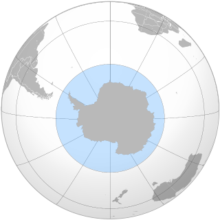
The Southern Ocean, also known as the Antarctic Ocean, comprises the southernmost waters of the world ocean, generally taken to be south of 60° S latitude and encircling Antarctica. With a size of 20,327,000 km2 (7,848,000 sq mi), it is regarded as the second-smallest of the five principal oceanic divisions: smaller than the Pacific, Atlantic, and Indian oceans but larger than the Arctic Ocean.

NOAAS Okeanos Explorer is a converted United States Navy ship, now an exploratory vessel for the National Oceanic and Atmospheric Administration (NOAA), officially launched in 2010. Starting in 2010, NOAA entered into a five-year partnership with the San Francisco Exploratorium. The focus is on gathering scientific information about oceans for the public as well as for scientific uses. As much as 95% of the ocean remains unexplored, NOAA officials said. The ship is equipped with cameras and will provide real-time viewing of the ocean floor for scientists and for the public.
Schmidt Ocean Institute (SOI) is a 501(c)(3) non-profit operating foundation established in March 2009 by Eric Schmidt and Wendy Schmidt. The Institute's goal is to advance innovative oceanographic research and discovery through technological advancement, collaborative research, outreach and education, and open sharing of information. SOI supports oceanographic research by providing collaborators with free ship time aboard their research vessel Falkor (too) and expert technical shipboard support. Collaborating researchers and institutions utilizing Falkor commit to openly share and communicate the outcomes of their research, including raw observations and data. Research proposals are reviewed through a peer-reviewed process and assessed based on their potential for technological innovation, oceanographic research, and overall impact. Since its inception in 2009, SOI has supported over 60 expeditions all around the globe.
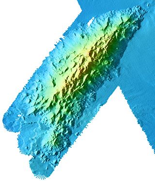
The Bounty Trough is a major submerged feature, a bathymetric depression, of the oceanography of the southwest Pacific Ocean. It is located off the east coast of New Zealand's South Island. It is named after the Bounty Islands near the Eastern end of the trough. The islands, in turn, are named after HMS Bounty.
The International Ocean Discovery Program (IODP) is an international marine research collaboration dedicated to advancing scientific understanding of the Earth through drilling, coring, and monitoring the subseafloor. The research enabled by IODP samples and data improves scientific understanding of changing climate and ocean conditions, the origins of ancient life, risks posed by geohazards, and the structure and processes of Earth's tectonic plates and uppermost mantle. IODP began in 2013 and builds on the research of four previous scientific ocean drilling programs: Project Mohole, Deep Sea Drilling Project, Ocean Drilling Program, and Integrated Ocean Drilling Program. Together, these programs represent the longest running and most successful international Earth science collaboration.
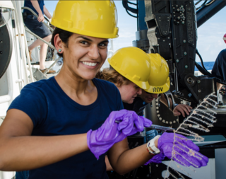
Diva Joan Amon is a marine biologist from Trinidad. She is currently a post-doctoral researcher in the Benioff Ocean Initiative at the University of California, Santa Barbara and a 2022 Pew Marine Fellow. Previously, she was a Marie Skłodowska-Curie Actions (MSCA) Research Fellow at the Natural History Museum, London.

Falsimargarita callista is a species of sea snail, a marine gastropod mollusk, in the family Calliostomatidae within the superfamily Trochoidea, the top snails, turban snails and their allies.
Helen Clare Bostock, is an oceanographer researching past, present and future conditions in the Southern Ocean. In 2011 she led a research voyage on board the RV Tangaroa to the Solander Trough region of the Tasman Sea. Two years later she was deputy voyage leader for an expedition to the Mertz Polynya, Antarctica. In 2016 she was awarded the McKay Hammer, for her combined research achievements between 2013 and 2016.

Alan John Jamieson is a Scottish marine biologist, engineer, explorer and author, best known for his deep-sea exploration and study of life at the deepest places in the oceans. He is known for extensive use of deep-sea landers to establish the maximum depth and community dynamics of many organismal groups, as well as the discovery of many new species and highlighting the presence of anthropogenic impacts at full ocean depth. During the Five Deeps Expedition, and follow on expeditions in 2020, he completed various dives in a manned submersible to some of the deepest places in the world. He has published over 100 scientific papers and participated in 65 deep-sea expeditions.
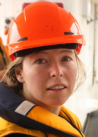
Sadie Mills is a New Zealand marine biologist and an invertebrate collection manager at New Zealand's National Institute of Water and Atmospheric Research. Mills specialises in the taxonomy of Ophiuroidea and has written a book titled Extraordinary echinoderms : a guide to the echinoderms of New Zealand. Mills has participated in over 20 research expeditions while working for the National Institute of Water and Atmospheric Research. She was the co-leader of the Ocean Census Bounty Trough research expedition.
