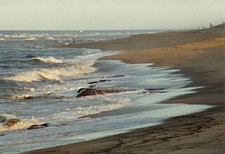
Cape Cod is a hook-shaped peninsula extending into the Atlantic Ocean from the southeastern corner of mainland Massachusetts, in the northeastern United States. Its historic, maritime character and ample beaches attract heavy tourism during the summer months. The name Cape Cod, coined in 1602 by Bartholomew Gosnold, is the ninth oldest English place-name in the U.S.

Chatham is a town in Barnstable County, Massachusetts, United States. Chatham is located at the southeast tip of Cape Cod and has historically been a fishing community. First settled by the English in 1664, the township was originally called Monomoit based on the indigenous population's term for the region. Chatham was incorporated as a town on June 11, 1712, and has become a summer resort area. The population was 6,594 at the 2020 census, and can swell to 25,000 during the summer months. There are four villages that comprise the town, those being Chatham (CDC), South Chatham, North Chatham, and West Chatham. Chatham is home to the Monomoy National Wildlife Refuge, and the decommissioned Monomoy Point Light both located on Monomoy Island. A popular attraction is the Chatham Light, which is an operational lighthouse that is operated by the United States Coast Guard.

The Watuppa Branch is a roughly six-mile freight railroad line in southeastern Massachusetts. The track originates at Mount Pleasant Junction, where it diverges from the New Bedford Secondary, and runs through Dartmouth before terminating in north Westport. The line is owned by the Massachusetts Department of Transportation and is operated by Bay Colony Railroad, which interchanges with Massachusetts Coastal Railroad at the junction in New Bedford. The abandoned western portion of the right-of-way is used by the Quequechan River Rail Trail.

Massachusetts Route 137 is a 6.833-mile-long (10.997 km) north–south state route on Cape Cod in the U.S. state of Massachusetts. The route begins at an intersection with Route 28 in the town of Chatham. The route serves as a connector between Chatham, the town of Harwich and Brewster. In Brewster, Route 137 ends at a junction with Route 6A, a short distance southwest of Route 124.

Route 124 is a 6.8-mile-long (10.9 km) north–south state highway located in the towns of Harwich and Brewster in the U.S. state of Massachusetts. Its southern terminus is at Route 28 and Route 39 in Harwich and its northern terminus is at Route 6A in Brewster.

The Cape Cod Rail Trail (CCRT) is a 25.5-mile (41.0 km) paved rail trail located on Cape Cod in Massachusetts. The trail route passes through the towns of Yarmouth, Dennis, Harwich, Brewster, Orleans, Eastham, and Wellfleet. It connects to the 6-plus mile (10 km) Old Colony Rail Trail leading to Chatham, the 2 mile Yarmouth multi-use trail, and 8 miles (13 km) of trails within Nickerson State Park. Short side trips on roads lead to national seashore beaches including Coast Guard Beach at the end of the Nauset Bike Trail in Cape Cod National Seashore. The trail is part of the Claire Saltonstall Bikeway.
The Fairhaven Branch Railroad was a short-line railroad in Massachusetts. It ran from West Wareham on the Cape Cod main line of the Old Colony Railroad, southwest to Fairhaven, a town across the Acushnet River from New Bedford.

The Shining Sea Bikeway is a rail trail on Cape Cod in Falmouth, Massachusetts, United States. The path runs for 10.7 miles (17.2 km) from the Steamship Authority ferry terminal in Woods Hole to North Falmouth.

The Norwottuck Branch Rail Trail, formerly the Norwottuck Rail Trail, is an 11-mile (18 km) combination bicycle/pedestrian paved rail trail running from Northampton, Massachusetts, through Hadley and Amherst, to Belchertown, Massachusetts. It opened in 1992, and is now part of the longer Mass Central Rail Trail.

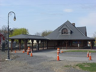
Chatham station is a former railroad station located on Depot Road in Chatham, Massachusetts which houses a museum. It has been listed on the National Register of Historic Places since 1978, and it is now home to the Chatham Railroad Museum.

Yarmouth station was a railroad station in the Yarmouth Port section of Yarmouth, Massachusetts.

Union Station served the residents of Chatham, New York, from 1887 to 1972 as a passenger station and until 1976 as a freight station. It was the final stop for Harlem Line trains. It had originally served trains of the Boston and Albany Railroad, then the New York Central Railroad and the Rutland Railway. It served as a junction for service that radiated to Rensselaer, New York, to the northwest; Hudson, New York, to the southwest; Vermont, to the northeast, and Pittsfield, Massachusetts to the east and New York City, to the south.

The Bruce Freeman Rail Trail is a partially-completed rail trail in Massachusetts. The path is a 10-foot-wide (3.0 m) paved multi-use trail, available for walking, running, biking, rollerblading, and other non-motorized uses. It follows the right-of-way of the disused Framingham and Lowell Line of the New York, New Haven and Hartford Railroad. The constructed route connects with the Bay Circuit Trail, and Phase 2D will connect with the Mass Central Rail Trail. The total planned length of the trail—which will eventually run continuously between Lowell and Framingham—is just under 25 miles (40 km).

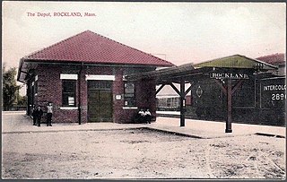
The Hanover Branch Railroad was a railroad in Massachusetts. It was incorporated in 1846 to provide a rail link from the Old Colony Railroad main line in Abington through Rockland to Hanover. The length of the line was 7.8 miles from North Abington to Hanover Four Corners. The line opened for service on July 18, 1868.

The Cape Cod Central Railroad was a railroad in southeastern Massachusetts, more specifically in central Cape Cod. It was incorporated in 1861 to extend the Cape Cod Railroad from Yarmouth to Orleans through the towns of Dennis, Harwich and Brewster. The 18.7 mile line opened for service in December, 1865.

The Providence, Warren and Bristol Railroad was a railroad in the state of Rhode Island that connected the city of Providence with Bristol, Rhode Island. The company was formed in 1854 by merging the Providence, Warren and Bristol Railroad Companies of Massachusetts and Rhode Island. The 14.1-mile line itself was completed on July 12, 1855.

The Dorchester and Milton Branch Railroad was a railroad in Massachusetts. It was incorporated in 1846 as a branch off the Old Colony Railroad main line from Boston to Plymouth. The 3.3 mile road was completed on December 1, 1847, from Neponset Village in Dorchester, Massachusetts, through the town of Milton to the village of Mattapan.

The Northern Strand Community Trail, also known as the Bike to the Sea Trail, is a 10-mile public-use path project, including a rail trail portion, which connects the cities of Everett, Malden, Revere, Saugus, and Lynn, along the former Saugus Branch Railroad of the Boston & Maine Railroad and other shared-use roads. The trail is part of the East Coast Greenway, a project planning to connect almost 3,000 miles of trail from Calais, Maine to Key West, Florida. The path has been planned by Bike to the Sea, a non-profit cycling advocacy group, with help from the surrounding cities.

The Millis Branch was a branch of what is now the MBTA Commuter Rail system. Branching off the still-operating Needham Line at Needham Junction, it ran through the towns of Dover, Medfield, Millis, and Medway. Due to lack of subsidies and poor ridership, the line was cut back to Millis station in April 1966, and all service ended on April 21, 1967.


