The Erie Canal is a canal in New York, United States that is part of the east–west, cross-state route of the New York State Canal System. Originally, it ran 363 miles (584 km) from where Albany meets the Hudson River to where Buffalo meets Lake Erie. It was built to create a navigable water route from New York City and the Atlantic Ocean to the Great Lakes. When completed in 1825, it was the second longest canal in the world and greatly affected the development and economy of New York, New York City, and the United States.

The Grand Union Canal in England is part of the British canal system. Its main line starts in London and ends in Birmingham, stretching for 137 miles (220 km) with 166 locks. It has arms to places including Leicester, Slough, Aylesbury, Wendover and Northampton.

The Portsmouth and Arundel Canal was a canal in the south of England that ran between Portsmouth and Arundel, it was built in 1823 but was never a financial success and was abandoned in 1855; the company was wound up in 1888. The canal was part of a larger scheme for the construction of a secure inland canal route from London to Portsmouth, which allowed craft to move between the two without having to venture into the English Channel and possibly encounter enemy ships or natural disaster. It was built by the Portsmouth & Arundel Navigation company. The canal was made up of three sections: a pair of ship canals, one on Portsea Island and one to Chichester, and a barge canal that ran from Ford on the River Arun to Hunston where it joined the Chichester section of the canal.

A lock is a device used for raising and lowering boats, ships and other watercraft between stretches of water of different levels on river and canal waterways. The distinguishing feature of a lock is a fixed chamber in which the water level can be varied; whereas in a caisson lock, a boat lift, or on a canal inclined plane, it is the chamber itself that rises and falls.

Latchford is a suburb and electoral ward of Warrington, Cheshire, England. It is around one mile south-east of Warrington town centre and has a total resident population of 7,856.

Fenny Stratford is a constituent town of Milton Keynes, Buckinghamshire, England and in the Civil Parish of Bletchley and Fenny Stratford. Originally an independent town, it was included in the Milton Keynes "designated area" in 1967. From 1895 it formed an urban district with Bletchley, until 1974 when it became part of the borough of Milton Keynes. It is located at the south east edge of the city and is its gateway to northbound travellers on the A5.

The Lee Navigation is a canalised river incorporating the River Lea. It flows from Hertford Castle Weir to the River Thames at Bow Creek; its first lock is Hertford Lock and its last Bow Locks.

The Wey and Arun Canal is a partially restored, 23-mile-long (37 km) canal in the south east of England. It runs southwards from the River Wey at Shalford, Surrey to the River Arun at Pallingham, in West Sussex. The canal comprises parts of two separate undertakings – the northern part of the Arun Navigation, opened in 1787 between Pallingham and Newbridge Wharf, and the Wey and Arun Junction Canal, opened in 1816, which connected the Arun at Newbridge to the Godalming Navigation near Shalford, south of Guildford. The canal was built with 26 locks.
Bow Back Rivers or Stratford Back Rivers is a complex of waterways between Bow and Stratford in east London, England, which connect the River Lea to the River Thames. Starting in the twelfth century, works were carried out to drain Stratford Marshes and several of the waterways were constructed to power watermills. Bow Creek provided the final outfall to the Thames, and the other channels were called Abbey Creek, Channelsea River, City Mill River, Prescott Channel, Pudding Mill River, Saint Thomas Creek, Three Mills Back River, Three Mills Wall River and Waterworks River.

The Caldon Canal, opened in 1779, runs 18 miles from Etruria, in Stoke-on-Trent where it leaves the Trent and Mersey Canal at the summit level, to Froghall, Staffordshire. The canal has 17 locks and the 69-metre long Froghall Tunnel.
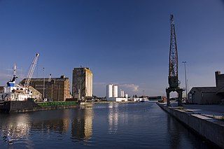
Sharpness is an English port in Gloucestershire, one of the most inland in Britain, and eighth largest in the South West. It is on the River Severn at grid reference SO669027, at a point where the tidal range, though less than at Avonmouth downstream, is still large.
The Hollinwood Branch Canal was a canal near Hollinwood, in Oldham, England. It left the main line of the Ashton Canal at Fairfield Junction immediately above lock 18. It was just over 4.5 miles (7.2 km) long and went through Droylsden and Waterhouses to terminate at Hollinwood Basin. It rose through four locks at Waterhouses (19–22) and another four at Hollinwood (23–26). Immediately above lock 22 at Waterhouses was Fairbottom Junction where the Fairbottom Branch Canal started. Beyond Hollinwood Basin there was a lock free private branch, known as the Werneth Branch Canal, to Old Lane Colliery, which opened in 1797. It is a biological Site of Special Scientific Interest and a Local Nature Reserve.

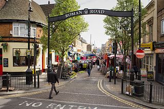
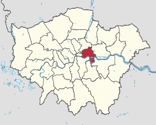
The London Borough of Tower Hamlets, in spite of being close to the centre of London and perhaps retaining the idea of it being the docklands area, has over 100 areas of parks and open spaces within its boundaries. These range from the huge to small gardens and squares. In common with all the London boroughs, these green spaces provide "lungs" for the leisure pursuits of the inhabitants.

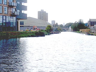
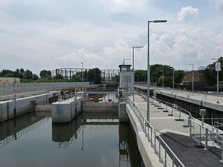
Bow Locks (No20) is a set of bi-directional locks in Bromley-by-Bow in the London Borough of Tower Hamlets and Newham. The locks link the tidal Bow Creek to the River Lee Navigation, which is a canalised river. These locks were first built in 1850 and then rebuilt in 1930, at the same time as the Prescott Channel was cut nearby. At high tide, the tide from Bow Creek formerly flowed through Bow Locks, to raise the level of the canals, such as the Limehouse Cut. In 2000, these locks were modified to keep the tide out, to reduce silting in the canal system.

The Hackney Cut is an artificial channel of the Lee Navigation built in England in 1769 by the River Lea Trustees to straighten and improve the Navigation. It begins at the Middlesex Filter Beds Weir, below Lea Bridge, and is situated in the (modern) London Borough of Hackney. When built it contained two pound locks and a half-lock, but was rebuilt to handle larger barges in the 1850s, and now only Old Ford Lock, which is actually a duplicated pair, remains.

The Rapidan Dam Canal of the Rappahannock Navigation is a canal intended to safely carry Batteaus, sturdy flat-bottomed boats used primarily for transporting cargo, around the rapids at the confluence of the Rappahannock and Rapidan Rivers. The Rapidan Canal, funded and constructed by The Rappahannock Company, consists of two different canals built at different times. All of the Rappahannock Navigation, of which the Rapidan Canal is a part, is located in the Piedmont region of Virginia. The Confluence, the name used on maps of the day and sometimes maps of today to denote where the two rivers meet, is located where the borders of the Virginia Counties of Spotsylvania, Stafford and Culpeper meet but is owned by the City of Fredericksburg, Virginia. The Rapidan Canal was listed on the Virginia Landmarks Register (VLR) on June 19, 1973, and on the National Register of Historic Places on July 26, 1973.