Oldcastle, Bridgend

Last updated

Oldcastle is an area and electoral ward of the town of Bridgend, Wales, to the south of the town centre. The ward elects councillors to Bridgend Town Council and Bridgend County Borough Council.

Contents

Description

Nolton Street, Bridgend Nolton Street Bridgend - geograph.org.uk - 1008417.jpg
Nolton Street, Bridgend

Oldcastle is located immediately south of Bridgend town centre. The area is bordered to the west by the River Ogmore. Oldcastle originally spread along Nolton Street and Cowbridge Road (and was also known as Nolton). [1]

The Oldcastle name is believed to refer to Nolton Castle (rather than the nearby Newcastle Castle), whose remains were recorded in the 16th-century on the southeast of a bend in the River Ogmore. [2] With the 'new' castle dating from at least 1106, the 'old' castle is presumed to have been in existence before 1100 and would have been an earth and timber structure. [3]

The modern area also includes the Bridgend campus of Bridgend College.

Electoral ward

The Oldcastle electoral ward extends south to include the areas of Whiterock and Hernston. The ward is bounded by the River Ewenny (and the Vale of Glamorgan) to the south, The Rhiw, Brackla Street and Pen-y-Banc in the north, coterminous with the boundaries of Bridgend town to the east and west. [4] According to the 2011 UK Census the population of the ward was 4,799 (with 3,930 aged 18 or over). [5]

Oldcastle is one of three wards to Bridgend Town Council (with Morfa and Newcastle), electing up to six of the nineteen Bridgend town councillors. [6]

Prior to 1996 Oldcastle was a ward to Ogwr Borough Council, electing two (Conservative) councillors.

Oldcastle is also a county ward to Bridgend County Borough Council, electing two county councillors. [7] Since the 1995 elections the ward has generally been represented by the Labour Party, though had Liberal Democrat representation between 2004 and 2012. [7] In February 2015 the Oldcastle (Labour) councillors were two of six councillors suspended from the council for voting against a merger proposal with the Vale of Glamorgan Council. [8]

Related Research Articles

<span class="mw-page-title-main">Vale of Glamorgan</span> County borough in Wales

The Vale of Glamorgan, often referred to as The Vale, is a county borough in the south-east of Wales. It borders Bridgend County Borough to the west, Cardiff to the east, Rhondda Cynon Taf to the north, and the Bristol Channel to the south. With an economy based largely on agriculture and chemicals, it is the southernmost unitary authority in Wales. Attractions include Barry Island Pleasure Park, the Barry Tourist Railway, Medieval wall paintings in St Cadoc's Church, Llancarfan, Porthkerry Park, St Donat's Castle, Cosmeston Lakes Country Park and Cosmeston Medieval Village. The largest town is Barry. Other towns include Penarth, Llantwit Major, and Cowbridge. There are many villages in the county borough.

<span class="mw-page-title-main">Bridgend</span> Town in south Wales

Bridgend is a town in Bridgend County Borough in Wales, 20 miles (32 km) west of Cardiff and 20 miles (32 km) east of Swansea. The town is named after the medieval bridge over the River Ogmore. The River Ewenny also flows through the town.

<span class="mw-page-title-main">Bridgend County Borough</span> County borough in Wales

Bridgend County Borough is a county borough in the south-east of Wales. The county borough has a total population of 139,200 people, and contains the town of Bridgend, after which it is named. Its members of the Senedd are Sarah Murphy MS, representing the Bridgend Constituency, and Huw Irranca-Davies MS representing the Ogmore Constituency, and its members of UK parliament are Jamie Wallis and Chris Elmore.

<span class="mw-page-title-main">Ogwr</span>

The Borough of Ogwr was one of six districts of Mid Glamorgan in Wales, which existed from 1974 to 1996.

<span class="mw-page-title-main">Bridgend (UK Parliament constituency)</span> Parliamentary constituency in the United Kingdom, 1983 onwards

Bridgend is a constituency represented in the House of Commons of the UK Parliament since 2019 by Jamie Wallis, a Conservative.

<span class="mw-page-title-main">Ogmore (UK Parliament constituency)</span> Parliamentary constituency in the United Kingdom, 1918 onwards

Ogmore is a constituency created in 1918 represented in the House of Commons of the UK Parliament by Chris Elmore of the Labour Party.

<span class="mw-page-title-main">St Brides Major</span> Human settlement in Wales

St. Brides Major is a village within the community also called St Brides Major in the Vale of Glamorgan in Wales.

<span class="mw-page-title-main">Bridgend County Borough Council</span> Local government of Bridgend County Borough, Wales

Bridgend County Borough Council is the governing body for Bridgend County Borough, one of the Principal Areas of Wales.

<span class="mw-page-title-main">Ogmore Vale</span> Human settlement in Wales

Ogmore Vale is a village in the county borough of Bridgend, Wales on the River Ogmore. The village's main source of income came from coal mining. Up until the year 1865, the Ogmore valley was a quiet, isolated, rural hill farming community of less than ten farms and a few cottages. Today, along with Nantymoel and Price Town it makes up the community of Ogmore Valley.

Bryncethin is a small village and electoral ward in the County Borough of Bridgend, South Wales, located just north of Junction 36 of the M4 Motorway and approximately 3 miles north of the county town of Bridgend. The population of the ward was 1,319 in 2011.

Cornelly is a community and electoral ward in Bridgend County Borough, South Wales. As of 2011 the population of the Cornelly ward was 7,059.

Llangeinor is a small village located in the Garw Valley around 5 miles (8 km) north of Bridgend in Bridgend County Borough, Wales. The ward population taken at the 2011 census was 1,243. The entire village is now protected as part of a conservation area.

<span class="mw-page-title-main">Ynysawdre</span> Human settlement in Wales

Ynysawdre is a small community in Bridgend County Borough, south Wales. It is located to the east of Aberkenfig in Wales, and comprises the two villages of Tondu and Brynmenyn. The name Ynysawdre is also usually used for a small section of Tondu. At the 2001 census, the population of the community was 3,698, reducing to 3,367 at the 2011 Census.

<span class="mw-page-title-main">Laleston</span> Human settlement in Wales

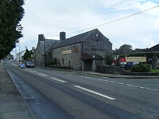
Laleston is a village and a community in Bridgend County Borough, south Wales, directly west of Bridgend town centre. The village takes its name from the Norman Lageles family who settled in the area. Buildings of note in the village include St David's Church, which still possesses features dating back to the 13th and 14th centuries, the Great House which was built in the early 16th century and Horeb Welsh Presbyterian Church (1831).

St Bride's Minor is a community in Bridgend County Borough, south Wales. Located north of Bridgend town it is made up of Sarn, a large housing estate, and the villages of Bryncethin and Abergarw. The southern border of the community is defined by the M4 motorway, though the community stretches briefly beyond the Motorway to take in the McArthurGlen Designer Outlet. The eastern, and largest area of the community consists of farmland and small scattered farm houses. At the 2001 census, the community's population was 5,575, increasing to 6,014 at the 2011 Census.

<span class="mw-page-title-main">Newcastle, Bridgend</span>

Newcastle is an area and electoral ward of the town of Bridgend, Wales. The area includes the medieval Newcastle Castle. The ward elects councillors to Bridgend Town Council and Bridgend County Borough Council.

<span class="mw-page-title-main">Llandow (electoral ward)</span> Electoral ward in Wales

Llandow, is the name of an electoral ward in the west of the Vale of Glamorgan, Wales. It covers its namesake community of Llandow as well as the neighbouring communities of Colwinston and Llangan. Since 1995 the ward has elected a county councillor to the Vale of Glamorgan Council.

Morfa is an electoral ward in the town of Bridgend, Wales. The ward elects councillors to Bridgend Town Council and, until 2022, Bridgend County Borough Council.

<span class="mw-page-title-main">Litchard</span>

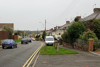
Litchard is a village and residential district north of Bridgend, Wales. It is also an electoral ward in the Coity Higher community, as well as a former ward to Bridgend County Borough Council.

References

  1. "Oldcastle, Glamorgan". A Vision of Britain Through Time. Retrieved 4 April 2019.
  2. "Oldcastle, Nolton, Suggested Castle Site (401432)". Coflein. RCAHMW . Retrieved 29 September 2021.
  3. "Oldcastle Bridgend". Gatehouse Gazetteer. Retrieved 4 April 2019.
  4. "Election maps". Ordnance Survey . Retrieved 4 April 2019.
  5. "Oldcastle - Key Stats / Age structure". UK Census Data. Retrieved 5 April 2019.
  6. "Wards and Councillors". Bridgend Town Council. Retrieved 4 April 2019.
  7. 1 2 "Bridgend County Borough Council Election Results 1995-2012" (PDF). The Elections Centre. Retrieved 3 April 2019.
  8. Abby Boulter (19 February 2015). "Labour suspends six Bridgend councillors for not supporting failed merger bid with Vale of Glamorgan". Wales Online . Retrieved 4 April 2019.

Coordinates: 51°30′11″N3°34′30″W / 51.503°N 3.575°W / 51.503; -3.575