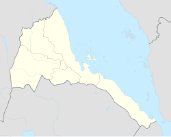
Adi Tekelezan Subregion is a subregion in the northwestern Anseba region of Eritrea. The capital lies at Adi Tekelezan.

Asmat Subregion is a subregion in the northwestern Anseba region of Eritrea. Its capital lies at Asmat.

Keren Subregion is a subregion in the northwestern Anseba region of Eritrea. Its capital lies at Keren (Cheren).
Ghala Nefhi Subregion is a subregion in the central Maekel region of Eritrea. Its capital lies at Ghala Nefhi.
Serejaka Subregion is a subregion in the central Maekel region of Eritrea. Its capital lies at Serejaka.
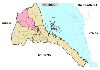
Forto Subregion is a subregion in the Gash-Barka region of western Eritrea. Its capital lies at Forto.
Haykota Subregion is a subregion in the western Gash-Barka region of Eritrea. Its capital lies at Haykota.
Teseney Subregion is a subregion in the western Gash-Barka region of Eritrea. Its capital lies at Teseney.
Foro Subregion is a subregion in the Northern Red Sea region of Eritrea. Its capital lies at Foro.
Massawa Subregion is a subregion in the Northern Red Sea region of Eritrea. Its capital lies at Massawa.
Adi Keyh Subregion is a subregion in the Debub (Southern) region of Eritrea. Its capital lies at Adi Keyh.
Adi Quala Subregion is a subregion in the southern Debub region of Eritrea. Its capital lies at Adi Quala.
Areza Subregion is a subregion in the Debub (Southern) region of Eritrea. Its capital lies at Areza.
Kudo Be'ur Subregion is a subregion in the Debub (Southern) region of Eritrea. Its capital lies at Kudo Be'ur.
Mendefera Subregion is a subregion in the Debub (Southern) region of Eritrea. Its capital lies at Mendefera.
Central Denkalya Subregion is a subregion in the Southern Red Sea region of Eritrea. It is bordered to the northwest by the Are'eta Subregion, to the southeast by the Southern Denkalya Subregion, to the north by the Red Sea, and to the south by Ethiopia.

Southern Denkalya Subregion is a subregion in the Southern Red Sea region of Eritrea.

Giamal Biscia is a village in western Eritrea. It is located in the Omhajer Subregion of the Gash-Barka region. It lies inside the Gash-Setit wildlife reserve 6 kilometres north-east of Arcugi.
Marijan is a village in Behrestagh Rural District, in the Central District of Amol County, Mazandaran Province, Iran. At the 2006 census, its population was 28, in 7 families.