
Google Maps is a web mapping service developed by Google. It offers satellite imagery, aerial photography, street maps, 360° interactive panoramic views of streets, real-time traffic conditions, and route planning for traveling by foot, car, bicycle and air, or public transportation. In 2020, Google Maps was used by over 1 billion people every month.

OpenStreetMap (OSM) is a collaborative project to create a free editable map of the world. The geodata underlying the map is considered the primary output of the project. The creation and growth of OSM has been motivated by restrictions on use or availability of map data across much of the world, and the advent of inexpensive portable satellite navigation devices.

Bing Maps is a web mapping service provided as a part of Microsoft's Bing suite of search engines and powered by the Bing Maps for Enterprise framework.

TomTom N.V. is a Dutch multinational developer & creator of location technology and consumer electronics. Founded in 1991 and headquartered in Amsterdam, TomTom released its first generation of satellite navigation devices to market in 2004. As of 2018 the company has 5,077 employees worldwide and operations in 29 countries throughout Europe, Asia-Pacific, and the Americas.
Wikimapia is a privately owned internet company that provides an open-content collaborative mapping project. The project implements an interactive "clickable" web map with a geographically-referenced wiki system, with the aim to mark and describe all geographical objects in the world.

Photosynth is a discontinued app and service from Microsoft Live Labs and the University of Washington that analyzes digital photographs and generates a three-dimensional model of the photos and a point cloud of a photographed object. Pattern recognition components compare portions of images to create points, which are then compared to convert the image into a model. Users are able to view and generate their own models using a software tool available for download at the Photosynth website.
Collaborative mapping is the aggregation of Web mapping and user-generated content, from a group of individuals or entities, and can take several distinct forms. With the growth of technology for storing and sharing maps, collaborative maps have become competitors to commercial services, in the case of OpenStreetMap, or components of them, as in Google Map Maker and Yandex.Map editor.

A screenshot, also known as ss,sc,screen capture, or screen grab, is a digital image that shows the contents of a computer display. A common screenshot is created by the operating system or software running on the device. A screenshot or screen capture may also be created by taking a photo of the screen.
Telenav, Inc. is a wireless location-based services corporation that provides services including Global Positioning System (GPS) satellite navigation, local search, automotive navigation solutions, mobile advertising, enterprise mobility and workflow automation. The company’s headquarters are located in Santa Clara, California in the United States with additional offices in the U.S., Germany, Japan, Romania, China, and Brazil.

OsmAnd is a map and navigation app for Android and iOS. It uses the OpenStreetMap (OSM) map database for its primary displays, but is an independent app not endorsed by the OpenStreetMap Foundation. It is available in both free and paid versions; the latter unlocks the download limit for offline maps and provides access to Wikipedia points of interest (POIs) and their descriptions from within the app.
This article contains a list with gratis satellite navigation software for a range of devices. Some of the free software mentioned here does not have detailed maps or the ability to follow streets or type in street names. However, in many cases, it is also that which makes the program free, avoid the need of an Internet connection, and make it very lightweight. Very basic programs like this may not be suitable for road navigation in cars, but serve their purpose for navigation while walking or trekking, and for use at sea. To determine the GPS coordinates of a destination, one can use sites such as GPScoordinates.eu and GPS visualizer.

Mapillary is a service for sharing crowdsourced geotagged photos, developed by remote company Mapillary AB, based in Malmö, Sweden.

Haiku is a free and open-source operating system compatible with the now discontinued BeOS.
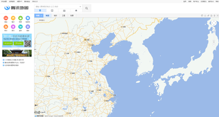
Tencent Maps is a desktop and web mapping service application and technology provided by Tencent, offering satellite imagery, street maps, street view and historical view perspectives, as well as functions such as a route planner for traveling by foot, car, or with public transportation. Android and iOS versions are available.

JOSM(Java OpenStreetMap Editor) is a free software desktop editing tool for OpenStreetMap geodata created in Java, originally developed by Immanuel Scholz and currently maintained by Dirk Stöcker. It has a lot of advanced features, but also more complicated user interface than default online editor iD.

iD is a free software online editor for OpenStreetMap (OSM) geodata created in JavaScript and released in 2013. It is designed to be simple and user friendly and is used as a default editor on main OSM page.
Yandex.Maps is a Russian web mapping service developed by Yandex. The service provides detailed maps of the whole world. It includes a search, information about traffic jams, routing and street panoramas. The service was launched in 2004.