
The Siachen Glacier is a glacier located in the eastern Karakoram range in the Himalayas at about 35.421226°N 77.109540°E, just northeast of the point NJ9842 where the Line of Control between India and Pakistan ends. At 76 km (47 mi) long, it is the longest glacier in the Karakoram and second-longest in the world's non-polar areas. It falls from an altitude of 5,753 m (18,875 ft) above sea level at its head at Indira Col on the India–China border down to 3,620 m (11,875 ft) at its terminus. The entire Siachen Glacier, with all major passes, has been under the administration of India as part of the union territory of Ladakh, located in the Kashmir region since 1984. Pakistan maintains a territorial claim over the Siachen Glacier and controls the region west of Saltoro Ridge, lying west of the glacier, with Pakistani posts located 1 km below more than 100 Indian posts on the ridge.

Operation Safed Sagar was the code name assigned to the Indian Air Force's role in acting jointly with the Indian Army during the 1999 Kargil war that was aimed at flushing out regular and irregular troops of the Pakistani Army from vacated Indian Positions in the Kargil sector along the Line of Control. It was the first large scale use of Airpower in the Jammu and Kashmir region since the Indo-Pakistani War of 1971.

Captain Bana SinghPVC is an Indian soldier and a recipient of the nation's highest gallantry award, the Param Vir Chakra. As a Naib Subedar in the Indian Army, he led the team that wrested control of the highest peak on the Siachen Glacier in Kashmir from Pakistani forces as part of Operation Rajiv. Following his success, India renamed the peak to Bana Post in his honour.
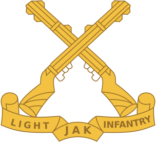
The Jammu and Kashmir Light Infantry is an infantry regiment of the Indian Army. The regimental center is in Srinagar's Airport Complex at Awantipora with a winter setup near Jammu. Its regimental insignia consists of a pair of crossed rifles. The regiment mostly consists of volunteers from the state of Jammu & Kashmir and ethnic groups from the state. The Jammu and Kashmir Light Infantry is considered to be one of the most decorated regiment of the Indian army having won 1 Param Veer Chakra and 3 Ashok Chakra. Naib Subedar Chuni Lal of the 8th battalion Jammu and Kashmir Light Infantry is one of the most decorated personnel of the Indian Army.
Operation Meghdoot was the codename for the Indian Army operation to take full control of the Siachen Glacier in Ladakh). Executed on the morning of 13 April 1984 in the highest battlefield in the world, Meghdoot was the first military offensive of its kind. This operation preempted Pakistan's Operation Ababeel; and was a success. Resulting in Indian forces gaining control of the Siachen Glacier in its entirety.

The Saltoro Mountains form a subrange within the Karakoram Range and are situated in the southeastern part of the Karakoram. They lie on the southwest side of the Siachen Glacier, which is one of the two longest glaciers in the world outside the polar regions. The name "Saltoro" is also associated with the Saltoro Valley, located west of this range and descending on the Pakistani side of the Saltoro Range, which generally follows the Actual Ground Position Line (AGPL).

Ghent Kangri is a high peak near the north end of the Saltoro Mountains, a subrange of the Karakoram range. It is located west of the Siachen Glacier near the Actual Ground Position Line between India and Pakistan.

The Siachen conflict, sometimes referred to as the Siachen Glacier conflict or the Siachen War, was a military conflict between India and Pakistan over the disputed 1,000-square-mile (2,600 km2) Siachen Glacier region in Kashmir. The conflict was started in 1984 by India's successful capture of the Siachen Glacier as part of Operation Meghdoot, and continued with Operation Rajiv in 1987. India took control of the 70-kilometre-long (43 mi) Siachen Glacier and its tributary glaciers, as well as all the main passes and heights of the Saltoro Ridge immediately west of the glacier, including Sia La, Bilafond La, and Gyong La. Pakistan controls the glacial valleys immediately west of the Saltoro Ridge. A cease-fire went into effect in 2003, but both sides maintain a heavy military presence in the area. The conflict has resulted in thousands of deaths, mostly due to natural hazards. External commentators have characterized it as pointless, given the perceived uselessness of the territory, and indicative of bitter stubbornness on both sides.
Bilafond La (meaning "Pass of the Butterflies" in Balti language, also known as the Saltoro Pass, is a mountain pass situated on Saltoro Ridge, sitting immediately west of the vast Siachen Glacier, some 40 km directly north of map point NJ 980420 which defined the end of the 1972 Line of Control between Pakistan and India as part of the Simla Agreement. Bilafond La is on the ancient Silk Route linking the Indian Subcontinent and China.
Sia La is a mountain pass situated on Saltoro Ridge, in Ladakh, India, some 60 km (37 mi) north-northwest of map point NJ9842 which defined the end of the 1972 Line of Control between India and Pakistan as part of the Simla Agreement. Sia La sits near the Chinese border and immediately northwest of the upper part of the vast Siachen Glacier, connecting that glacier to the Pakistani-controlled Kondus Glacier and valley to the west.
Gyong La is a mountain pass situated on Saltoro Ridge southwest of the vast Siachen Glacier, some 20 km (12 mi) directly north of map point NJ9842 which defined the end of the 1972 Line of Control between India and Pakistan. With Pakistan controlling areas just to the west along Chumik Glacier, the immediate Gyong La area has been under India's control since 1989. Dozens of Indian military tents and other equipment are visible in 2013 and 2016 Google Earth imagery 100 meters east, 670 meters northeast, and 2.7 km east-northeast of Gyong La, linked by clear trails. Nearer the former Pakistani "Naveed Top" position and 3.85 km west-northwest of Gyong La is a post and helipad is visible in 2001 and 2016 Google Earth imagery at 5,800 m (19,000 ft) elevation, higher than both the Indian positions and Gyong La.
Siachen Base Camp, 12,000 feet above sea level at Partapur, is a base camp of 102 Infantry Brigade of XIV Corps of Indian Army which protects 110 km long Actual Ground Position Line (AGPL) with at least 108 forward military outposts and artillery observation posts in the disputed region of Siachen Glacier in Ladakh Union Territory of India. It is approximately 6 hours drive north from the town of Leh via one of the highest vehicle-accessible passes in the world, Khardung La at 17,582 feet. Bana Top (20,500 ft) is the highest post in the region, which requires 80 km and 20 day trek for troops. Pahalwan Post and posts near Indira Col are other high posts. Kumar Post or Kumar Base, named after the Colonel Narendra "Bull" Kumar, serves as the battalion head quarter located 60 km from the Siachen base towards Indira Col. The Siachen Brigade consists of five to eight battalions of Ladakh Scouts supported by artillery, air defence, engineer and other logistic units. Pakistan has not been able to scale the crest of the Saltoro Range occupied by India. The temperature goes down to minus 86 °C during winters with icy 300 kmph blizzards. The average temperature is between minus 25 °C during day and minus 55 °C during the night.

The Actual Ground Position Line (AGPL) divides current positions of Indian and Pakistani military posts and troops along the entire 110 kilometres (68 mi) long frontline in the disputed region of Siachen Glacier. AGPL generally runs along the Saltoro Mountains range, beginning from the northernmost point of the (LOC) at Point NJ 9842 and ending in the north on the Indira Ridge at the India-China-Pakistan LAC tripoint near Sia Kangri about 4 km (2.5 mi) northwest of Indira Col West, with peaks in excess of 7,000 m (23,000 ft) and temperatures ranging to around −55 °C (−67 °F). India gained control of 1,000 square miles (2,600 km2) of disputed territory in 1984 because of its military operations in Siachen. A cease-fire was announced in 2003.

NJ9842, also called NJ 980420, is the northernmost demarcated point of the India-Pakistan cease fire line in Kashmir known as the Line of Control (LoC). The India–Pakistan AGPL, begins from the NJ9842 on LoC and ends near the Indira Ridge at the trijunction of areas controlled by China, India, and Pakistan.
Indira Col West is a mountain pass at 5,988 metres (19,646 ft)) altitude on the Indira Ridge of Siachen Muztagh in Karakoram Range. It is on the border between Indian-controlled Siachen Glacier and the Chinese-controlled Trans-Karakoram Tract, close to the tripoint of India, Pakistan, and China. The India-Pakistan Actual Ground Position Line (AGPL) in the Siachen area ends near the pass. It is possible to ascend the pass from both the north and south sides controlled by China and India respectively.

Naib Subedar Chuni Lal AC, VrC, SM was an Indian Army soldier of The Jammu and Kashmir Light Infantry. He was born in Bhaderwah, and basically from Gandhari Paddar and lived in Bhara village with parents Shanker Dass and Shakuntala Devi in Doda district of Jammu. Decorated with Vir Chakra and Sena Medal (Gallantry), JC-593527, Lal was killed in action on 24 June 2007 in a militant flush-out operation in Kashmir's Kupwara sector. These militants, all of whom were also shot dead, were trying to cross the Line of Control (LoC) and enter Indian territory. The success of this militant flush-out operation, which claimed his life, earned him the highest peacetime military decoration awarded for valor, courageous action or self-sacrifice away from the battlefield, the Ashok Chakra. He is the highest decorated soldier of the Indian Army of all time, honored with Sena Medal, Vir Chakra and Ashok Chakra.
Chumik Glacier is located in the Siachen region, in Pakistan. Located on the west of Saltoro ridge, it is a 4-mile-long offshoot of the Bilafond Glacier.
Varinder Singh Minhas VrC, SM was an Indian Army officer. As a Major, he commanded Operation Rajiv to capture the erstwhile Quaid post in Siachen area. During this action, then-Nb Sub Bana Singh won the Param Vir Chakra, India's highest award for gallantry. Then-major Varinder Singh was also seriously wounded in combat during this action, and was awarded the Vir Chakra for gallantry in the face of the enemy.
Operation Rajiv was the codename for an Indian Army operation that aimed to capture a high point along the Actual Ground Position Line (AGPL) on the Siachen Glacier in June 1987. Prior to this operation, the area had been under the control of Pakistani forces, who had established a post on the peak, designated Quaid Post. Following India's successful capture of the peak, the post was renamed to Bana Top after Naib Subedar Bana Singh, who led the operation. Since Operation Rajiv in 1987, India continues to hold this post, which lies just to the south of the strategic Bilafond La mountain pass, also controlled by India. Alongside the higher-altitude installations, India has also established posts on the slopes at lower heights in this sector.
Saltoro valley is the highest valley in Pakistan and is located within the region of Baltistan. This valley is under the administration of Pakistan and is situated near the Saltoro Mountain Range which includes the prominent Saltoro Kangri peak and the Saltoro River. Saltoro Valley is in proximity to the Siachen Glacier, which is the world's highest battleground and a disputed territory between India and Pakistan.
