Wye River is a minor river in the northeast of the South Island of New Zealand.

Pegasus Bay, earlier known as Cook's Mistake, is a bay on the east coast of the South Island of New Zealand.

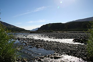
The Waiau Toa / Clarence River is on northeast South Island of New Zealand. It is 230 kilometres (140 mi) long, which makes it the eighth longest river in New Zealand.

Tasman Bay / Te Tai-o-Aorere, originally known as Blind Bay, is a large V-shaped bay at the north end of New Zealand's South Island. Located in the centre of the island's northern coast, it stretches along 120 kilometres (75 mi) of coastline and is 70 kilometres (43 mi) across at its widest point. It is an arm of the Tasman Sea, lying on the western approach to Cook Strait.
The Wairau River is one of the longest rivers in New Zealand's South Island. It flows for 170 kilometres (110 mi) from the Spenser Mountains, firstly in a northwards direction and then northeast down a long, straight valley in inland Marlborough.

Of an estimated 200 place names the Dutch bestowed on Australian localities in the 17th century as a result of the Dutch voyages of exploration along the western, northern and southern Australian coasts, only about 35 can still be found on current maps. Five out of six names were either renamed or forgotten or their locations were lost. Other places were named after the early Dutch explorers by later British explorers or colonists, for instance the Australian state of Tasmania is named after Abel Tasman. Australia itself was called New Holland by the English and Nieuw Holland by the Dutch.
The Mangamuka River is a river of the far north of the Northland Region of New Zealand's North Island. It flows generally south from the Maungataniwha Range southeast of Kaitaia, and the last few kilometres of its length are a wide, silty arm of the Hokianga Harbour, which it reaches 10 kilometres (6 mi) northeast of Rawene.
The Mangatete River or Mangatete Stream is a river of the Northland Region of New Zealand's North Island. It flows northwest from its origins to the east of Kaitaia, reaching the Rangaunu Harbour to the east of Awanui.
The Mangonuiowae River is a river of New Zealand's Northland Region. It is a tributary of the Rotokakahi River, which it reaches 10 kilometres (6 mi) northeast of Whangape Harbour
The Oruru River is a river of the Northland Region of New Zealand's North Island. It flows north from its sources south of Mangonui to reach the Taipa River 5 kilometres (3 mi) from Taipa.
The Perunui River is a short river of the Northland Region of New Zealand's North Island. It is one of the many feeder rivers of the Hokianga Harbour system.

The Rai River is a river of the Tasman Region of New Zealand's South Island. It flows predominantly south, reaching the Pelorus River at Pelorus Bridge. The township of Rai Valley is located close to the river's banks.
The Rotokakahi River is a river of the Northland Region of New Zealand's North Island. Its winding course is predominantly southwestward from its origins in the Maungataniwha Range. It reaches the Tasman Sea 25 kilometres (16 mi) south of Kaitaia, and its estuary forms one of the two arms of Whangape Harbour.
The Tawapuku River is a river of the Northland Region of New Zealand's North Island. It flows generally southwest to join the Awarua River 40 kilometres north of Dargaville.
The Utakura River is a river of the Northland Region of New Zealand's North Island. It flows west from its sources northwest of Kaikohe, reaching the Waihou River at the point where it widens to become an arm of the Hokianga Harbour.
The Victoria River is a river of the Northland Region of New Zealand's North Island. It flows generally northwest from the Maungataniwha Range, reaching the Awanui River to the east of Kaitaia.
The Waimamakau River is a short river of the Northland Region of New Zealand's North Island. Confusingly, it is a tributary of the Waimamaku River, reaching the latter 10 kilometres southeast of Omapere.
New Zealand's largest Manganui River is a river of the Northland Region of New Zealand's North Island. It follows a generally westward course from its sources west of Ruakaka before its outflow into the Wairoa River 5 kilometres (3 mi) east of Dargaville. The river's lower course is noted for its convoluted, winding path through low-lying swampy terrain, and several oxbow lakes are associated with this stretch of the river.
The Waimea Plains is a small but fertile area of low-lying land south of the port city of Nelson, situated on Tasman Bay in the South Island of New Zealand. It is irrigated by the Waimea River from the Waimea Inlet in the north and bounded by the town of Brightwater in the south. The fertile soil promotes the growth of kiwifruit, apples and vineyards.

The Bryant Range is a range of low mountains in the northern South Island of New Zealand. They form part of the boundary of the Nelson and Tasman Districts with Marlborough Region, as well as forming the western boundary of Mount Richmond Forest Park The range is traversed by State Highway 6 at the Rai Saddle close to its northern end.


