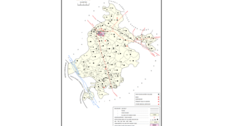
Osiyan is a village in Unnao district, Uttar Pradesh, India near town Bighapur. J.D.V.M. Inter College, Osiyan, Unnao is in this village.
Osiyan is a village in Unnao district, Uttar Pradesh, India near town Bighapur. J.D.V.M. Inter College, Osiyan, Unnao is in this village.

Unnao is a city in the Indian state of Uttar Pradesh. It is the administrative headquarters of Unnao district and a part of Lucknow division, between Kanpur and Lucknow. Unnao is a large industrial city with three industrial suburbs around it. Unnao has the country's largest leather Export in the UPSIDC.such as Mirza International,Model Tannery, Omega Tannery,Model Exim,Calico Trends,Super Tannery,Amin Tannery and Rahman Industries etc.The city is famous for its leather ,Leather Factories, mosquito net, Zardozi and chemical industries. Unnao is an historical city with many historical buildings and structures. Trans Ganga City, a new satellite town of Unnao is being developed in order to develop Unnao as a major industrial and infrastructural hub as the region comes under Kanpur-Lucknow Counter Magnet Area. Unnao district is a part of Central Ganges Plain of the state covering an area of 4558 km2. The city is enlisted as a municipality of Kanpur metropolitan area and is the second largest city within the metropolitan area. nawabganj pakshi vihar located along NH27 is one of best place to see migratory birds which come from various countries during winter season and it has been included in the list of RAMSAR sites. Best time to visit this sanctuary is from November to March.

Unnao district is a district of Uttar Pradesh state in northern India. The city of Unnao is the district headquarters. The district is part of Lucknow Division.

Bighapur is a town and nagar panchayat in Unnao district of Uttar Pradesh, India. First officially classified as a town for the 1981 census, it now serves as a tehsil headquarters(established in Patan). Important items manufactured here include clay pots, leather products, and wooden furniture. As of 2011, the population of Bighapur is 6,501, in 1,201 households.
Osian or Osiyan may refer to:
Unnao Junction Railway Station, also known as Unnao Railway Station, is a major railway station located in Unnao district in the Indian state of Uttar Pradesh. It serves Unnao and the surrounding areas. The station falls under the jurisdiction of the Northern Railway zone of the Indian Railways and serves as a crucial transportation hub for the region. Unnao Junction railway station is on the Lucknow–Kanpur Suburban Railway and Varanasi–Kanpur branch line.

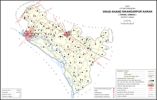
Maharamau is a small village in the Sikandarpur Karan block of Unnao district, Uttar Pradesh, India. As of 2011, its population was 550 in 106 households. It has one primary school and no healthcare facilities.
Osiyan railway station is a railway station in Jodhpur district, Rajasthan. Its code is OSN. It serves Osiyan town. The station consists of a single platform. Passenger, Express and Superfast trains halt here.

Bichhiya is a village and corresponding community development block in Unnao district of Uttar Pradesh, India. Located about 16 km southeast of Unnao on the main road to Purwa, it also serves as the seat of a nyaya panchayat and has an Ayurvedic dispensary, a veterinary hospital, an artificial insemination centre, and a family planning centre. The main crops are wheat, gram, barley, juwar, and paddy, and irrigation is largely provided by canal. As of 2011, the village's population is 2,347, in 482 households.

Daun is a village in Asoha block of Unnao district, Uttar Pradesh, India. It has one primary school and one medical dispensary. As of 2011, its population is 2,743, in 527 households.

Asawar is a village in Asoha block of Unnao district, Uttar Pradesh, India. It has two primary schools and no healthcare facilities. As of 2011, its population is 3,080, in 572 households.

Zorawarganj is a village in Asoha block of Unnao district, Uttar Pradesh, India. It is not connected to major district roads and has two primary schools and no healthcare facilities. As of 2011, its population is 2,553, in 498 households.

Chhulamau is a village in Purwa block of Unnao district, Uttar Pradesh, India. It is not connected to major district roads and has three primary schools and no healthcare facilities. As of 2011, its population is 961, in 180 households.

Tikar Khurd is a village in Purwa block of Unnao district, Uttar Pradesh, India. It is not connected to major district roads and has two primary schools and no healthcare facilities. As of 2011, its population is 1,086, in 201 households.

Magarwara is a village in Sikandarpur Karan block of Unnao district, Uttar Pradesh, India. It is located 6 km from the district headquarters, Unnao. It is located on state highways and has one primary school and no healthcare facilities. It has a train station on the Lucknow-Kanpur line, between Kanpur Bridge and Unnao train station; the same stretch of track is also connected with Rae Bareli and Balamau station past Unnao. Magarwara Bone Mill, established in 1927, is one of the major industrial establishments in Unnao district. As of 2011, its population is 6,584, in 1,263 households.

Poni is a village in Sikandarpur Karan block of Unnao district, Uttar Pradesh, India. It is connected to state highways and has 2 primary schools and no healthcare facilities. As of 2011, its population is 1,078, in 289 households.

Nari Chak is a village in Hilauli block of Unnao district, Uttar Pradesh, India. As of 2011, its population is 2,129, in 363 households, and it has 3 primary schools and no healthcare facilities.

Sandana is a village in Hilauli block of Unnao district, Uttar Pradesh, India. As of 2011, its population is 6,082, in 1,184 households, and it has 3 primary schools and no healthcare facilities.

Barenda is a village in Hilauli block of Unnao district, Uttar Pradesh, India. As of 2011, its population is 864, in 174 households, and it has 2 primary schools and no healthcare facilities.

Reola is a village in Hilauli block of Unnao district, Uttar Pradesh, India. As of 2011, its population is 594, in 105 households, and it has no schools and no healthcare facilities.

Subas Khera is a village in Hilauli block of Unnao district, Uttar Pradesh, India. As of 2011, its population is 810, in 168 households, and it has one primary school and no healthcare facilities.