Bighapur

Last updated

Bighapur
Bighapur block map.png
Map of Bighapur CD block
India Uttar Pradesh location map.svg
Red pog.svg
Bighapur
Location in Uttar Pradesh, India
India location map 3.png
Red pog.svg
Bighapur
Bighapur (India)
Coordinates: 26°21′N80°41′E / 26.35°N 80.68°E / 26.35; 80.68
CountryFlag of India.svg  India
State Uttar Pradesh
District Unnao
Area
[1]
  Total2.3 km2 (0.9 sq mi)
Elevation
122 m (400 ft)
Population
 (2011) [1]
  Total6,501
  Density2,800/km2 (7,300/sq mi)
Languages
  Official Hindi
Time zone UTC+5:30 (IST)
Vehicle registration UP35
Website up.gov.in

Bighapur is a town and nagar panchayat in Unnao district of Uttar Pradesh, India. [1] First officially classified as a town for the 1981 census, [2] it now serves as a tehsil headquarters(established in Patan). [1] Important items manufactured here include clay pots, leather products, and wooden furniture. [1] As of 2011, the population of Bighapur is 6,501, in 1,201 households. [1]

Contents

Bighapur is the headquarters of a community development block, which was first inaugurated on 1 October 1959 in order to oversee implementation of India's Five-Year Plans at a local and rural level. [3] As of 2011, the block comprises 128 rural villages, with a total population of 136,589 people in 27,180 households. [1]

Demographics

Historical population
YearPop.±%
1981 5,125    
1991 5,935+15.8%
2001 6,294+6.0%
2011 6,501+3.3%
Source: 2011 Census of India [1]

According to the 2011 census, Bighapur has a population of 6,501 people, in 1,201 households. [1] The town's sex ratio is 927 females to every 1000 males; 3,374 of Bighapur's residents are male (52%) and 3,127 are female (48%). [1] The 0-6 age group makes up about 10.1% of the town's population; the sex ratio for this group is 918, which is higher than the district urban average of 903. [1] Members of Scheduled Castes make up 25.75% of the town's population, while no members of Scheduled Tribes were recorded. [1] The town's literacy rate was 80.9% (counting only people age 7 and up); literacy was higher among men and boys (87.7%) than among women and girls (73.5%). [1] The scheduled castes literacy rate is 70.8% (78.2% among men and boys, and 62.6% among women and girls). [1]

In terms of employment, 22.8% of Nawabganj residents were classified as main workers (i.e. people employed for at least 6 months per year) in 2011. [1] Marginal workers (i.e. people employed for less than 6 months per year) made up 11.6%, and the remaining 65.5% were non-workers. [1] Employment status varied significantly according to gender, with 53.2% of men being either main or marginal workers, compared to only 14.2% of women. [1]

27.2% of Bighapur residents live in slum conditions as of 2011. [1] There are 4 slum areas in Bighapur: Nageshwar Nagar, Shastri Nagar, Gandhi Nagar, and Sandhohi Nagar (the largest). [1] These range in size from about 60 to 150 households and have between 5 and 50 tap water access points. [1] The number of flush toilets installed in people's homes ranges from 10 to 35. [1] All 4 areas are serviced by open sewers. [1]

Education

Degree colleges:

Inter Colleges:

Healthcare

Bighapur has one block level hospital near BSNL telephone exchange, Bighapur.

Transport

Rail

Bighapur Railway Station is the junction point for Rae Bareli, unchahar, Kanpur, Unnao. There are total 4 passenger trains which are passes through Bighapur Railway Station and has stoppage also.

Road

Bighapur is situated just 30 km away from Unnao Bypass Gate near Nirala Nagar and distance from Raebareli, Uttar Pradesh is approx 70 km. Distance between Bighapur and Kanpur is only 40 km.

Villages

Bighapur CD block has the following 128 villages: [1]

Village nameTotal land area (hectares)Population (in 2011)
Lal Ganj 235.9853
Kalaon 321.5785
Rajapur Garhewa 168.6511
Anon 3202,534
Jagdish Pur 232.4711
Baijnath Khera 98.9542
Magrayar 886.44,248
Behta Gopi 311.71,666
Pahihardo 5232,734
Saidpur 86.7531
Bighapur Kalan 462.8782
Danda Mau 116930
Tikari Mau 59525
Kalhe Pur 123982
Bighapur Khurd 202.1117
Aosiyan 889.64,514
Premi Khera 38.4213
Sasan 233.31,138
Dhuadhar 75476
Mardanpur 999.1587
Akbabad 310.62,055
Jagat Khera 133.7646
Shukla Khera 131851
Kukri 79.7471
Mirmau 64813
Sukhdev Pur 94387
Dhamni Khera 136.4952
Parsanda 229.21,715
Maharajpur 55.4592
Dainta 80.4464
Bhairam Pur 154.61,025
Kheswa 202.31,028
Gauri 138.9964
Manpur 100.71,255
Bhogita 340.21,329
Indemau Nihali Khera 268.81,691
Goshi Khera 14.7532
Aram 280.81,108
Rajapur Piprha 1991,076
Katra Diwan Khera 377.83,282
Bhabe Mau 102651
Nasirpur 3461,892
Lalganj 1021,705
Rujihai 1622,289
Dundpur 104780
Mawaiya 119.4731
Ghatampur Kalan 601.63,029
Chak Dhaurehara 42.4186
Ghatampur Khurd 3491,526
Pandeypur 272.9813
Naraotampur 38.9411
Bisenmau 52.6484
Pali 3321,758
Sarhe Mau 144765
Karnai Pur 137701
Sathniwala Khera 3731,328
Adhurj Pur 260746
Kamra Jana Pur 2801,686
Narghva 404394
Chak Khurd Hai 61.4154
Karmi 4371,281
Garhewa 405.81,641
Chautari Khurd 00
Keola Khera 315.23
Khurd Hai 94247
Piprasar 55585
Duruharu 200.238
Terhwa 195954
Bbhadaiya Khera 378.50
Fatehpur 95499
Katri Bhadaiya Khera 107.10
Dariyabad 92.6418
Chak Udhaintal 171.20
Chilauli 791.31,707
Qutubuddin Garheva 117.61,145
Terha 3733,909
Belhadyal Ganj 439.41,461
Saru Khera 233.52,533
Bardaha 763.13,895
Akberpur 8233,075
Rudrpur 185710
Kharjhara 304.31,235
Kumbhi 687.53,800
Ratui Khera 193.9358
Barahardo 267.33,763
Jhagar Pur 202.3757
Chak Patkan Khera 36101
Parauri Chandika Baks 103799
Parauri Harchand 55.2390
Ruppur Joravarpur 83528
Birpur Dithwa 194815
Purauna 424.22,095
Kandhiani 114.6386
Dundpur 129.21,179
Ramnagar Ahetmali 101.997
Chak Nihali Khera 71.99
Sagwar 307.42,815
Bhartipur 157.91,467
Nihali Khera 112997
Tilokpur 1341,107
Ramnagar Gair Ahetmali 330.3266
Chak Jalala 88.58
Kachi Bari 34.797
Rasulpur Rata Khera 137896
Mishran Khera 303121
Lala Khera Mustahkam 123.6747
Lala Khera Gair Mustahkam 112.9240
Babu Khera Kachhoh 145.50
Chahlala 227.4200
Jairaj Mau 132.1971
Raipur 135.81,260
Alipur 148.52,200
Harishchandrapur 71.7831
Pithai Khera Khurd 47.4490
Digvijaipur 339.4605
Gulal Khera 57.2491
Hilgi 70.3456
Navajikhera 25.3205
Majhigawa 329.61,350
Bay 88.3715
Rawatpur 329.12,640
Bhagulekhera 32.6354
Mahrenda 97.6405
Madhopur 49.7351
Ganeshikhera 3194
Dhanuhikhera 1842,760
Bhatkherwa Khurd 39.6159
Bhatkherwa Kalan 67.8846
Pankhupur 94.944
Ratuakhera 98.529
Manpur Gair Ahtmali 374.538
Pasniyan Khera 163.2277
Manpurahtmali 91.40

Related Research Articles

<span class="mw-page-title-main">Auras, Uttar Pradesh</span> Township in Uttar Pradesh, India

Auras is a town and nagar panchayat in Hasanganj tehsil of Unnao district, Uttar Pradesh, India. First officially classified as a town for the 1981 census, Auras is located just north of the Sai River, on the road from Unnao to Sandila. Other roads branch off to Mohan, Newalganj, and Malihabad.

<span class="mw-page-title-main">Unnao district</span> District of Uttar Pradesh in India

Unnao district is a district of Uttar Pradesh state in northern India. The city of Unnao is the district headquarters. The district is part of Lucknow Division.

<span class="mw-page-title-main">Bangarmau</span> Nagar palika parishad in Uttar Pradesh, India

Bangarmau is a big city with Tehsil Bangarmau, in the Unnao district, Uttar Pradesh, India. It is located on high ground overlooking the left bank of the Kalyani river, about 50 km northwest of Unnao and 22 km northwest of Safipur. Roads fan out in all directions from Bangarmau, including the main Unnao-Hardoi road that passes through town. Major commodities produced here include wheat flour, rice, and pulses. As of 2011, the population of Bangarmau is 44,204, in 7,600 households.

<span class="mw-page-title-main">Fatehpur Chaurasi</span> City in Uttar Pradesh, India

Fatehpur Chaurasi is a town and a nagar panchayat in Unnao district in the state of Uttar Pradesh, India. First officially classified as a town for the 1981 census, Fatehpur Chaurasi is located on the north bank of the Kalyani river, a bit to the south of the main road from Unnao to Bangarmau. Local industries include the production of furniture, boxes, almirahs, shoes, and slippers. As of 2011, the town's population is 6,715, in 1,158 households.

<span class="mw-page-title-main">Ganj Muradabad</span> City in Uttar Pradesh, India

Ganj Muradabad is a town and nagar panchayat in Safipur tehsil of Unnao district, Uttar Pradesh, India. It also serves as the headquarters of a community development block containing 86 rural villages. Handicrafts are a major industry here. As of 2011, Ganj Moradabad has a population of 10,957, in 1,723 households.

<span class="mw-page-title-main">Lalganj, Uttar Pradesh</span> Town in Uttar Pradesh, India

Lalganj is a town with nagar panchayat in Raebareli district of Uttar Pradesh, India. It is located on the road from Raebareli to Fatehpur, with other roads leading to Dalmau, Unnao, and Baksar. It is developing rapidly due to the Rail Coach Factory and also has the largest railway station in the district.

<span class="mw-page-title-main">Maharajganj, Raebareli</span> Nagar panchayat in Uttar Pradesh, India

Maharajganj is a town and nagar panchayat in Rae Bareli district, Uttar Pradesh, India. It serves as the headquarters of a tehsil. As of 2011, its population is 6,673, in 1,037 households.

Maurawan, also spelled Mauranwan, is a town and nagar panchayat in Purwa tehsil of Unnao district, Uttar Pradesh, India. It is located 12 km from Purwa on the road to Raebareli, and 3 km to the southwest of the town is the large Basaha lake. As of 2011, its population is 15,484, in 2,399 households.

Nyotini is a town and nagar panchayat in Hasanganj tehsil of Unnao district, Uttar Pradesh, India. Located 3 km southeast of Hasanganj on the right bank of the Sai river, Nyotini was historically one of the main centres of Muslim settlement in the district and it has several mosques and shrines. As of 2011, its population is 7,577, in 1,212 households.

<span class="mw-page-title-main">Purwa</span> Nagar panchayat in Uttar Pradesh, India

Purwa is a town and nagar panchayat in Unnao district, Uttar Pradesh, India. It is located 32 km southeast of Unnao, the district headquarters. Roads connect it with several major cities including Unnao, Lucknow, Kanpur, and Rae Bareli. As of 2011, its population is 24,467 people, in 4,128 households.

Ugu is a town and a nagar panchayat in Unnao district in the Indian state of Uttar Pradesh. First officially classified as a town for the 1981 census, Ugu is an old town with medieval ruins that hosts a biweekly market and an annual mela. It is located on the main Unnao-Hardoi road, a bit northwest of Safipur. Some of the main items manufactured here are shoes, slippers, furniture, and lipstick cover. As of 2011, the population is 6,318, in 1,044 households.

<span class="mw-page-title-main">Unchahar</span> Town in Uttar Pradesh, India

Unchahar is a town and nagar panchayat in Raebareli district in the Indian state of Uttar Pradesh. It serves as the headquarters of a tehsil as well as a community development block. It is located on Lucknow Allahabad Highway, 115 km from Lucknow, 85 km from Allahabad. The place is well connected by rail and roads to nearby cities of Kanpur, Lucknow, and Allahabad. Unchahar is also a constituency of Uttar Pradesh Legislative assembly.

Hyderabad is a town and nagar panchayat in Hasanganj tehsil of Unnao District, Uttar Pradesh, India. It is located on the main Unnao-Sandila road, near its intersection with the road connecting Lucknow and Bangarmau. Major commodities produced in Hyderabad include roasted rice, food products, and earthenware pottery. As of 2011, its population is 7,697 people, in 1,328 households.

<span class="mw-page-title-main">Salon, India</span> Town in Uttar Pradesh, India

Salon is a town and nagar panchayat in Raebareli district in the Indian state of Uttar Pradesh. It serves as the headquarters of a tehsil as well as a community development block. Originally it was also the headquarters of the entire district, but they were moved after the Indian Rebellion of 1857. It is located a bit to the south of the Sai river, at the junction of the Raebareli-Pratapgarh and Jais-Khaga roads. Other roads lead to Dalmau, Manikpur, and Kunda. To the east is a large jhil.

Kursath, also spelled Kursat, is a town and nagar panchayat in Unnao district in the Indian state of Uttar Pradesh. It is watered by the Sai river, which flows about 1.5 km to the north, and the Bangarmau-Hasanganj road passes about 4 km to the south of the town. The soil here is mostly loam and clay, with a small amount of sand. The main crops are wheat, barley, bejhar, juwar, bajra, paddy, maize, and sugarcane. Irrigation is provided mainly by canal.

<span class="mw-page-title-main">Nawabganj, Unnao</span> Nagar panchayat in Uttar Pradesh, India

Nawabganj is a town and nagar panchayat in Hasanganj tehsil of Unnao district, Uttar Pradesh, India. It is located northeast of Unnao on the Lucknow-Kanpur road, near the Ajgain railway station. Founded in 1842 and first officially classified as a town for the 1981 census, Nawabganj once served as the seat of a tehsil under the Nawabs of Awadh and is today the headquarters of a community development block containing 124 villages.

<span class="mw-page-title-main">Terha</span> Village in Uttar Pradesh, India

Terha is a village and gram panchayat in Unnao district, Uttar Pradesh, India. Terha holds a market twice per week, on Sundays and Thursdays, and the main items of trade are gur, vegetables, and cloths. As of 2011, the population of Terha is 3,909, in 759 households, and it has one primary school and no healthcare facilities.

<span class="mw-page-title-main">Magrayar</span> Village in Uttar Pradesh, India

Magrayar is a village in Bighapur block of Unnao district, Uttar Pradesh, India. Located 7km from Bighapur, Magrayar hosts a market on Mondays and Thursdays and was historically the seat of a pargana since at least the late 1500s. As of 2011, Magrayar's population is 4,248, in 964 households.

<span class="mw-page-title-main">Maharamau</span> Village in Uttar Pradesh, India

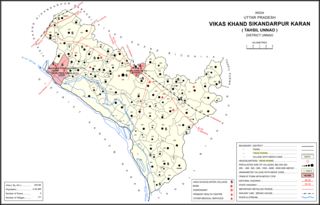
Maharamau is a small village in the Sikandarpur Karan block of Unnao district, Uttar Pradesh, India. As of 2011, its population was 550 in 106 households. It has one primary school and no healthcare facilities.

<span class="mw-page-title-main">Sikandarpur Sarausi</span>

Sikandarpur Sarausi is a community development block in Unnao tehsil of Unnao district, Uttar Pradesh, India. It consists of 96 rural villages, with a total population of 185,779 people.

References

  1. 1 2 3 4 5 6 7 8 9 10 11 12 13 14 15 16 17 18 19 20 21 22 23 "Census of India 2011: Uttar Pradesh District Census Handbook - Unnao, Part A (Village and Town Directory)". Census 2011 India. pp. 36–55, 390–416, 525–44. Retrieved 12 July 2021.
  2. Census 1981 Uttar Pradesh: District Census Handbook Part XIII-A: Village & Town Directory, District Unnao (PDF). 1982. p. 15. Retrieved 12 July 2021.
  3. Baghel, Amar Singh (1979). Uttar Pradesh District Gazetteers: Unnao. Rampur: Government Press. pp. 150–2. Retrieved 12 July 2021.