Patan, Uttar Pradesh

Last updated

Patan
Pātan
Town
India Uttar Pradesh location map.svg
Red pog.svg
Patan
Location in Unnao, Uttar Pradesh
India location map.svg
Red pog.svg
Patan
Patan (India)
Coordinates: 26°18′20″N80°46′51″E / 26.30563°N 80.780703°E / 26.30563; 80.780703 [1]
CountryFlag of India.svg  India
State Uttar Pradesh
District Unnao
Government
  Body Gram panchayat
Area
[2]
  Total4.595 km2 (1.774 sq mi)
Population
[2]
  Total5,364
  Density1,200/km2 (3,000/sq mi)
Languages
  Official Hindi
Time zone UTC+5:30 (IST)
<-- PIN -->
209506
Vehicle registration UP35
Website up.gov.in

Patan is a town in Sumerpur block of Unnao District in the state of Uttar Pradesh, India. [2] It is located 16km south of Purwa on the main Unnao-Allahabad road, [3] and a short distance to the south of the Loni river. [4] Part of the historical region of Baiswara, it historically gave its name to a pargana which existed since at least the time of Akbar, and under the Nawabs of Awadh it was the seat of a tehsil. [4] The Rae Bareli-Kanpur branch of the Northern Railway zone runs through Patan, and the Takia train station is located in the village. [3] A huge fair called the Takia-ka-Mela is held in Patan on the first Thursday in Paus, in honour of the saint Niamat Shah, revered by both Hindus and Muslims, drawing tens of thousands of visitors. [3] A second fair, established by Muhabbat Shah's disciple Shafqat Shah, is also held in Muhabbat Shah's honour at the tomb on the first Thursday of Jeth. [4]

Contents

As of 2011, Patan has a population of 5,364 people, in 1,044 households. [2] It serves as the seat of a nyaya panchayat and has a post office, a bus station, an intermediate college, a library, a temple dedicated to Lingeshwar Mahadeo, and the tomb of the 18th-century darvish Muhabbat Shah, which is where the Takia-ka-Mela is held. [3] The village hosts a market twice per week, on Mondays and Fridays, where vegetables and cloth are sold. [5]

History

There is a large old mound in Patan, ascribed to the Bhars. [3] Local tradition holds that the Bhars were the original rulers of the Patan area, before it came under control of the Bais Rajputs. [4] Under the Mughal emperor Akbar, Patan gave its name to a pargana, which continued to exist into the 20th century. [4]

Under the Nawabs of Awadh, Patan was the seat of a tehsil, with its headquarters on the western side of town. [4] The tehsildar also had control over the town's thana (police station). [4] The darvish Muhabbat Shah, who is buried in Patan, was a contemporary of the Nawab Shuja-ud-Daula. [4] He supposedly first came to Patan on a pilgrimage. [4] His tomb is now the site of two annual fairs; [3] the larger, the Takia-ka-Mela, was supposedly inaugurated by Muhabbat Shah in honour of his favourite disciple, Niamat Shah, who is also buried here in the takya (graveyard). [4] Muhabbat Shah is still venerated and his spirit is believed to cure possession; people used to perform exorcisms by tying up the afflicted person and leaving them in a tree near Muhabbat Shah's tomb overnight. [4]

At the turn of the 20th century, Patan was described as a small town that was mostly significant for hosting the two fairs at Muhabbat Shah's tomb. [4] It had an upper primary school with 60 students at the time. [4] Its population was overwhelmingly Hindu — of the 2,545 residents recorded in the 1901 census, only 158 were Muslims. [4]

The 1961 census recorded Patan as comprising 4 hamlets, with a total population of 2,159 people (1,082 male and 1,077 female), in 630 households and 420 physical houses. [5] The area of the village was given as 1,137 acres. [5] Average attendance of the Takia-ka-Mela fair was about 46,000 people at the time, while average attendance of the twice-weekly market was 1,000. [5] The M.G. Higher Secondary School in Patan, established in 1952, had a faculty of 17 teachers (all male) and a student body of 463 (also all male) at the time. [5] The village of Patan also had the following small industrial establishments at the time: 1 grain mill, 9 miscellaneous food processing facilities, 1 manufacturer of (non-chewing) tobacco products, 3 makers of textile garments, 7 makers of wood products not otherwise classified, 2 bicycle repair shops, 7 makers of jewellery and/or precious metal items, and 9 manufacturers and/or repairers of items not assigned to any group. [5]

Culture

Patan hosts two annual fairs at the tomb of Muhabbat Shah. [4] One is the Takia-ka-Mela, which is held on the first Thursday of Paus in honour of Niamat Shah and which regularly draws tens of thousands of visitors, both Hindu and Muslim. [3] Vendors bring agricultural implements, wooden items, glassware, cloth, sweets, toys, and miscellaneous other items to sell at the fair. [5] [3] The story goes that, one day, a Kurmi devotee of Muhabbat Shah fell down a well and cried out to Muhabbat Shah for help, believing him to be omnipresent, but to no avail. [4] The Kurmi then cried out for Niamat Shah, who instantly appeared, took him by the hand, and helped him out of the well. [4] When Muhabbat Shah found out about what happened, he was furious and commanded Niamat Shah to die, which he did. [4] Muhabbat Shah then ordered a fair to be held in commemoration of Niamat Shah, over the latter's tomb. [4]

A second fair is also held in honour of Muhabbat Shah on the first Thursday of Jeth. [4] [3] Originally inaugurated by Shafqat Shah, another of Muhabbat Shah's disciples, [4] it regularly drew around 1,000 visitors around the middle of the 20th century. [5] [3]

Agriculture

As of 2011, Patan village lands cover an area of 459.5 hectares, of which 155.3 are farmland (another 80.7 ha are orchards). [2] The main crops grown in Patan are wheat, barley, gram, juwar, bajra, and paddy. [3] Of the total cultivated area, a majority (120.7 ha) are irrigated; irrigation is mostly provided by tube wells. [2]

Related Research Articles

<span class="mw-page-title-main">Unnao district</span> District of Uttar Pradesh in India

Unnao district is a district of Uttar Pradesh state in northern India. The city of Unnao is the district headquarters. The district is part of Lucknow Division.

<span class="mw-page-title-main">Dalmau</span> City in Uttar Pradesh, India

Dalmau is a historic town and tehsil headquarters in Rae Bareli district of Uttar Pradesh, India. Situated on the banks of the Ganga, between Raebareli and Fatehpur, the town has several historical monuments including the old fort, several dargahs, and the Haji Zahid mosque. Dalmau is also home to the Ebrahim Sharki palace belonging to the Nawab Shuza-ud-daula. Visitors can also see the Baithak of Alha Udal and enjoy a stroll along the Dalmau Pump canal. Dalmau also enjoys a unique place in the literary world because it was here that the famous Hindi poet Suryakant Tripathi "Nirala" wrote his poems while sitting on the fort and overlooking the scene below.

<span class="mw-page-title-main">Mallawan</span> Town in Uttar Pradesh, India

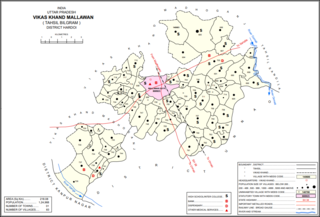
Mallawan, also spelled Mallanwan is a town and Nagar Palika Parishad in Hardoi district of Uttar Pradesh, India. It served as the original district headquarters from 1856 to 1858. It is located south of Bilgram, on the road to Unnao. Mallawan is a major centre of handloom weaving, with handloom cloth being a major export. As of 2011, the population of Mallawan is 36,915, in 6,086 households. It is included in the legislative assembly constituency of Bilgram-Mallanwan.

<span class="mw-page-title-main">Purwa</span> Nagar panchayat in Uttar Pradesh, India

Purwa is a town and nagar panchayat in Unnao district, Uttar Pradesh, India. It is located 32 km southeast of Unnao, the district headquarters. Roads connect it with several major cities including Unnao, Lucknow, Kanpur, and Rae Bareli. As of 2011, its population is 24,467 people, in 4,128 households.

Ugu is a town and a nagar panchayat in Unnao district in the Indian state of Uttar Pradesh. First officially classified as a town for the 1981 census, Ugu is an old town with medieval ruins that hosts a biweekly market and an annual mela. It is located on the main Unnao-Hardoi road, a bit northwest of Safipur. Some of the main items manufactured here are shoes, slippers, furniture, and lipstick cover. As of 2011, the population is 6,318, in 1,044 households.

<span class="mw-page-title-main">Baksar</span> Village in Uttar Pradesh, India

Baksar is a village in Sumerpur block of Unnao district, Uttar Pradesh, India. The southernmost village in the district, Baksar is located on the bank of the Ganges at a spot where it flows slightly northward. Because of this, the river is considered especially sacred here, and enormous crowds gather here to bathe in its waters at a mela during the month of Kartik. The spot has a temple dedicated to Sri Chandrika Devi on the riverbank. As of 2011, the population of Baksar is 2,413 people, in 466 households.

<span class="mw-page-title-main">Magrayar</span> Village in Uttar Pradesh, India

Magrayar is a village in Bighapur block of Unnao district, Uttar Pradesh, India. Located 7km from Bighapur, Magrayar hosts a market on Mondays and Thursdays and was historically the seat of a pargana since at least the late 1500s. As of 2011, Magrayar's population is 4,248, in 964 households.

<span class="mw-page-title-main">Miyanganj</span> Town in Uttar Pradesh, India

Miyanganj, also spelled Mianganj, is a village and corresponding community development block in Hasanganj tehsil of Unnao district, Uttar Pradesh, India. It is located on the road from Lucknow to Bangarmau, just to the west of the crossroads with another route linking Unnao and Sandila.

<span class="mw-page-title-main">Jhalotar</span> Village in Uttar Pradesh, India

Jhalotar is a village in Hasanganj block of Unnao district, Uttar Pradesh, India. It is located just to the west of the Mohan-Ajgain road, near a lake called Kundra Samundar. It hosts a weekly haat and has one primary school and no healthcare facilities. Drinking water is provided by hand pump. As of 2011, the population of the village is 1,990, in 319 households.

<span class="mw-page-title-main">Kantha, Unnao</span> Village in Uttar Pradesh, India

Kantha is a village in Asoha block of Unnao district, Uttar Pradesh, India. It hosts two small melas, one of which is the Mahabirji-ka-Mela, held every Tuesday during the month of Jyaistha. People bring sweets, toys, and other items to sell at the fair. Kantha also hosts a market twice per week, on Mondays and Fridays, with vegetables being the main item of trade. As of 2011, the population of Kantha is 9,973, in 2,079 households.

<span class="mw-page-title-main">Sarwan, Unnao</span> Village in Uttar Pradesh, India

Sarwan is a village in Asoha block of Unnao district, Uttar Pradesh, India. It hosts a Deviji mela on Chaitra Badi 8-9 dedicated to the worship of the goddess Devi. Vendors bring agricultural implements, furniture, sweets, toys, and miscellaneous everyday items to sell at the fair. On Chait Krishna 7-8, Sarwan also hosts a market for the Durgaji Ka Mela, where mostly cloths and sweets are sold. Sarwan is located on a major district road and has one primary school and one medical practitioner. As of 2011, its population is 3,824, in 806 households.

<span class="mw-page-title-main">Hilauli</span> Village in Uttar Pradesh, India

Hilauli is a village in Purwa tehsil of Unnao district, Uttar Pradesh, India. It is located on the road from Maurawan to Bachhrawan in Rae Bareli district, near the banks of the Sai. Hilauli hosts a market twice per week, on sunday and Thursdays, with grain and vegetables being the main items bought and sold. As of 2011, the population of Hilauli is 13,318, in 2,533 households.

<span class="mw-page-title-main">Mawai, Hilauli</span> Village in Uttar Pradesh, India

Mawai is a village in Hilauli block of Unnao district, Uttar Pradesh, India. As of 2011, its population is 14,690, in 2,734 households, and it has 8 primary schools and one medical clinic. It hosts a regular market and has a post office.

<span class="mw-page-title-main">Panhan</span> Village in Uttar Pradesh, India

Panhan, also called Panhan Khas, is a small village in Purwa block of Unnao district, Uttar Pradesh, India. Located due south of Purwa and a bit to the west of the Loni River, it historically was the seat of a pargana. As of 2011, the village's population is 545 people, in 104 households.

<span class="mw-page-title-main">Sumerpur, Unnao</span> Hamlet in Uttar Pradesh, India

Sumerpur is a hamlet of the village Chhanchhi Rai Khera, in Purwa tehsil of Unnao district, Uttar Pradesh, India. Located 26km south of Purwa and 50km southeast of Unnao, Sumerpur serves as the headquarters of a community development block as well as a nyaya panchayat. Sumerpur block was first established on 2 October 1955 in order to oversee implementation of India's Five-Year Plans at a local and rural level. As of 2011, the block comprises 148 villages and has a total population of 151,933 people in 28,469 households.

<span class="mw-page-title-main">Bihar, Unnao</span> Village in Uttar Pradesh, India

Bihar is a village in Sumerpur block of Unnao district, Uttar Pradesh, India. Located on the main Unnao-Raebareli road, just to the east of the Loni river and near its confluence with the Kharahi, Bihar was briefly the headquarters of a tehsil in Raebareli district from 1860 until 1862, when it was moved into Unnao district. As of 2011, the population of Bihar is 5,952, in 1,088 households, and it has 5 primary schools and no healthcare facilities.

<span class="mw-page-title-main">Parsanda</span> Village in Uttar Pradesh, India

Parsanda is a village in Bighapur block of Unnao district, Uttar Pradesh, India. It hosts a market on Thursdays, Fridays, and Sundays, and vegetables and cloth are the main items bought and sold. As of 2011, the population of Parsanda is 1,715, in 377 households, and it has one primary school and no healthcare facilities.

<span class="mw-page-title-main">Thulendi</span> Village in Uttar Pradesh, India

Thulendi is a village in Bachhrawan block of Rae Bareli district, Uttar Pradesh, India. It is located 6 km from Bachhrawan, the block headquarters, on an elevated plain with clayey soil. A historic village, Thulendi served as a pargana headquarters from the early 1400s until the late 1700s, and it has several old monuments including a fort built under the Jaunpur Sultanate and two large tanks othat are said to be even older. As of 2011, Thulendi's population is 6,616, in 1,195 households.

<span class="mw-page-title-main">Hardoi, Raebareli</span> Village in Uttar Pradesh, India

Hardoi is a village in Maharajganj block of Rae Bareli district, Uttar Pradesh, India. Located on the road from Maharajganj to Bachhrawan, Hardoi historically served as the seat of a pargana and has a now-ruined fort built in the early 1400s under the Jaunpur Sultanate. As of 2011, its population is 2,308, in 415 households.

<span class="mw-page-title-main">Didaur</span> Village in Uttar Pradesh, India

Didaur, also spelled Dedaur, is a village in Sataon block of Rae Bareli district, Uttar Pradesh, India. It is located 8 km from Raebareli on the road to Unnao, just east of the intersection with the road to Lalganj. It is near the right bank of the Sai river. As of 2011, Didaur has a population of 4,781 people, in 900 households. The village hosts two annual festivals: one is the Badhwapur-ka-Mela, which is dedicated to the worship of Nag Devta and is held on Bhadra Sudi 5, and the other is the Jhurhapur-ka-Mela, which is dedicated to worship of Rama and falls on Phalguna Sudi 8.

References

  1. "GeoNames Search". geonames.nga.mil. Archived from the original on 12 April 2014.
  2. 1 2 3 4 5 6 "Census of India 2011: Uttar Pradesh District Census Handbook - Unnao, Part A (Village and Town Directory)". Census 2011 India. pp. 416–41. Retrieved 18 July 2021.
  3. 1 2 3 4 5 6 7 8 9 10 11 Baghel, Amar Singh (1979). Uttar Pradesh District Gazetteers: Unnao. Rampur: Government Press. pp. 267–8. Retrieved 18 July 2021.
  4. 1 2 3 4 5 6 7 8 9 10 11 12 13 14 15 16 17 18 19 20 21 Nevill, H.R. (1903). Unao: A Gazetteer, Being Volume XXXVIII Of The District Gazetteers Of The United Provinces Of Agra And Oudh. Allahabad: Government Press. pp. 218–20. Retrieved 18 July 2021.
  5. 1 2 3 4 5 6 7 8 Census 1961: District Census Handbook, Uttar Pradesh (37 - Unnao District) (PDF). Lucknow. 1965. pp. 133, 152, 157, cxvi-cxvii of section "Purwa Tahsil", cxxvi–cxxvii. Retrieved 18 July 2021.{{cite book}}: CS1 maint: location missing publisher (link)