According to the 2001 census,[4] Fatehpur Chaurasi had a population of 5424. Males constitute 53% of the population and females 47%. Fatehpur Chaurasi has an average literacy rate of 52%, lower than the national average of 59.5%: male literacy is 60%, and female literacy is 44%. In Fatehpur Chaurasi, 17% of the population is under 6 years of age.
According to the 2011 census, Fatehpur Chaurasi has a population of 6,715 people, in 1,158 households.[1] The town's sex ratio is 892 females to every 1000 males; 3,550 of Fatehpur Chaurasi's residents are male and 3,165 are female.[1] Among the 0-6 age group, the sex ratio is 955, which is higher than the district urban average.[1] Members of Scheduled Castes make up 7.3% of the town's population, while no members of scheduled tribes were recorded.[1] The town's literacy rate was 70.1% (counting only people age 7 and up); literacy was higher among men and boys (78.6%) than among women and girls (60.4%).[1]
In terms of employment, 18.0% of Fatehpur Chaurasi residents were classified as main workers (i.e. people employed for at least 6 months per year) in 2011.[1] Marginal workers (i.e. people employed for less than 6 months per year) made up 10.4%, and the remaining 71.6% were non-workers.[1] Employment status varied heavily according to gender, with 45.7% of men being either main or marginal workers, compared to only 9.0% of women.[1]
Education
Fatehpur chaurasi has a Jawahar Navodaya Vidyalaya, where students of different parts of the district of unnao come to study
Office
Fatehpur chaurasi has a Sarkari Result Head Office Archived 3 May 2023 at the Wayback Machine , where students of different parts of the district of unnao come to get help
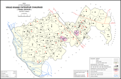
Villages
Fatehpur Chaurasi CD block has the following 116 villages:[1]
This page is based on this Wikipedia article Text is available under the CC BY-SA 4.0 license; additional terms may apply. Images, videos and audio are available under their respective licenses.