Sumerpur, Unnao

Last updated

Sumerpur
Hamlet
Sumerpur block map.png
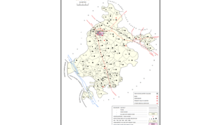
Map of Sumerpur CD block
India Uttar Pradesh location map.svg
Red pog.svg
Sumerpur
Location in Uttar Pradesh, India
Coordinates: 26°16′52″N80°48′09″E / 26.281116°N 80.802436°E / 26.281116; 80.802436 [1]
Country IndiaFlag of India.svg  India
State Uttar Pradesh
District Unnao
Languages
  Official Hindi|Avadhi
Time zone UTC+5:30 (IST)
Vehicle registration UP-35

Sumerpur is a hamlet of the village Chhanchhi Rai Khera, in Purwa tehsil of Unnao district, Uttar Pradesh, India. [2] Located 26km south of Purwa and 50km southeast of Unnao, Sumerpur serves as the headquarters of a community development block as well as a nyaya panchayat. [2] Sumerpur block was first established on 2 October 1955 in order to oversee implementation of India's Five-Year Plans at a local and rural level. [2] As of 2011, the block comprises 148 villages and has a total population of 151,933 people in 28,469 households. [3]

Sumerpur has a library, a primary healthcare centre, an artificial insemination centre, and a veterinary hospital. [2] The main crops are wheat, barley, gram, juwar, bajra, and paddy. [2] Irrigation is provided by a canal and by wells. [2] Sumerpur is located in the historical pargana of Bihar, which is 4km to the northeast and connected to Sumerpur by an unmetalled road. [2]

Sumerpur hosts a market twice per week, on Thursdays and Sundays, with vegetables and cloth being the main items of business. [4] As of 1961, its average attendance was about 300 people. [4]

Villages

Sumerpur CD block has the following 148 villages: [3]

Village nameTotal land area (hectares)Population (in 2011)
Pakrakhurd 455.82,395
Barua 127.3528
Saraiya 149.8548
Khijhauli 220.21,242
Kotwar 141.4877
Malauna 599.64,029
Bhagwantpur 234.1521
Diwara 399.8818
Hindhnagar 160.3845
Purai 240.82,905
Kundunpur 96.2612
Hindupur 82414
Gaura 7483,948
Pokhari 188.31,350
Niyoti 84.5564
Bisramau 84.7856
Bijaiti Khera 43330
Kutubpur 252.31,693
Behta 82536
Sahila 3822,339
Mavaiya 116.9696
Akampur 486.12,107
Rawatpur 219.51,439
Behar 622.65,952
Kedarkhera 131.7480
Rampur 79.6651
Bajeura 571,106
Chakdariyapur 60.5203
Siriyapur 177.21,150
Kalyanpur 359.71,490
Chhanchirai Khera 233.41,437
Barkhera 107.7953
Kiratpur 123.81,257
Kalyani 2351,320
Tajakpur 171989
Naya Khera 32.6291
Dubai 348.42,139
Murarkhera 97.8299
Kakrari 248.51,492
Gadariyakhera 124.5623
Chandpur 84.9671
Atmannukhera 166.9772
Dewakhera 96.8555
Patan 459.55,364
Dighi 66.1555
Bazidpur 86656
Mohkampur 55.9340
Alawalpur 151.2792
Thari 91.7403
Rampur 79.61,213
Manikapur 04,750
Sarai Manihar 309.31,919
Jamipur 671.13,140
Mawayia 215.41,059
Chainpur 661.53,866
Taudhakpur 68.1781
Nari Khera 89.1758
Sarai Mangali 121.2626
Millipur 49.8268
Jalapur 185.81,204
Harpasi Khera 55.344
Dubey Khera 191.81,346
Sajhamau 164985
Purender Pur 137473
Chak Bhagan Khera 0173
Bhatkherwa 0507
Kurwan 52.7405
Narharpur 84.796
Mushkabad 60.8301
Akthi 93.2686
Hariharpur 49.6532
Kapurpur 116.5475
Sultanpur 0656
Bhaiya Khera 98.1911
Paharpur 138.5908
Patari 68.7773
Garehwa 255.1457
Asai Khera 62.9318
Bhadiha 84307
Jungal Bujurg 76.2513
Jangli Khurd 76.2446
Maheshkhera 228.21,218
Naikamau 290.21,716
Panai Buzurg 367.12,171
Ajutikhera 96.8469
Panai Khurd 2771,419
Gosai Khera 53.8300
Sairampur 64.5202
Birarmau 36.6291
Chaturkhera 73.3824
Dokrai 129.71,353
Bajpaikhera 214.8834
Akwara 81.9637
Pithai Khera Sagam Nora 200.81,096
Gobaraha 105.91,420
Hamirpur 432.32,634
Dharamdas Khera 121.9777
Mudiyankhera 174.2666
Japsara 2081,586
Pitwakhera 99.7539
Bairampur 80.7354
Lilia 52.2282
Sawain 92.81,499
Bhadeora 268.11,591
Babukhera Dixtanwala 132.81,026
Palhepur 76.9254
Pachan Khera 441.7596
Unchgaon 2471,773
Gauraiya 175.11,349
Baidan Khera 41.2324
Ahraura 174.41,358
Racholiya 119.9735
Dhankauli 427.73,181
Daudapur 58624
Kundrabakht Khera 149.71,003
Kanthi 74.2722
Mubarakpur 171.61,376
Chautarikalan Gairmustahkam 150.329
Chautari Kalan Mustahkam 157.213
Dhanpati Khera Mustahkam 70.20
Purikhera Mustahkam 81.99
Purikhera Gairmustahkam 75.20
Dhanpati Khera Gairmustahkam 1240
Sethupur Gairahetmali 149.11,512
Sherhupurahtmali 1950
Dharampur 537381
Dulikhera 1,3193,030
Rasulpur Darigaon 72.4569
Chaksangrampur 5.80
Hisyampur 118.8838
Rukunpur 35.5257
Sangrampur 524.82,778
Mohammad Pur 48156
Tandaspur 36.8336
Nanmau 37.9493
Naraindas Khera 95841
Narainpur 47.8395
Chakthanpur 207
Nathai Khera 60.4463
Ramnair 115.21,598
Kalyanpur 111.3751
Jagatpur 103.41,075
Anuikhera 24.8371
Tangapur 76.9376
Baksar 365.52,413
Katribaxer 218.50
Malepurmustahkam 74.9795
Katari Bhalepur 413.60

Related Research Articles

<span class="mw-page-title-main">Purwa</span> Nagar panchayat in Uttar Pradesh, India

Purwa is a town and nagar panchayat in Unnao district, Uttar Pradesh, India. It is located 32 km southeast of Unnao, the district headquarters. Roads connect it with several major cities including Unnao, Lucknow, Kanpur, and Rae Bareli. As of 2011, its population is 24,467 people, in 4,128 households.

<span class="mw-page-title-main">Baksar</span> Village in Uttar Pradesh, India

Baksar is a village in Sumerpur block of Unnao district, Uttar Pradesh, India. The southernmost village in the district, Baksar is located on the bank of the Ganges at a spot where it flows slightly northward. Because of this, the river is considered especially sacred here, and enormous crowds gather here to bathe in its waters at a mela during the month of Kartik. The spot has a temple dedicated to Sri Chandrika Devi on the riverbank. As of 2011, the population of Baksar is 2,413 people, in 466 households.
<span class="mw-page-title-main">Magrayar</span> Village in Uttar Pradesh, India

Magrayar is a village in Bighapur block of Unnao district, Uttar Pradesh, India. Located 7km from Bighapur, Magrayar hosts a market on Mondays and Thursdays and was historically the seat of a pargana since at least the late 1500s. As of 2011, Magrayar's population is 4,248, in 964 households.

<span class="mw-page-title-main">Bichhiya, Unnao</span> Village in Uttar Pradesh, India

Bichhiya is a village and corresponding community development block in Unnao district of Uttar Pradesh, India. Located about 16 km southeast of Unnao on the main road to Purwa, it also serves as the seat of a nyaya panchayat and has an Ayurvedic dispensary, a veterinary hospital, an artificial insemination centre, and a family planning centre. The main crops are wheat, gram, barley, juwar, and paddy, and irrigation is largely provided by canal. As of 2011, the village's population is 2,347, in 482 households.

<span class="mw-page-title-main">Asoha</span> Village in Uttar Pradesh, India

Asoha is a village in Purwa tehsil of Unnao district, Uttar Pradesh, India. It is located about 16 km north of Purwa, the tehsil headquarters, and 51 km east of Unnao, the district headquarters. The main crops grown here are wheat, barley, gram, juwar, paddy, and pulses, and irrigation is provided by a canal as well as by tanks. The soil here is mostly clay. As of 2011, the population of Asoha is 3,709, in 856 households.

<span class="mw-page-title-main">Utraura</span> Village in Uttar Pradesh, India

Utraura is a village in Asoha block of Unnao district, Uttar Pradesh, India. It is not located on major district roads and has one primary school and no healthcare facilities. As of 2011, its population is 1,281, in 281 households.

<span class="mw-page-title-main">Fatehganj, Unnao</span> Village in Uttar Pradesh, India

Fatehganj is a village in Purwa block of Unnao district, Uttar Pradesh, India. It is located on a major district road and has one primary school and no healthcare facilities. As of 2011, its population is 798, in 245 households.

<span class="mw-page-title-main">Kanchanpur, Unnao</span> Village in Uttar Pradesh, India

Kanchanpur is a village in Asoha block of Unnao district, Uttar Pradesh, India. It is located on a major district road and has one primary school and no healthcare facilities. As of 2011, its population is 1,793, in 314 households.

<span class="mw-page-title-main">Sarwara</span> Village in Uttar Pradesh, India

Sarwara is a village in Asoha block of Unnao district, Uttar Pradesh, India. It is not connected to major or minor district roads and has no schools and no healthcare facilities. As of 2011, its population is 715, in 148 households.

<span class="mw-page-title-main">Sangrampur, Unnao</span> Village in Uttar Pradesh, India

Sangrampur, also called Daundia Khera, is a village in Sumerpur block of Unnao district, Uttar Pradesh, India. Located on the high bank of the Naurahi river a bit to the west of the main Unnao-Dalmau road, it is most notable for its historic importance as the capital of the Bais of Baiswara. It was the seat of a pargana beginning in the 1700s. As of 2011, its population is 2,778 in 530 households. It has four primary schools and no healthcare facilities.

<span class="mw-page-title-main">Bihar, Unnao</span> Village in Uttar Pradesh, India

Bihar is a village in Sumerpur block of Unnao district, Uttar Pradesh, India. Located on the main Unnao-Raebareli road, just to the east of the Loni river and near its confluence with the Kharahi, Bihar was briefly the headquarters of a tehsil in Raebareli district from 1860 until 1862, when it was moved into Unnao district. As of 2011, the population of Bihar is 5,952, in 1,088 households, and it has 5 primary schools and no healthcare facilities.

<span class="mw-page-title-main">Gaura, Unnao</span> Village in Uttar Pradesh, India

Gaura is a village in Sumerpur block of Unnao district, Uttar Pradesh, India. As of 2011, its population is 3,948, in 724 households, and it has one primary school and no healthcare facilities.

<span class="mw-page-title-main">Malauna</span> Village in Uttar Pradesh, India

Malauna is a village in Sumerpur block of Unnao district, Uttar Pradesh, India. As of 2011, its population is 4,029, in 741 households, and it has two primary schools and no healthcare facilities.

<span class="mw-page-title-main">Jamipur</span> Village in Uttar Pradesh, India

Jamipur is a village in Sumerpur block of Unnao district, Uttar Pradesh, India. As of 2011, its population is 3,140, in 588 households, and it has two primary schools and no healthcare facilities.

<span class="mw-page-title-main">Akampur</span> Village in Uttar Pradesh, India

Akampur is a village in Sumerpur block of Unnao district, Uttar Pradesh, India. As of 2011, its population is 2,107, in 380 households, and it has one primary school and no healthcare facilities.

<span class="mw-page-title-main">Akthi</span> Village in Uttar Pradesh, India

Akthi is a village in Sumerpur block of Unnao district, Uttar Pradesh, India. As of 2011, its population is 686, in 114 households, and it has two primary schools and no healthcare facilities.

<span class="mw-page-title-main">Nari Khera</span> Village in Uttar Pradesh, India

Nari Khera is a village in Sumerpur block of Unnao district, Uttar Pradesh, India. As of 2011, its population is 758, in 130 households, and it has one primary school and no healthcare facilities.

<span class="mw-page-title-main">Jangal Khurd</span> Village in Uttar Pradesh, India

Jangal Khurd is a village in Sumerpur block of Unnao district, Uttar Pradesh, India. As of 2011, its population is 446, in 93 households, and it has one primary school and no healthcare facilities.

<span class="mw-page-title-main">Sarai Manihar</span> Village in Uttar Pradesh, India

Sarai Manihar is a village in Sumerpur block of Unnao district, Uttar Pradesh, India. As of 2011, its population is 1,919, in 352 households, and it has two primary schools and no healthcare facilities.

<span class="mw-page-title-main">Dubai, Unnao</span> Village in Uttar Pradesh, India

Dubai is a village in Sumerpur block of Unnao district, Uttar Pradesh, India. As of 2011, its population is 2,139, in 410 households, and it has one primary school and no healthcare facilities.

References

  1. "GeoNames Search". geonames.nga.mil. Archived from the original on 12 April 2014. Retrieved 23 July 2023.
  2. 1 2 3 4 5 6 7 Baghel, Amar Singh (1979). Uttar Pradesh District Gazetteers: Unnao. Rampur: Government Press. pp. 150–2, 273. Retrieved 12 July 2021.
  3. 1 2 "Census of India 2011: Uttar Pradesh District Census Handbook - Unnao, Part A (Village and Town Directory)". Census 2011 India. pp. 416–41. Retrieved 12 July 2021.
  4. 1 2 Census 1961: District Census Handbook, Uttar Pradesh (37 - Unnao District) (PDF). Lucknow. 1965. p. 157. Retrieved 12 July 2021.{{cite book}}: CS1 maint: location missing publisher (link)