Historically, there was a pargana of Sarosi, which was created during the reign of Akbar in the 1500s.[2] The pargana was later renamed Sikandarpur after another one of its main villages; C.A. Elliott wrote in 1862 that the name change had "recently become habitual" then.[2]
The present block was inaugurated on 1 October 1961 in order to oversee implementation of India's Five-Year Plans at a local and rural level.[3] It was one of two blocks in the district (the other being Safipur) that was selected for implementation of the applied nutrition programme.[3] Sikandarpur, the old pargana's namesake, was chosen as the block headquarters.[3]
Demographics
As of 2011, Sikandarpur Sarausi CD block has a population of 185,779 people, in 36,202 households.[1] This population includes 98,687 males and 87,092 females.[1] The corresponding sex ratio of 883 females to every 1000 males is lower than the district rural average of 906.[1] About 14.4% of the block's population is in the 0-6 age group as of 2011.[1] The sex ratio of this group is 931, which is higher than the rural average of 923 for Unnao district.[1] Members of Scheduled Castes make up 26.5% of the block's population, the lowest proportion among the district's 16 CD blocks, and members of Scheduled Tribes make up 0.02%.[1] The literacy rate of Sikandarpur Sarausi block is 61.9% (counting only people age 7 and up); literacy is higher among men and boys (70.0%) than among women and girls (52.6%).[1] Among Scheduled Castes, the literacy rate is 55.2% — 63.6% among men and boys, and 45.7% among women and girls.[1] The 17.8% gender literacy gap among this group is the lowest among the blocks in Unnao district.[1]
In terms of employment, 24.9% of Sikandarpur Sarausi block residents were classified as main workers (i.e. people employed for at least 6 months per year) in 2011.[1] Marginal workers (i.e. people employed for less than 6 months per year) made up 11.2%, and the remaining 63.9% were non-workers.[1] Employment status varied significantly according to gender, with 52.9% of men being either main or marginal workers, compared to only 17.0% of women.[1]
Agriculture is the predominant source of employment in Sikandarpur Sarausi block: 36.6% of the block's workers were cultivators who owned or leased their own land as of 2011, and a further 32.1% were agricultural labourers who worked someone else's land for wages.[1] Another 3.8% were counted as household industry workers, and the remaining 27.5% were other workers.[1]
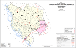
Villages
Sikandarpur Sarausi CD block has the following 96 villages:[1]
This page is based on this Wikipedia article Text is available under the CC BY-SA 4.0 license; additional terms may apply. Images, videos and audio are available under their respective licenses.