Baksar is a village in Sumerpur block of Unnao district, Uttar Pradesh, India. The southernmost village in the district, Baksar is located on the bank of the Ganges at a spot where it flows slightly northward. Because of this, the river is considered especially sacred here, and enormous crowds gather here to bathe in its waters at a mela during the month of Kartik. The spot has a temple dedicated to Sri Chandrika Devi on the riverbank. As of 2011, the population of Baksar is 2,413 people, in 466 households.

Magrayar is a village in Bighapur block of Unnao district, Uttar Pradesh, India. Located 7km from Bighapur, Magrayar hosts a market on Mondays and Thursdays and was historically the seat of a pargana since at least the late 1500s. As of 2011, Magrayar's population is 4,248, in 964 households.

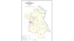
Miyanganj, also spelled Mianganj, is a village and corresponding community development block in Hasanganj tehsil of Unnao district, Uttar Pradesh, India. It is located on the road from Lucknow to Bangarmau, just to the west of the crossroads with another route linking Unnao and Sandila.

Hasanganj is a village and tehsil headquarters in Unnao district of Uttar Pradesh, India. It is located near Mohan, at a road junction leading to Miyanganj and Rasulabad. As of 2011, its population is 4,658, in 818 households.
Jhalotar is a village in Hasanganj block of Unnao district, Uttar Pradesh, India. It is located just to the west of the Mohan-Ajgain road, near a lake called Kundra Samundar. It hosts a weekly haat and has one primary school and no healthcare facilities. Drinking water is provided by hand pump. As of 2011, the population of the village is 1,990, in 319 households.

Asoha is a village in Purwa tehsil of Unnao district, Uttar Pradesh, India. It is located about 16 km north of Purwa, the tehsil headquarters, and 51 km east of Unnao, the district headquarters. The main crops grown here are wheat, barley, gram, juwar, paddy, and pulses, and irrigation is provided by a canal as well as by tanks. The soil here is mostly clay. As of 2011, the population of Asoha is 3,709, in 856 households.

Fatehganj is a village in Purwa block of Unnao district, Uttar Pradesh, India. It is located on a major district road and has one primary school and no healthcare facilities. As of 2011, its population is 798, in 245 households.

Hilauli is a village in Purwa tehsil of Unnao district, Uttar Pradesh, India. It is located on the road from Maurawan to Bachhrawan in Rae Bareli district, near the banks of the Sai. Hilauli hosts a market twice per week, on sunday and Thursdays, with grain and vegetables being the main items bought and sold. As of 2011, the population of Hilauli is 13,318, in 2,533 households.
Nari Chak is a village in Hilauli block of Unnao district, Uttar Pradesh, India. As of 2011, its population is 2,129, in 363 households, and it has 3 primary schools and no healthcare facilities.
Lotna is a village in Hilauli block of Unnao district, Uttar Pradesh, India. As of 2011, its population is 2,443, in 477 households, and it has 2 primary schools and no healthcare facilities.
Sandana is a village in Hilauli block of Unnao district, Uttar Pradesh, India. As of 2011, its population is 6,082, in 1,184 households, and it has 3 primary schools and no healthcare facilities.
Asrenda is a village in Hilauli block of Unnao district, Uttar Pradesh, India. As of 2011, its population is 4,475, in 782 households, and it has 2 primary schools and no healthcare facilities.
Jera is a village in Hilauli block of Unnao district, Uttar Pradesh, India. As of 2011, its population is 2,826, in 521 households, and it has one primary school and no healthcare facilities.
Sagauli is a village in Hilauli block of Unnao district, Uttar Pradesh, India. As of 2011, its population is 2,048, in 380 households, and it has 3 primary schools and no healthcare facilities.
Subas Khera is a village in Hilauli block of Unnao district, Uttar Pradesh, India. As of 2011, its population is 810, in 168 households, and it has one primary school and no healthcare facilities.
Mawai is a village in Hilauli block of Unnao district, Uttar Pradesh, India. As of 2011, its population is 14,690, in 2,734 households, and it has 8 primary schools and one medical clinic. It hosts a regular market and has a post office.
Lawa Singhan Khera is a large village in Hilauli block of Unnao district, Uttar Pradesh, India. Located on the Sai river, it is a dispersed settlement consisting of several separate hamlets. As of 2011, its population is 9,984, in 1,797 households, and it has 8 primary schools and no medical clinics. It hosts a weekly haat and has a sub post office.
Panhan, also called Panhan Khas, is a small village in Purwa block of Unnao district, Uttar Pradesh, India. Located due south of Purwa and a bit to the west of the Loni River, it historically was the seat of a pargana. As of 2011, the village's population is 545 people, in 104 households.

Ajgain is a village in Nawabganj block of Unnao district, Uttar Pradesh, India. It is located northeast of Unnao, near the main Lucknow-Kanpur road. It has a railway station on the Lucknow-Kanpur line, lying between Sonik and Kusumbhi. It holds a market on Mondays and Fridays, with grain and vegetables being the main items of trade. As of 2011, the population of Ajgain is 8,926, in 1,481 households.

Paho, also spelled Pahu, is a village in Khiron block of Rae Bareli district, Uttar Pradesh, India. It is located near the road from Raebareli to Mauranwan and Unnao, close to the border with Unnao district. It is 18 km away from Lalganj, the tehsil headquarters. As of 2011, Paho has a population of 5,620 people, in 1,088 households. It has two primary schools and no healthcare facilities, and it hosts a weekly haat but not a permanent market. It is the seat of a nyaya panchayat which also includes 7 other villages.