Kursath, also spelled Kursat, is a town and nagar panchayat in Unnao district in the Indian state of Uttar Pradesh. It is watered by the Sai river, which flows about 1.5 km to the north, and the Bangarmau-Hasanganj road passes about 4 km to the south of the town. The soil here is mostly loam and clay, with a small amount of sand. The main crops are wheat, barley, bejhar, juwar, bajra, paddy, maize, and sugarcane. Irrigation is provided mainly by canal.
Patan is a town in Sumerpur block of Unnao District in the state of Uttar Pradesh, India. It is located 16km south of Purwa on the main Unnao-Allahabad road, and a short distance to the south of the Loni river. Part of the historical region of Baiswara, it historically gave its name to a pargana which existed since at least the time of Akbar, and under the Nawabs of Awadh it was the seat of a tehsil. The Rae Bareli-Kanpur branch of the Northern Railway zone runs through Patan, and the Takia train station is located in the village. A huge fair called the Takia-ka-Mela is held in Patan on the first Thursday in Paus, in honour of the saint Niamat Shah, revered by both Hindus and Muslims, drawing tens of thousands of visitors. A second fair, established by Muhabbat Shah's disciple Shafqat Shah, is also held in Muhabbat Shah's honour at the tomb on the first Thursday of Jeth.

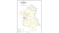
Miyanganj, also spelled Mianganj, is a village and corresponding community development block in Hasanganj tehsil of Unnao district, Uttar Pradesh, India. It is located on the road from Lucknow to Bangarmau, just to the west of the crossroads with another route linking Unnao and Sandila.

Kantha is a village in Asoha block of Unnao district, Uttar Pradesh, India. It hosts two small melas, one of which is the Mahabirji-ka-Mela, held every Tuesday during the month of Jyaistha. People bring sweets, toys, and other items to sell at the fair. Kantha also hosts a market twice per week, on Mondays and Fridays, with vegetables being the main item of trade. As of 2011, the population of Kantha is 9,973, in 2,079 households.
Mirri Kalan is a village in Asoha block of Unnao district, Uttar Pradesh, India. It has nine primary schools and four medical practitioners as well as one veterinary hospital. As of 2011, its population is 5,622, in 1,066 households.
Daun is a village in Asoha block of Unnao district, Uttar Pradesh, India. It has one primary school and one medical dispensary. As of 2011, its population is 2,743, in 527 households.
Zorawarganj is a village in Asoha block of Unnao district, Uttar Pradesh, India. It is not connected to major district roads and has two primary schools and no healthcare facilities. As of 2011, its population is 2,553, in 498 households.
Darsawan is a village in Asoha block of Unnao district, Uttar Pradesh, India. It is not connected to major district roads and has two primary schools and two medical practitioners. As of 2011, its population is 3,074, in 600 households.
Kalu Khera is a village in Asoha block of Unnao district, Uttar Pradesh, India. It is located on a major district road and has one primary school and one medical clinic. In 2011, its population was 1,888, in 355 households.

Bhatmau is a village in Purwa block of Unnao district, Uttar Pradesh, India. It is not connected to major district roads and has one primary school and no healthcare facilities. As of 2011, its population is 1,326, in 309 households.
Sarwan is a village in Asoha block of Unnao district, Uttar Pradesh, India. It hosts a Deviji mela on Chaitra Badi 8-9 dedicated to the worship of the goddess Devi. Vendors bring agricultural implements, furniture, sweets, toys, and miscellaneous everyday items to sell at the fair. On Chait Krishna 7-8, Sarwan also hosts a market for the Durgaji Ka Mela, where mostly cloths and sweets are sold. Sarwan is located on a major district road and has one primary school and one medical practitioner. As of 2011, its population is 3,824, in 806 households.
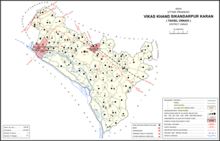
Magarwara is a village in Sikandarpur Karan block of Unnao district, Uttar Pradesh, India. It is located 6 km from the district headquarters, Unnao. It is located on state highways and has one primary school and no healthcare facilities. It has a train station on the Lucknow-Kanpur line, between Kanpur Bridge and Unnao train station; the same stretch of track is also connected with Rae Bareli and Balamau station past Unnao. Magarwara Bone Mill, established in 1927, is one of the major industrial establishments in Unnao district. As of 2011, its population is 6,584, in 1,263 households.

Hilauli is a village in Purwa tehsil of Unnao district, Uttar Pradesh, India. It is located on the road from Maurawan to Bachhrawan in Rae Bareli district, near the banks of the Sai. Hilauli hosts a market twice per week, on sunday and Thursdays, with grain and vegetables being the main items bought and sold. As of 2011, the population of Hilauli is 13,318, in 2,533 households.
Gulariha is a village in Hilauli block of Unnao district, Uttar Pradesh, India. It is a dispersed settlement with several constituent hamlets, and it is right next to the border with Rae Bareli district. The Bhundi tank is located in the village, and it provides water for irrigation. As of 2011, its population is 12,482, in 2,300 households, and it has 10 primary schools and no healthcare facilities.

Ajgain is a village in Nawabganj block of Unnao district, Uttar Pradesh, India. It is located northeast of Unnao, near the main Lucknow-Kanpur road. It has a railway station on the Lucknow-Kanpur line, lying between Sonik and Kusumbhi. It holds a market on Mondays and Fridays, with grain and vegetables being the main items of trade. As of 2011, the population of Ajgain is 8,926, in 1,481 households.

Bihar is a village in Sumerpur block of Unnao district, Uttar Pradesh, India. Located on the main Unnao-Raebareli road, just to the east of the Loni river and near its confluence with the Kharahi, Bihar was briefly the headquarters of a tehsil in Raebareli district from 1860 until 1862, when it was moved into Unnao district. As of 2011, the population of Bihar is 5,952, in 1,088 households, and it has 5 primary schools and no healthcare facilities.
Makhi is a large village in Miyanganj block of Unnao district, Uttar Pradesh, India. It hosts a Ramlila fair for one day during the month of Kuar, and it also holds a market twice per week, on Mondays and Saturdays. The main items sold at the market are grain and vegetables. Makhi also has a train station on the Kanpur-Balamau line, between the stations at Safipur and Patiyara. As of 2011, its population is 13,786, in 2,503 households.

Rampur Sudauli is a village in Bachhrawan block of Rae Bareli district, Uttar Pradesh, India. One of the main villages in the historical pargana of Bachhrawan, Rampur Sudauli is located at the corner of three districts: Raebareli, Lucknow and Unnao This spot is 15 km from Bachhrawan, at the point where the Sai river first enters the district.

Sataon is a village and corresponding community development block in Rae Bareli district, Uttar Pradesh, India. It is located a bit to the west of the river Sai on the main Raebareli-Unnao road. It is 22 km from Raebareli, the district headquarters. As of 2011, its population is 9,151, in 1,756 households. It has 4 primary schools and 1 medical clinic.
Didaur, also spelled Dedaur, is a village in Sataon block of Rae Bareli district, Uttar Pradesh, India. It is located 8 km from Raebareli on the road to Unnao, just east of the intersection with the road to Lalganj. It is near the right bank of the Sai river. As of 2011, Didaur has a population of 4,781 people, in 900 households. The village hosts two annual festivals: one is the Badhwapur-ka-Mela, which is dedicated to the worship of Nag Devta and is held on Bhadra Sudi 5, and the other is the Jhurhapur-ka-Mela, which is dedicated to worship of Rama and falls on Phalguna Sudi 8.