Ganj Muradabad | |
---|---|
City | |
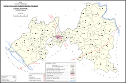
![]() Map of Ganj Moradabad CD block | |
Coordinates: 26°58′N80°11′E / 26.967°N 80.183°E | |
Country | ![]() |
State | Uttar Pradesh |
District | Unnao |
Area | |
• Total | 5 km2 (2 sq mi) |
Population (2011) [1] | |
• Total | 10,957 |
• Density | 2,200/km2 (5,700/sq mi) |
Languages | |
• Official | Hindi |
Time zone | UTC+5:30 (IST) |
Ganj Muradabad is a town and nagar panchayat in Bangarmau tehsil of Unnao district, Uttar Pradesh, India. [1] It also serves as the headquarters of a community development block containing 86 rural villages. [1] Handicrafts are a major industry here. [1] As of 2011, Ganj Moradabad has a population of 10,957, in 1,723 households. [1]
This place is famous for the shrine of one of the prominent saint of naqshbandiya golden Chain Gaus E Zaman Maulana Shah Fazl-e-Rahman Ganj Muradabadi, Maulvi Shah Abdul Kareem sb, Maulvi Abdul Haleem sb, Faizullah Shah Baba. This town is protected from all corners by these personalities.
One can visit Ganjmuradabad by bus as well as train. There are daily bus service from (Jhakar Katti) near Kanpur Station to Ganjmuradabad its 85 km from there. From Lucknow one has to go to Kaisar Bagh Bus stand there are only four bus service available in the morning till 1 pm ganjmuradabad is 90 km from there. One can also come from Hardoi as well as Unnao its hardly 55 km from there. Agra Lucknow Expressway is 3 km. from here.
Year | Pop. | ±% |
---|---|---|
1901 | 4,760 | — |
1911 | 3,296 | −30.8% |
1921 | Not given | — |
1931 | Not given | — |
1941 | Not given | — |
1951 | Not given | — |
1961 | Not given | — |
1971 | Not given | — |
1981 | 6,312 | — |
1991 | 7,906 | +25.3% |
2001 | 9,372 | +18.5% |
2011 | 10,957 | +16.9% |
Source: 2011 Census of India [1] |
As of 2001 [update] India census, [2] Ganj Muradabad had a population of 9377. Males constitute 53% of the population and females 47%. Ganj Muradabad has an average literacy rate of 38%, lower than the national average of 59.5%: male literacy is 44%, and female literacy is 31%. In Ganj Muradabad, 18% of the population is under 6 years of age.
The 2011 census recorded Ganj Muradabad's population as 10,957 people, in 1,723 households. [1] The population consisted of 5,766 males and 5,191 females, with a corresponding sex ratio of 900 females to every 1000 males. [1] The sex ratio in the 0-6 age group was 951, which was higher than the district urban average of 903. [1] Members of scheduled castes made up 7.82% of the town's population, while no members of scheduled tribes were recorded. [1] The literacy rate of Ganj Muradabad was 53.5% (counting only people age 7 and up); literacy was higher among men and boys (59.5%) than among women and girls (46.8%). [1] The female literacy rate of Ganj Moradabad was the lowest among towns in Unnao district. [1]
In terms of employment, Ganj Muradabad had the highest percentage of main workers (i.e. people employed for at least 6 months per year) among towns in Unnao district in 2011, with 30.6% falling into this category. [1] Marginal workers (i.e. people employed for less than 6 months per year) made up 12.1%, and the remaining 57.3% were non-workers. [1] Employment status varied significantly according to gender, with 53.2% of men being either main or marginal workers, compared to 30.9% of women. [1]
Ganj Muradabad CD block has the following 86 villages: [1]
Village name | Total land area (hectares) | Population (in 2011) |
---|---|---|
Sirdharpur Ahatmali | 537.2 | 2,109 |
Sirdharpur Ghat Ahatmali | 633.2 | 3,748 |
Jasarapur | 192.9 | 1,007 |
Khairhan | 173.3 | 1,154 |
Mufarreapur | 94.5 | 338 |
Dariapur | 174.5 | 1,149 |
Darapur | 168.3 | 1,658 |
Chandpur | 122.3 | 41 |
Bhikharipur Patsia Gair Ahatmali | 856.5 | 7,823 |
Bhikharipur Patsia Ahatmali | 1,053.7 | 367 |
Umerpur Bakhtaori | 56.2 | 778 |
Mela Ramkuar | 285.6 | 1,149 |
Behata Kachh | 184.6 | 1,286 |
Jalhe Pur | 132 | 631 |
Lonari | 110.8 | 622 |
Kushraj Pur | 342 | 1,804 |
Jhakhara | 84.7 | 399 |
Balla Pur | 710.3 | 4,506 |
Jafara Bad | 222.1 | 1,308 |
Suppa Pur | 116.9 | 384 |
Rasoolpur Majhgawa | 120 | 808 |
Maharaja Pur | 179.9 | 1,034 |
Allmaou Saray | 178.2 | 966 |
Chiteapur | 72.3 | 507 |
Biraechmao | 80.2 | 628 |
Chorha | 271.7 | 1,490 |
Lad Pur | 57.5 | 268 |
Devkhari | 220.2 | 1,542 |
Bahalol Pur Mutasil | 143.3 | 1,636 |
Devria | 323.2 | 1,438 |
Sultan Pur | 527 | 2,962 |
Lahara Pur | 296 | 1,939 |
Ganj Muradabad | 368.2 | 113 |
Chakkandoli | 20.6 | 0 |
Fatehpur Khalsa | 294.4 | 1,734 |
Raghuram Pur | 148.3 | 1,172 |
Fateh Pur Hamja | 187.5 | 2,297 |
Baraoki | 267.8 | 1,749 |
Kapoor Pur | 82.9 | 1,292 |
Chakhanuman | 29.7 | 380 |
Hayat Nagar | 114.3 | 2,301 |
Chaholia | 176.2 | 1,459 |
Jahangeerabad | 298.2 | 2,646 |
Dasgawan | 409.8 | 1,906 |
Kalwari | 228.4 | 1,109 |
Mahamdabad | 319.2 | 1,888 |
Tahirpur | 80.9 | 525 |
Hasanpur Majra | 111.9 | 826 |
Madarpur | 147.6 | 707 |
Akbarpur | 102.4 | 645 |
Jatpur Belthara | 157.7 | 930 |
Roshanabad | 460.1 | 2,380 |
Bevl Islamabad | 1,428.8 | 7,599 |
Patti Gowa | 192.5 | 838 |
Gowa | 70.2 | 686 |
Hadi Dad Pur | 130.7 | 445 |
Bhikkhan Pur Gopalpur | 174.5 | 1,083 |
Haraepur | 585.1 | 3,230 |
Maholia | 208.6 | 1,337 |
Kaitholi | 247.7 | 1,616 |
Khambha Mao | 242.3 | 1,682 |
Ramcote | 188.8 | 953 |
Behtamujawer | 620.4 | 4,119 |
Bhataoli | 182.9 | 1,358 |
Abaink | 330.3 | 2,265 |
Atwa | 310.8 | 1,797 |
Matukari | 386.9 | 1,847 |
Newada Dharamdas | 64.9 | 244 |
Rani Pur Grant | 585.2 | 1,795 |
Khambhaoli | 315.4 | 1,663 |
Ameer Pur Gambhirpur | 352.6 | 2,265 |
Gosha Kutub | 174.4 | 1,971 |
Kabir Pur | 298.3 | 2,543 |
Sahayami | 116.5 | 1,653 |
Ismail Pur Ama Para | 249.6 | 1,487 |
Jogi Cote | 518.6 | 4,863 |
Dasdan | 193.7 | 645 |
Asaysa | 557.8 | 5,395 |
Rasool Pur Roori | 495.4 | 3,008 |
Garha | 188.6 | 1,485 |
Saida Pur | 69.8 | 460 |
Gosha Paryag Pur | 149.6 | 1,212 |
Roori Saidik Pur | 1,080.6 | 6,410 |
Salem Pur | 119.9 | 532 |
Mawae Ghansyam | 165.5 | 1,286 |
Jhaetera | 155.1 | 1,655 |
Auras is a town and nagar panchayat in Hasanganj tehsil of Unnao district, Uttar Pradesh, India. First officially classified as a town for the 1981 census, Auras is located just north of the Sai River, on the road from Unnao to Sandila. Other roads branch off to Mohan, Newalganj, and Malihabad.
Bahraich is a city and a municipal board in Bahraich district in the state of Uttar Pradesh, India. Located on the Saryu River, a tributary of the Ghaghara river, Bahraich is 125 kilometres north-east of Lucknow, the state capital. The districts of Barabanki, Gonda, Balrampur, Lakhimpur Kheri, Shravasti and Sitapur share local boundaries with Bahraich. A factor which makes this town important is the international border shared with Nepal..
Raebareli is a city in Indian state of Uttar Pradesh. It is the administrative headquarters of Raebareli district and a part of Lucknow Division. The city is situated on the banks of the Sai river, 82 km (51 mi) southeast of Lucknow. It possesses many architectural features and sites, chief of which is a strong and spacious fort. As of 2011, Raebareli has a population of 191,316 people, in 35,197 households.
Unnao district is a district of Uttar Pradesh state in northern India. The city of Unnao is the district headquarters. The district is part of Lucknow Division.
Badarka, founded in 1643 CE, is a village & gram panchayat in Unnao tehsil of Unnao sub-district of Unnao district in Uttar Pradesh state of India. It is situated 15 km south of Unnao city between Ata & Lohcha villages on Kanpur-Raibareli road. The village is famed for being the native place of the renowned freedom fighter Chandrasekhar Azad and his parents - father Pandit Sitaram Tiwari and mother Jagrani Devi.
Bighapur is a town and nagar panchayat in Unnao district of Uttar Pradesh, India. First officially classified as a town for the 1981 census, it now serves as a tehsil headquarters(established in Patan). Important items manufactured here include clay pots, leather products, and wooden furniture. As of 2011, the population of Bighapur is 6,501, in 1,201 households.
Chandpur is a town and a municipal board in Bijnor district in the Indian state of Uttar Pradesh, India.
Gajraula is a city and municipal board in Amroha district in the state of Uttar Pradesh, India. Gajraula is also the headquarters of Gajraula block. It is located on NH 9, a four-lane highway connecting Uttarakhand and cities such as Bareilly and Lucknow via Delhi. It is a significant industrial hub in Uttar Pradesh and home to a number of multinational corporations, including Jubliant Life Sciences, RACL Geartech, and Israeli Pharma Teva API, as well as several engineering colleges. Moradabad, Meerut, Bulandsahar, Budaun, Hapur, and Delhi NCR are among the larger nearby cities.
Gangaghat is a city and a municipal board in Unnao district in the state of Uttar Pradesh, India. It's Just 12 km from Unnao, 2 km from Kanpur. It is also known as Shuklaganj and is located on the banks of holy river Ganges about 5 km from Kanpur on the SH 58 to Unnao. The population was 70803 as of the 2001 census. According to the census of 2011 it is 84072. It has 91% of literacy and is 5 km from Kanpur Cantonment. Though it lies in Unnao district, it lies adjacent to Kanpur and hence is a suburb of Kanpur. The city is enlisted as a municipality of Kanpur metropolitan area.
Mallawan, also spelled Mallanwan is a town and Nagar Palika Parishad in Hardoi district of Uttar Pradesh, India. It served as the original district headquarters from 1856 to 1858. It is located south of Bilgram, on the road to Unnao. Mallawan is a major centre of handloom weaving, with handloom cloth being a major export. As of 2011, the population of Mallawan is 36,915, in 6,086 households. It is included in the legislative assembly constituency of Bilgram-Mallanwan.
Purwa is a town and nagar panchayat in Unnao district, Uttar Pradesh, India. It is located 32 km southeast of Unnao, the district headquarters. Roads connect it with several major cities including Unnao, Lucknow, Kanpur, and Rae Bareli. As of 2011, its population is 24,467 people, in 4,128 households.
Safipur is a town and nagar panchayat in Unnao district in the Indian state of Uttar Pradesh. Located 27 km northwest of the city of Unnao, Safipur serves as a tehsil headquarters and is well-connected by roads to nearby towns. Founded in the 1300s and originally called Saipur, the town's present name of Safipur is in honour of the 16th-century Muslim saint Makhdum Shah Safi, whose dargah is located here. Important commodities manufactured in Safipur today include steel boxes and almirahs, furniture, and incense sticks. As of 2011, Safipur's population is 25,688, in 4,288 households.
Sandila is a town and nagar palika parishad in Hardoi district in the Indian state of Uttar Pradesh. It serves as a tehsil headquarters within the district. Located midway between Hardoi and Lucknow, Sandila is a well-connected town with roads leading in all directions and a major broad gauge rail line passing through the south side of town. Important industries include sweets — its laddus are especially well-known — as well as beedi production and zardozi work.
Thakurdwara is a town in Moradabad district in the indian state of Uttar Pradesh.
Hyderabad is a town and nagar panchayat in Hasanganj tehsil of Unnao District, Uttar Pradesh, India. It is located on the main Unnao-Sandila road, near its intersection with the road connecting Lucknow and Bangarmau. Major commodities produced in Hyderabad include roasted rice, food products, and earthenware pottery. As of 2011, its population is 7,697 people, in 1,328 households.
Kursath, also spelled Kursat, is a town and nagar panchayat in Unnao district in the Indian state of Uttar Pradesh. It is watered by the Sai river, which flows about 1.5 km to the north, and the Bangarmau-Hasanganj road passes about 4 km to the south of the town. The soil here is mostly loam and clay, with a small amount of sand. The main crops are wheat, barley, bejhar, juwar, bajra, paddy, maize, and sugarcane. Irrigation is provided mainly by canal.
Mohan is a town and a nagar panchayat in Unnao district in the Indian state of Uttar Pradesh.
Paho, also spelled Pahu, is a village in Khiron block of Rae Bareli district, Uttar Pradesh, India. It is located near the road from Raebareli to Mauranwan and Unnao, close to the border with Unnao district. It is 18 km away from Lalganj, the tehsil headquarters. As of 2011, Paho has a population of 5,620 people, in 1,088 households. It has two primary schools and no healthcare facilities, and it hosts a weekly haat but not a permanent market. It is the seat of a nyaya panchayat which also includes 7 other villages.
Khanpur Khusti is a village in Khiron block of Rae Bareli district, Uttar Pradesh, India. It is located 14 km from Lalganj, the tehsil headquarters. As of 2011, it has a population of 1,723 people, in 315 households. It has 1 primary school and no healthcare facilities and does not host a weekly haat or a permanent market. It belongs to the nyaya panchayat of Deogaon.
Muradabad is a village in Akhand Nagar block of Kadipur tehsil in Sultanpur district, Uttar Pradesh, India. As of 2011, it has a population of 1,543 people, in 238 households. It has one primary school and no healthcare facilities and it hosts both a regular market and a weekly haat. It belongs to the nyaya panchayat of Sajampur.