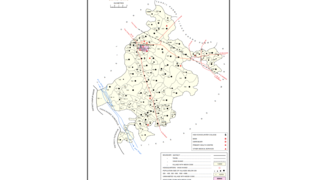
Kursath, also spelled Kursat, is a town and nagar panchayat in Unnao district in the Indian state of Uttar Pradesh. It is watered by the Sai river, which flows about 1.5 km to the north, and the Bangarmau-Hasanganj road passes about 4 km to the south of the town. The soil here is mostly loam and clay, with a small amount of sand. The main crops are wheat, barley, bejhar, juwar, bajra, paddy, maize, and sugarcane. Irrigation is provided mainly by canal.

Baksar is a village in Sumerpur block of Unnao district, Uttar Pradesh, India. The southernmost village in the district, Baksar is located on the bank of the Ganges at a spot where it flows slightly northward. Because of this, the river is considered especially sacred here, and enormous crowds gather here to bathe in its waters at a mela during the month of Kartik. The spot has a temple dedicated to Sri Chandrika Devi on the riverbank. As of 2011, the population of Baksar is 2,413 people, in 466 households.

Terha is a village and gram panchayat in Unnao district, Uttar Pradesh, India. Terha holds a market twice per week, on Sundays and Thursdays, and the main items of trade are gur, vegetables, and cloths. As of 2011, the population of Terha is 3,909, in 759 households, and it has one primary school and no healthcare facilities.

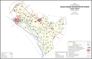
Magarwara is a village in Sikandarpur Karan block of Unnao district, Uttar Pradesh, India. It is located 6 km from the district headquarters, Unnao. It is located on state highways and has one primary school and no healthcare facilities. It has a train station on the Lucknow-Kanpur line, between Kanpur Bridge and Unnao train station; the same stretch of track is also connected with Rae Bareli and Balamau station past Unnao. Magarwara Bone Mill, established in 1927, is one of the major industrial establishments in Unnao district. As of 2011, its population is 6,584, in 1,263 households.

Asrenda is a village in Hilauli block of Unnao district, Uttar Pradesh, India. As of 2011, its population is 4,475, in 782 households, and it has 2 primary schools and no healthcare facilities.

Panhan, also called Panhan Khas, is a small village in Purwa block of Unnao district, Uttar Pradesh, India. Located due south of Purwa and a bit to the west of the Loni River, it historically was the seat of a pargana. As of 2011, the village's population is 545 people, in 104 households.

Shukla Khera is a village in Bighapur block of Unnao district, Uttar Pradesh, India. As of 2011, its population is 851, in 203 households, and it has one primary school and no healthcare facilities.

Kukri is a village in Bighapur block of Unnao district, Uttar Pradesh, India. As of 2011, its population is 471, in 93 households, and it has one primary school and no healthcare facilities.

Maharajpur is a village in Bighapur block of Unnao district, Uttar Pradesh, India. As of 2011, its population is 592, in 151 households, and it has one primary school and no healthcare facilities.

Rasulpur is a village in Nawabganj block of Unnao district, Uttar Pradesh, India. As of 2011, its population is 1,326, in 221 households, and it has no schools or healthcare facilities.

Arjunamau is a village in Nawabganj block of Unnao district, Uttar Pradesh, India. As of 2011, its population is 1,923, in 364 households, and it has one primary school and no healthcare facilities.

Hasnapur is a village in Nawabganj block of Unnao district, Uttar Pradesh, India. As of 2011, its population is 917, in 159 households, and it has a pre-primary school and no healthcare facilities.

Akampur is a village in Sumerpur block of Unnao district, Uttar Pradesh, India. As of 2011, its population is 2,107, in 380 households, and it has one primary school and no healthcare facilities.

Akthi is a village in Sumerpur block of Unnao district, Uttar Pradesh, India. As of 2011, its population is 686, in 114 households, and it has two primary schools and no healthcare facilities.

Jangal Khurd is a village in Sumerpur block of Unnao district, Uttar Pradesh, India. As of 2011, its population is 446, in 93 households, and it has one primary school and no healthcare facilities.

Dubai is a village in Sumerpur block of Unnao district, Uttar Pradesh, India. As of 2011, its population is 2,139, in 410 households, and it has one primary school and no healthcare facilities.

Parsanda is a village in Bighapur block of Unnao district, Uttar Pradesh, India. It hosts a market on Thursdays, Fridays, and Sundays, and vegetables and cloth are the main items bought and sold. As of 2011, the population of Parsanda is 1,715, in 377 households, and it has one primary school and no healthcare facilities.

Parsandan is a village in Nawabganj block of Unnao district, Uttar Pradesh, India. It was historically the capital of a pargana, since at least the time of Akbar. As of 2011, its population is 3,946, in 778 households.

Makhi is a large village in Miyanganj block of Unnao district, Uttar Pradesh, India. It hosts a Ramlila fair for one day during the month of Kuar, and it also holds a market twice per week, on Mondays and Saturdays. The main items sold at the market are grain and vegetables. Makhi also has a train station on the Kanpur-Balamau line, between the stations at Safipur and Patiyara. As of 2011, its population is 13,786, in 2,503 households.

Rampur Sudauli is a village in Bachhrawan block of Rae Bareli district, Uttar Pradesh, India. One of the main villages in the historical pargana of Bachhrawan, Rampur Sudauli is located at the corner of three districts: Raebareli, Lucknow and Unnao This spot is 15 km from Bachhrawan, at the point where the Sai river first enters the district.


