Asawar is a village in Asoha block of Unnao district, Uttar Pradesh, India. It has two primary schools and no healthcare facilities. As of 2011, its population is 3,080, in 572 households.

Nari Chak is a village in Hilauli block of Unnao district, Uttar Pradesh, India. As of 2011, its population is 2,129, in 363 households, and it has 3 primary schools and no healthcare facilities.
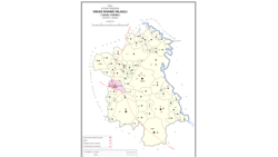
Maharani Khera is a village in Hilauli block of Unnao district, Uttar Pradesh, India. As of 2011, its population is 2,683, in 502 households. It has one primary school and no healthcare facilities.
Lotna is a village in Hilauli block of Unnao district, Uttar Pradesh, India. As of 2011, its population is 2,443, in 477 households, and it has 2 primary schools and no healthcare facilities.
Sandana is a village in Hilauli block of Unnao district, Uttar Pradesh, India. As of 2011, its population is 6,082, in 1,184 households, and it has 3 primary schools and no healthcare facilities.
Bardaha is a village in Hilauli block of Unnao district, Uttar Pradesh, India. As of 2011, its population is 2,529, in 469 households, and it has one primary school and no healthcare facilities.
Asrenda is a village in Hilauli block of Unnao district, Uttar Pradesh, India. As of 2011, its population is 4,475, in 782 households, and it has 2 primary schools and no healthcare facilities.
Barenda is a village in Hilauli block of Unnao district, Uttar Pradesh, India. As of 2011, its population is 864, in 174 households, and it has 2 primary schools and no healthcare facilities.
Bachhaura is a village in Hilauli block of Unnao district, Uttar Pradesh, India. As of 2011, its population is 2,607, in 521 households, and it has one primary schools and no healthcare facilities.
Lachhi Khera is a village in Hilauli block of Unnao district, Uttar Pradesh, India. As of 2011, its population is 1,488, in 232 households, and it has one primary school and no healthcare facilities.
Jera is a village in Hilauli block of Unnao district, Uttar Pradesh, India. As of 2011, its population is 2,826, in 521 households, and it has one primary school and no healthcare facilities.
Sagauli is a village in Hilauli block of Unnao district, Uttar Pradesh, India. As of 2011, its population is 2,048, in 380 households, and it has 3 primary schools and no healthcare facilities.
Sarai Thakuri is a village in Hilauli block of Unnao district, Uttar Pradesh, India. As of 2011, its population is 671, in 123 households, and it has one primary school and no healthcare facilities.
Reola is a village in Hilauli block of Unnao district, Uttar Pradesh, India. As of 2011, its population is 594, in 105 households, and it has no schools and no healthcare facilities.
Subas Khera is a village in Hilauli block of Unnao district, Uttar Pradesh, India. As of 2011, its population is 810, in 168 households, and it has one primary school and no healthcare facilities.
Lohli is a village in Hilauli block of Unnao district, Uttar Pradesh, India. As of 2011, its population is 827, in 147 households, and it has one primary school and no healthcare facilities.
Basdeo Khera is a village in Hilauli block of Unnao district, Uttar Pradesh, India. As of 2011, its population is 103, in 22 households, and it has one primary school and no healthcare facilities.
Para is a village in Hilauli block of Unnao district, Uttar Pradesh, India. As of 2011, its population is 7,701, in 1,262 households, and it has 6 primary schools and no healthcare facilities. It hosts a regular market and has a sub post office.

Rawatpur is a village in Purwa block of Unnao district, Uttar Pradesh, India. As of 2011, its population is 457, in 78 households, and it has no schools and no healthcare facilities.
Rasulpur is a village in Purwa block of Unnao district, Uttar Pradesh, India. As of 2011, its population is 617, in 118 households, and it has no schools and no healthcare facilities.