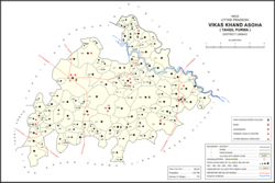
Asawar is a village in Asoha block of Unnao district, Uttar Pradesh, India. It has two primary schools and no healthcare facilities. As of 2011, its population is 3,080, in 572 households.

Chhulamau is a village in Purwa block of Unnao district, Uttar Pradesh, India. It is not connected to major district roads and has three primary schools and no healthcare facilities. As of 2011, its population is 961, in 180 households.
Asehru is a village in Purwa block of Unnao district, Uttar Pradesh, India. It is not connected to major district roads and has one primary school and no healthcare facilities. As of 2011, its population is 1,361, in 268 households.
Bhatmau is a village in Purwa block of Unnao district, Uttar Pradesh, India. It is not connected to major district roads and has one primary school and no healthcare facilities. As of 2011, its population is 1,326, in 309 households.
Kishan Khera is a village in Purwa block of Unnao district, Uttar Pradesh, India. It is not connected to major district roads and has one primary school and one medical practitioner. As of 2011, its population is 845, in 177 households.
Tikar Kalan is a village in Purwa block of Unnao district, Uttar Pradesh, India. It is connected to minor district roads and has one primary school and no healthcare facilities. As of 2011, its population is 1,077, in 211 households.
Tikar Khurd is a village in Purwa block of Unnao district, Uttar Pradesh, India. It is not connected to major district roads and has two primary schools and no healthcare facilities. As of 2011, its population is 1,086, in 201 households.
Lakhmademau is a village in Purwa block of Unnao district, Uttar Pradesh, India. It is connected to minor district roads and has one primary schools and one medical practitioner. As of 2011, its population is 1,461, in 296 households.
Nimaicha is a village in Asoha block of Unnao district, Uttar Pradesh, India. It is not located on major district roads and has one primary school and no healthcare facilities. As of 2011, its population is 607, in 116 households.
Kanchanpur is a village in Asoha block of Unnao district, Uttar Pradesh, India. It is located on a major district road and has one primary school and no healthcare facilities. As of 2011, its population is 1,793, in 314 households.
Anwarpur is a village in Asoha block of Unnao district, Uttar Pradesh, India. It is not located on major district roads and has one primary school and no healthcare facilities. As of 2011, its population is 707, in 133 households.
Keoni is a village in Asoha block of Unnao district, Uttar Pradesh, India. It is not located on major district roads and has one primary school and no healthcare facilities. As of 2011, its population is 653, in 104 households.
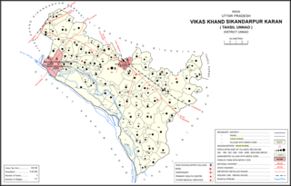
Magarwara is a village in Sikandarpur Karan block of Unnao district, Uttar Pradesh, India. It is located 6 km from the district headquarters, Unnao. It is located on state highways and has one primary school and no healthcare facilities. It has a train station on the Lucknow-Kanpur line, between Kanpur Bridge and Unnao train station; the same stretch of track is also connected with Rae Bareli and Balamau station past Unnao. Magarwara Bone Mill, established in 1927, is one of the major industrial establishments in Unnao district. As of 2011, its population is 6,584, in 1,263 households.
Poni is a village in Sikandarpur Karan block of Unnao district, Uttar Pradesh, India. It is connected to state highways and has 2 primary schools and no healthcare facilities. As of 2011, its population is 1,078, in 289 households.
Pipri is a village in Asoha block of Unnao district, Uttar Pradesh, India. It is connected to minor district roads and has two primary schools and no healthcare facilities. As of 2011, its population is 1,777, in 347 households.
Sarwara is a village in Asoha block of Unnao district, Uttar Pradesh, India. It is not connected to major or minor district roads and has no schools and no healthcare facilities. As of 2011, its population is 715, in 148 households.

Nari Chak is a village in Hilauli block of Unnao district, Uttar Pradesh, India. As of 2011, its population is 2,129, in 363 households, and it has 3 primary schools and no healthcare facilities.
Sandana is a village in Hilauli block of Unnao district, Uttar Pradesh, India. As of 2011, its population is 6,082, in 1,184 households, and it has 3 primary schools and no healthcare facilities.
Subas Khera is a village in Hilauli block of Unnao district, Uttar Pradesh, India. As of 2011, its population is 810, in 168 households, and it has one primary school and no healthcare facilities.

Jangal Khurd is a village in Sumerpur block of Unnao district, Uttar Pradesh, India. As of 2011, its population is 446, in 93 households, and it has one primary school and no healthcare facilities.