Mirri Khurd, also called Kusal Khera, is a village in Asoha block of Unnao district, Uttar Pradesh, India. It has no schools or healthcare facilities. As of 2011, its population is 589, in 109 households.
Kalu Khera is a village in Asoha block of Unnao district, Uttar Pradesh, India. It is located on a major district road and has one primary school and one medical clinic. In 2011, its population was 1,888, in 355 households.

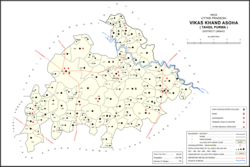
Kishan Khera is a village in Purwa block of Unnao district, Uttar Pradesh, India. It is not connected to major district roads and has one primary school and one medical practitioner. As of 2011, its population is 845, in 177 households.
Tikar Khurd is a village in Purwa block of Unnao district, Uttar Pradesh, India. It is not connected to major district roads and has two primary schools and no healthcare facilities. As of 2011, its population is 1,086, in 201 households.
Kanchanpur is a village in Asoha block of Unnao district, Uttar Pradesh, India. It is located on a major district road and has one primary school and no healthcare facilities. As of 2011, its population is 1,793, in 314 households.

Maharani Khera is a village in Hilauli block of Unnao district, Uttar Pradesh, India. As of 2011, its population is 2,683, in 502 households, and it has one primary school and no healthcare facilities.
Lachhi Khera is a village in Hilauli block of Unnao district, Uttar Pradesh, India. As of 2011, its population is 1,488, in 232 households, and it has one primary school and no healthcare facilities.
Subas Khera is a village in Hilauli block of Unnao district, Uttar Pradesh, India. As of 2011, its population is 810, in 168 households, and it has one primary school and no healthcare facilities.
Mawai is a village in Hilauli block of Unnao district, Uttar Pradesh, India. As of 2011, its population is 14,690, in 2,734 households, and it has 8 primary schools and one medical clinic. It hosts a regular market and has a post office.
Basdeo Khera is a village in Hilauli block of Unnao district, Uttar Pradesh, India. As of 2011, its population is 103, in 22 households, and it has one primary school and no healthcare facilities.
Bhatan Khera is a village in Hilauli block of Unnao district, Uttar Pradesh, India. As of 2011, its population is 820, in 174 households, and it has one primary school and no healthcare facilities.
Lawa Singhan Khera is a large village in Hilauli block of Unnao district, Uttar Pradesh, India. Located on the Sai river, it is a dispersed settlement consisting of several separate hamlets. As of 2011, its population is 9,984, in 1,797 households, and it has 8 primary schools and no medical clinics. It hosts a weekly haat and has a sub post office.

Shukla Khera is a village in Bighapur block of Unnao district, Uttar Pradesh, India. As of 2011, its population is 851, in 203 households, and it has one primary school and no healthcare facilities.
Jagat Khera is a village in Bighapur block of Unnao district, Uttar Pradesh, India. As of 2011, its population is 646, in 125 households, and it has no schools and no healthcare facilities.

Sumerpur is a hamlet of the village Chhanchhi Rai Khera, in Purwa tehsil of Unnao district, Uttar Pradesh, India. Located 26km south of Purwa and 50km southeast of Unnao, Sumerpur serves as the headquarters of a community development block as well as a nyaya panchayat. Sumerpur block was first established on 2 October 1955 in order to oversee implementation of India's Five-Year Plans at a local and rural level. As of 2011, the block comprises 148 villages and has a total population of 151,933 people in 28,469 households.
Sangrampur, also called Daundia Khera, is a village in Sumerpur block of Unnao district, Uttar Pradesh, India. Located on the high bank of the Naurahi river a bit to the west of the main Unnao-Dalmau road, it is most notable for its historic importance as the capital of the Bais of Baiswara. It was the seat of a pargana beginning in the 1700s. As of 2011, its population is 2,778 in 530 households. It has four primary schools and no healthcare facilities.
Nari Khera is a village in Sumerpur block of Unnao district, Uttar Pradesh, India. As of 2011, its population is 758, in 130 households, and it has one primary school and no healthcare facilities.

Kalui Khera is a village in Bachhrawan block of Rae Bareli district, Uttar Pradesh, India. As of 2011, its population is 1,734, in 342 households. It is located 10 km from Bachhrawan, the block headquarters, and the main staple foods are wheat and rice. It has one primary school and no healthcare facilities.
Rani Khera is a village in Bachhrawan block of Rae Bareli district, Uttar Pradesh, India. As of 2011, its population is 2,042, in 460 households. It is located 6 km from Bachhrawan, the block headquarters, and the main staple foods are wheat and rice. It has one primary school and no healthcare facilities.

Rani Khera is a village in Shivgarh block of Rae Bareli district, Uttar Pradesh, India. As of 2011, its population is 368, in 75 households. It has one primary school and no healthcare facilities. It is located 20 km from Maharajganj, the tehsil headquarters. The main staple foods are wheat and rice.