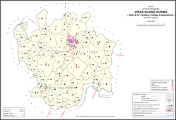
Purwa is a town and nagar panchayat in Unnao district, Uttar Pradesh, India. It is located 32 km southeast of Unnao, the district headquarters. Roads connect it with several major cities including Unnao, Lucknow, Kanpur, and Rae Bareli. As of 2011, its population is 24,467 people, in 4,128 households.

Asoha is a village in Purwa tehsil of Unnao district, Uttar Pradesh, India. It is located about 16 km north of Purwa, the tehsil headquarters, and 51 km east of Unnao, the district headquarters. The main crops grown here are wheat, barley, gram, juwar, paddy, and pulses, and irrigation is provided by a canal as well as by tanks. The soil here is mostly clay. As of 2011, the population of Asoha is 3,709, in 856 households.

Bikamau is a village in Asoha block of Unnao district, Uttar Pradesh, India. It is not connected to major district roads and has one primary school and no healthcare facilities. As of 2011, its population is 1,235, in 246 households.

Chhulamau is a village in Purwa block of Unnao district, Uttar Pradesh, India. It is not connected to major district roads and has three primary schools and no healthcare facilities. As of 2011, its population is 961, in 180 households.

Asehru is a village in Purwa block of Unnao district, Uttar Pradesh, India. It is not connected to major district roads and has one primary school and no healthcare facilities. As of 2011, its population is 1,361, in 268 households.

Bhatmau is a village in Purwa block of Unnao district, Uttar Pradesh, India. It is not connected to major district roads and has one primary school and no healthcare facilities. As of 2011, its population is 1,326, in 309 households.

Kishan Khera is a village in Purwa block of Unnao district, Uttar Pradesh, India. It is not connected to major district roads and has one primary school and one medical practitioner. As of 2011, its population is 845, in 177 households.

Tikar Kalan is a village in Purwa block of Unnao district, Uttar Pradesh, India. It is connected to minor district roads and has one primary school and no healthcare facilities. As of 2011, its population is 1,077, in 211 households.

Tikar Khurd is a village in Purwa block of Unnao district, Uttar Pradesh, India. It is not connected to major district roads and has two primary schools and no healthcare facilities. As of 2011, its population is 1,086, in 201 households.

Lakhmademau is a village in Purwa block of Unnao district, Uttar Pradesh, India. It is connected to minor district roads and has one primary schools and one medical practitioner. As of 2011, its population is 1,461, in 296 households.

Nimaicha is a village in Asoha block of Unnao district, Uttar Pradesh, India. It is not located on major district roads and has one primary school and no healthcare facilities. As of 2011, its population is 607, in 116 households.

Majharia is a village in Asoha block of Unnao district, Uttar Pradesh, India. It is not located on major district roads and has one primary school and no healthcare facilities. As of 2011, its population is 1,096, in 205 households.

Kanchanpur is a village in Asoha block of Unnao district, Uttar Pradesh, India. It is located on a major district road and has one primary school and no healthcare facilities. As of 2011, its population is 1,793, in 314 households.

Anwarpur is a village in Asoha block of Unnao district, Uttar Pradesh, India. It is not located on major district roads and has one primary school and no healthcare facilities. As of 2011, its population is 707, in 133 households.

Pipri is a village in Asoha block of Unnao district, Uttar Pradesh, India. It is connected to minor district roads and has two primary schools and no healthcare facilities. As of 2011, its population is 1,777, in 347 households.

Sarwara is a village in Asoha block of Unnao district, Uttar Pradesh, India. It is not connected to major or minor district roads and has no schools and no healthcare facilities. As of 2011, its population is 715, in 148 households.

Hilauli is a village in Purwa tehsil of Unnao district, Uttar Pradesh, India. It is located on the road from Maurawan to Bachhrawan in Rae Bareli district, near the banks of the Sai. Hilauli hosts a market twice per week, on sunday and Thursdays, with grain and vegetables being the main items bought and sold. As of 2011, the population of Hilauli is 13,318, in 2,533 households.

Gulariha is a village in Hilauli block of Unnao district, Uttar Pradesh, India. It is a dispersed settlement with several constituent hamlets, and it is right next to the border with Rae Bareli district. The Bhundi tank is located in the village, and it provides water for irrigation. As of 2011, its population is 12,482, in 2,300 households, and it has 10 primary schools and no healthcare facilities.

Panhan, also called Panhan Khas, is a small village in Purwa block of Unnao district, Uttar Pradesh, India. Located due south of Purwa and a bit to the west of the Loni River, it historically was the seat of a pargana. As of 2011, the village's population is 545 people, in 104 households.

Sumerpur is a hamlet of the village Chhanchhi Rai Khera, in Purwa tehsil of Unnao district, Uttar Pradesh, India. Located 26km south of Purwa and 50km southeast of Unnao, Sumerpur serves as the headquarters of a community development block as well as a nyaya panchayat. Sumerpur block was first established on 2 October 1955 in order to oversee implementation of India's Five-Year Plans at a local and rural level. As of 2011, the block comprises 148 villages and has a total population of 151,933 people in 28,469 households.


