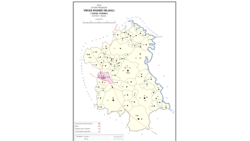
Maurawan, also spelled Mauranwan, is a town and nagar panchayat in Purwa tehsil of Unnao district, Uttar Pradesh, India. It is located 12 km from Purwa on the road to Raebareli, and 3 km to the southwest of the town is the large Basaha lake. As of 2011, its population is 15,484, in 2,399 households.

Purwa is a town and nagar panchayat in Unnao district, Uttar Pradesh, India. It is located 32 km southeast of Unnao, the district headquarters. Roads connect it with several major cities including Unnao, Lucknow, Kanpur, and Rae Bareli. As of 2011, its population is 24,467 people, in 4,128 households.

Nari Chak is a village in Hilauli block of Unnao district, Uttar Pradesh, India. As of 2011, its population is 2,129, in 363 households, and it has 3 primary schools and no healthcare facilities.

Maharani Khera is a village in Hilauli block of Unnao district, Uttar Pradesh, India. As of 2011, its population is 2,683, in 502 households. It has one primary school and no healthcare facilities.

Lotna is a village in Hilauli block of Unnao district, Uttar Pradesh, India. As of 2011, its population is 2,443, in 477 households, and it has 2 primary schools and no healthcare facilities.

Sandana is a village in Hilauli block of Unnao district, Uttar Pradesh, India. As of 2011, its population is 6,082, in 1,184 households, and it has 3 primary schools and no healthcare facilities.

Bardaha is a village in Hilauli block of Unnao district, Uttar Pradesh, India. As of 2011, its population is 2,529, in 469 households, and it has one primary school and no healthcare facilities.

Asrenda is a village in Hilauli block of Unnao district, Uttar Pradesh, India. As of 2011, its population is 4,475, in 782 households, and it has 2 primary schools and no healthcare facilities.

Barenda is a village in Hilauli block of Unnao district, Uttar Pradesh, India. As of 2011, its population is 864, in 174 households, and it has 2 primary schools and no healthcare facilities.

Lachhi Khera is a village in Hilauli block of Unnao district, Uttar Pradesh, India. As of 2011, its population is 1,488, in 232 households, and it has one primary school and no healthcare facilities.

Jera is a village in Hilauli block of Unnao district, Uttar Pradesh, India. As of 2011, its population is 2,826, in 521 households, and it has one primary school and no healthcare facilities.

Reola is a village in Hilauli block of Unnao district, Uttar Pradesh, India. As of 2011, its population is 594, in 105 households, and it has no schools and no healthcare facilities.

Subas Khera is a village in Hilauli block of Unnao district, Uttar Pradesh, India. As of 2011, its population is 810, in 168 households, and it has one primary school and no healthcare facilities.

Gulariha is a village in Hilauli block of Unnao district, Uttar Pradesh, India. It is a dispersed settlement with several constituent hamlets, and it is right next to the border with Rae Bareli district. The Bhundi tank is located in the village, and it provides water for irrigation. As of 2011, its population is 12,482, in 2,300 households, and it has 10 primary schools and no healthcare facilities.

Lohli is a village in Hilauli block of Unnao district, Uttar Pradesh, India. As of 2011, its population is 827, in 147 households, and it has one primary school and no healthcare facilities.

Mawai is a village in Hilauli block of Unnao district, Uttar Pradesh, India. As of 2011, its population is 14,690, in 2,734 households, and it has 8 primary schools and one medical clinic. It hosts a regular market and has a post office.

Basdeo Khera is a village in Hilauli block of Unnao district, Uttar Pradesh, India. As of 2011, its population is 103, in 22 households, and it has one primary school and no healthcare facilities.

Para is a village in Hilauli block of Unnao district, Uttar Pradesh, India. As of 2011, its population is 7,701, in 1,262 households, and it has 6 primary schools and no healthcare facilities. It hosts a regular market and has a sub post office.

Lawa Singhan Khera is a village in Hilauli block of Unnao district, Uttar Pradesh, India. Located on the Sai river, it is a dispersed settlement consisting of several separate hamlets. As of 2011, its population is 9,984, in 1,797 households, and it has 8 primary schools and no medical clinics. It hosts a weekly haat and has a sub post office.

Sumerpur is a hamlet of the village Chhanchhi Rai Khera, in Purwa tehsil of Unnao district, Uttar Pradesh, India. Located 26km south of Purwa and 50km southeast of Unnao, Sumerpur serves as the headquarters of a community development block as well as a nyaya panchayat. Sumerpur block was first established on 2 October 1955 in order to oversee implementation of India's Five-Year Plans at a local and rural level. As of 2011, the block comprises 148 villages and has a total population of 151,933 people in 28,469 households.


