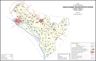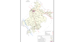
Asoha is a village in Purwa tehsil of Unnao district, Uttar Pradesh, India. It is located about 16 km north of Purwa, the tehsil headquarters, and 51 km east of Unnao, the district headquarters. The main crops grown here are wheat, barley, gram, juwar, paddy, and pulses, and irrigation is provided by a canal as well as by tanks. The soil here is mostly clay. As of 2011, the population of Asoha is 3,709, in 856 households.

Mirri Kalan is a village in Asoha block of Unnao district, Uttar Pradesh, India. It has nine primary schools and four medical practitioners as well as one veterinary hospital. As of 2011, its population is 5,622, in 1,066 households.

Daun is a village in Asoha block of Unnao district, Uttar Pradesh, India. It has one primary school and one medical dispensary. As of 2011, its population is 2,743, in 527 households.

Jhakwasa is a village in Asoha block of Unnao district, Uttar Pradesh, India. It is not connected to major district roads and has two primary schools and no healthcare facilities. As of 2011, its population is 1,065, in 196 households.

Samadha is a village in Asoha block of Unnao district, Uttar Pradesh, India. It is not connected to major district roads and has two primary schools and no healthcare facilities. As of 2011, its population is 3,681, in 694 households.

Darsawan is a village in Asoha block of Unnao district, Uttar Pradesh, India. It is not connected to major district roads and has two primary schools and two medical practitioners. As of 2011, its population is 3,074, in 600 households.

Utraura is a village in Asoha block of Unnao district, Uttar Pradesh, India. It is not located on major district roads and has one primary school and no healthcare facilities. As of 2011, its population is 1,281, in 281 households.

Nimaicha is a village in Asoha block of Unnao district, Uttar Pradesh, India. It is not located on major district roads and has one primary school and no healthcare facilities. As of 2011, its population is 607, in 116 households.

Magarwara is a village in Sikandarpur Karan block of Unnao district, Uttar Pradesh, India. It is located 6 km from the district headquarters, Unnao. It is located on state highways and has one primary school and no healthcare facilities. It has a train station on the Lucknow-Kanpur line, between Kanpur Bridge and Unnao train station; the same stretch of track is also connected with Rae Bareli and Balamau station past Unnao. Magarwara Bone Mill, established in 1927, is one of the major industrial establishments in Unnao district. As of 2011, its population is 6,584, in 1,263 households.

Poni is a village in Sikandarpur Karan block of Unnao district, Uttar Pradesh, India. It is connected to state highways and has 2 primary schools and no healthcare facilities. As of 2011, its population is 1,078, in 289 households.

Sagauli is a village in Hilauli block of Unnao district, Uttar Pradesh, India. As of 2011, its population is 2,048, in 380 households, and it has 3 primary schools and no healthcare facilities.

Shukla Khera is a village in Bighapur block of Unnao district, Uttar Pradesh, India. As of 2011, its population is 851, in 203 households, and it has one primary school and no healthcare facilities.

Ajgain is a village in Nawabganj block of Unnao district, Uttar Pradesh, India. It is located northeast of Unnao, near the main Lucknow-Kanpur road. It has a railway station on the Lucknow-Kanpur line, lying between Sonik and Kusumbhi. It holds a market on Mondays and Fridays, with grain and vegetables being the main items of trade. As of 2011, the population of Ajgain is 8,926, in 1,481 households.

Bihar is a village in Sumerpur block of Unnao district, Uttar Pradesh, India. Located on the main Unnao-Raebareli road, just to the east of the Loni river and near its confluence with the Kharahi, Bihar was briefly the headquarters of a tehsil in Raebareli district from 1860 until 1862, when it was moved into Unnao district. As of 2011, the population of Bihar is 5,952, in 1,088 households, and it has 5 primary schools and no healthcare facilities.

Malauna is a village in Sumerpur block of Unnao district, Uttar Pradesh, India. As of 2011, its population is 4,029, in 741 households, and it has two primary schools and no healthcare facilities.

Jamipur is a village in Sumerpur block of Unnao district, Uttar Pradesh, India. As of 2011, its population is 3,140, in 588 households, and it has two primary schools and no healthcare facilities.

Parsanda is a village in Bighapur block of Unnao district, Uttar Pradesh, India. It hosts a market on Thursdays, Fridays, and Sundays, and vegetables and cloth are the main items bought and sold. As of 2011, the population of Parsanda is 1,715, in 377 households, and it has one primary school and no healthcare facilities.

Parsandan is a village in Nawabganj block of Unnao district, Uttar Pradesh, India. It was historically the capital of a pargana, since at least the time of Akbar. As of 2011, its population is 3,946, in 778 households.

Makhi is a large village in Miyanganj block of Unnao district, Uttar Pradesh, India. It hosts a Ramlila fair for one day during the month of Kuar, and it also holds a market twice per week, on Mondays and Saturdays. The main items sold at the market are grain and vegetables. Makhi also has a train station on the Kanpur-Balamau line, between the stations at Safipur and Patiyara. As of 2011, its population is 13,786, in 2,503 households.

Rampur Sudauli is a village in Bachhrawan block of Rae Bareli district, Uttar Pradesh, India. One of the main villages in the historical pargana of Bachhrawan, Rampur Sudauli is located at the corner of three districts: Raebareli, Lucknow and Unnao This spot is 15 km from Bachhrawan, at the point where the Sai river first enters the district.


