Auras is a town and nagar panchayat in Hasanganj tehsil of Unnao district, Uttar Pradesh, India. First officially classified as a town for the 1981 census, Auras is located just north of the Sai River, on the road from Unnao to Sandila. Other roads branch off to Mohan, Newalganj, and Malihabad.

Nawabganj is a town and nagar panchayat in Hasanganj tehsil of Unnao district, Uttar Pradesh, India. It is located northeast of Unnao on the Lucknow-Kanpur road, near the Ajgain railway station. Founded in 1842 and first officially classified as a town for the 1981 census, Nawabganj once served as the seat of a tehsil under the Nawabs of Awadh and is today the headquarters of a community development block containing 124 villages.

Pariyar, also spelled Pariar, is a village in Sikandarpur Sarausi block of Unnao district, Uttar Pradesh, India. It is located on the left bank of the Ganges, 23km northwest of the city of Unnao. Nearby the village is the Mahua lake. Pariyar holds religious significance to Hindus; it is considered to be the place where the goddess Sita was exiled to, and the birthplace of her two sons Lava and Kusha. The village is known for holding a major fair during the month of Kartika, on the day of the full moon, which is attended by over 100,000 people. Historically, Pariyar was the seat of a pargana since 1785, and under the Nawabs of Awadh it was the seat of a tehsildar. Today, it is the headquarters of a nyaya panchayat. Pariyar is connected by road with Mohan and Rasulabad. As of 2011, its population is 7,363, in 1,355 households.
Patan is a town in Sumerpur block of Unnao District in the state of Uttar Pradesh, India. It is located 16km south of Purwa on the main Unnao-Allahabad road, and a short distance to the south of the Loni river. Part of the historical region of Baiswara, it historically gave its name to a pargana which existed since at least the time of Akbar, and under the Nawabs of Awadh it was the seat of a tehsil. The Rae Bareli-Kanpur branch of the Northern Railway zone runs through Patan, and the Takia train station is located in the village. A huge fair called the Takia-ka-Mela is held in Patan on the first Thursday in Paus, in honour of the saint Niamat Shah, revered by both Hindus and Muslims, drawing tens of thousands of visitors. A second fair, established by Muhabbat Shah's disciple Shafqat Shah, is also held in Muhabbat Shah's honour at the tomb on the first Thursday of Jeth.

Magrayar is a village in Bighapur block of Unnao district, Uttar Pradesh, India. Located 7km from Bighapur, Magrayar hosts a market on Mondays and Thursdays and was historically the seat of a pargana since at least the late 1500s. As of 2011, Magrayar's population is 4,248, in 964 households.

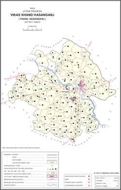
Miyanganj, also spelled Mianganj, is a village and corresponding community development block in Hasanganj tehsil of Unnao district, Uttar Pradesh, India. It is located on the road from Lucknow to Bangarmau, just to the west of the crossroads with another route linking Unnao and Sandila.

Hasanganj is a village and tehsil headquarters in Unnao district of Uttar Pradesh, India. It is located near Mohan, at a road junction leading to Miyanganj and Rasulabad. As of 2011, its population is 4,658, in 818 households.

Kantha is a village in Asoha block of Unnao district, Uttar Pradesh, India. It hosts two small melas, one of which is the Mahabirji-ka-Mela, held every Tuesday during the month of Jyaistha. People bring sweets, toys, and other items to sell at the fair. Kantha also hosts a market twice per week, on Mondays and Fridays, with vegetables being the main item of trade. As of 2011, the population of Kantha is 9,973, in 2,079 households.

Hilauli is a village in Purwa tehsil of Unnao district, Uttar Pradesh, India. It is located on the road from Maurawan to Bachhrawan in Rae Bareli district, near the banks of the Sai. Hilauli hosts a market twice per week, on sunday and Thursdays, with grain and vegetables being the main items bought and sold. As of 2011, the population of Hilauli is 13,318, in 2,533 households.
Mawai is a village in Hilauli block of Unnao district, Uttar Pradesh, India. As of 2011, its population is 14,690, in 2,734 households, and it has 8 primary schools and one medical clinic. It hosts a regular market and has a post office.

Panhan, also called Panhan Khas, is a small village in Purwa block of Unnao district, Uttar Pradesh, India. Located due south of Purwa and a bit to the west of the Loni River, it historically was the seat of a pargana. As of 2011, the village's population is 545 people, in 104 households.
Ajgain is a village in Nawabganj block of Unnao district, Uttar Pradesh, India. It is located northeast of Unnao, near the main Lucknow-Kanpur road. It has a railway station on the Lucknow-Kanpur line, lying between Sonik and Kusumbhi. It holds a market on Mondays and Fridays, with grain and vegetables being the main items of trade. As of 2011, the population of Ajgain is 8,926, in 1,481 households.
Rasulpur is a village in Nawabganj block of Unnao district, Uttar Pradesh, India. As of 2011, its population is 1,326, in 221 households, and it has no schools or healthcare facilities.
Arjunamau is a village in Nawabganj block of Unnao district, Uttar Pradesh, India. As of 2011, its population is 1,923, in 364 households, and it has one primary school and no healthcare facilities.
Hasnapur is a village in Nawabganj block of Unnao district, Uttar Pradesh, India. As of 2011, its population is 917, in 159 households, and it has a pre-primary school and no healthcare facilities.
Parsandan is a village in Nawabganj block of Unnao district, Uttar Pradesh, India. It was historically the capital of a pargana, since at least the time of Akbar. As of 2011, its population is 3,946, in 778 households.
Makhi is a large village in Miyanganj block of Unnao district, Uttar Pradesh, India. It hosts a Ramlila fair for one day during the month of Kuar, and it also holds a market twice per week, on Mondays and Saturdays. The main items sold at the market are grain and vegetables. Makhi also has a train station on the Kanpur-Balamau line, between the stations at Safipur and Patiyara. As of 2011, its population is 13,786, in 2,503 households.

Rampur Sudauli is a village in Bachhrawan block of Rae Bareli district, Uttar Pradesh, India. One of the main villages in the historical pargana of Bachhrawan, Rampur Sudauli is located at the corner of three districts: Raebareli, Lucknow and Unnao This spot is 15 km from Bachhrawan, at the point where the Sai river first enters the district.

Inhauna is a village and corresponding in Singhpur block of Rae Bareli district, Uttar Pradesh, India. As of 2011, its population is 13,049, in 2,021 households. Located at the junction of the Raebareli-Rudauli and Lucknow-Jaunpur roads, Inhauna is an old town that once served as the seat of a pargana as well as (briefly) a tehsil, and it has the ruins of an old fort built under the Nawabs of Awadh. The old marketplace, known as Ratanganj, was built in 1863 by the tahsildar Ratan Narain. Markets are held twice per week, on Mondays and Thursdays, and most of the trade is in livestock.

Khiron is a village and corresponding community development block in Rae Bareli district, Uttar Pradesh, India. Located on the main Raebareli-Unnao road, Khiron is an old Muslim town that historically served as the seat of a pargana. As of 2011, the village has a population of 9,955, in 1,714 households. It has six primary schools and one medical clinic. It serves as the headquarters of a nyaya panchayat that also includes 11 other villages.