This article has multiple issues. Please help improve it or discuss these issues on the talk page . (Learn how and when to remove these template messages)
|
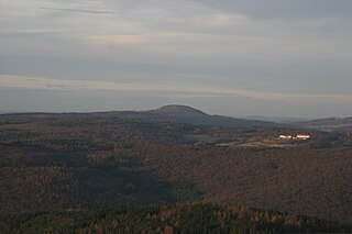
| Ospis | |
|---|---|
| Highest point | |
| Elevation | 439 m (1,440 ft) |
| Geography | |
| Location | Bavaria, Germany |
This article has multiple issues. Please help improve it or discuss these issues on the talk page . (Learn how and when to remove these template messages)
|
| Ospis | |
|---|---|
| Highest point | |
| Elevation | 439 m (1,440 ft) |
| Geography | |
| Location | Bavaria, Germany |

Upper Franconia is a Regierungsbezirk of the state of Bavaria, southern Germany. It forms part of the historically significant region of Franconia, the others being Middle Franconia and Lower Franconia, which are all now part of the German Federal State of Bayern (Bavaria).
Bayreuth is a Landkreis (district) in Bavaria, Germany. It surrounds, but does not include the city of Bayreuth. The district is bounded by the districts of Kulmbach, Hof, Wunsiedel, Tirschenreuth, Neustadt an der Waldnaab, Amberg-Sulzbach, Nürnberger Land, Forchheim and Bamberg.
Neckar-Odenwald-Kreis is a Landkreis (district) in the north of Baden-Württemberg, Germany. Neighboring districts are Main-Tauber-Kreis, Hohenlohe-Kreis, Heilbronn, Rhein-Neckar-Kreis, Odenwaldkreis (Hesse) and Landkreis Miltenberg (Bavaria). The district is part of the Rhine-Neckar Metropolitan Region.
Cham is a Landkreis (district) in Bavaria, Germany. It is bounded by the districts of Regen, Straubing-Bogen, Regensburg and Schwandorf and by the Czech Plzeň Region.
Main-Tauber-Kreis is a Landkreis (district) in the northeast of Baden-Württemberg, Germany. Neighboring districts are Miltenberg, Main-Spessart, Würzburg, Neustadt (Aisch)-Bad Windsheim and Ansbach, and the districts of Schwäbisch Hall, Hohenlohe and Neckar-Odenwald.
Coburg is a Landkreis (district) in Bavaria, Germany. It is bounded by the districts of Kronach, Lichtenfels, Bamberg and Haßberge, and by the state of Thuringia. The district surrounds, but does not include the city of Coburg.
Forchheim is a Landkreis (district) in Bavaria, Germany. It is bounded by the districts of Bamberg, Bayreuth, Nürnberger Land and Erlangen-Höchstadt.
Castell was a county of northern Bavaria, Germany, ruling a string of territories in the historical region of Franconia, both east and west of Würzburg. Little is known about the noble Counts of Castell, although they were the counts of Kreis Gerolzhofen, Regierungsbezirk, and Unterfranken of Bavaria. They were a member of the Fränkische Grafenkolleg.
St. Joseph is a neighborhood two miles south of downtown Louisville, Kentucky, United States, and immediately east of the University of Louisville. It borders the Meriwether neighborhood to the north and Schnitzelburg to the east. The area was named after the St. Joseph's Infirmary hospital, which was established by the Sisters of Charity of Nazareth. The building, once located at the corner of Preston Street and Eastern Parkway, was razed in 1980.

Lenzerheide is a mountain resort in the canton of Graubünden, Switzerland at the foot of the Parpaner Rothorn. The village lies in the municipality Vaz/Obervaz in the district of Albula, sub-district Alvaschein.
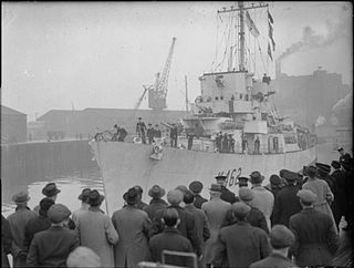
HMS Affleck was a Captain-class frigate which served during World War II. The ship was named after Sir Edmund Affleck, commander of HMS Bedford at the Moonlight Battle in 1780 during the American Revolutionary War.

Tollos is a municipality in the comarca of Comtat, Alicante, Valencia, Spain.
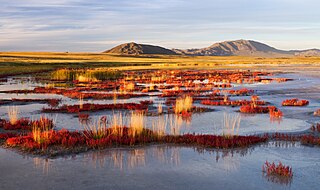
Uvs Lake Basin is an endorheic basin located on the territorial border of Mongolia and Tuva, a republic of the Russian Federation. The basin is part of the Central Asian Internal Drainage Basin and is named after Uvs Lake, a large saline lake situated in the western part of its drainage basin, and is one of the last remnants of the mammoth steppes. Uvs Lake is a shallow lake with an area of 3,350 km2 (1,290 sq mi). Its entire basin, which includes several smaller lakes, is 70,000 km2 (27,000 sq mi).
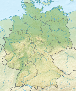
Germany is a country in Central and Western Europe that stretches from the Alps, across the North European Plain to the North Sea and the Baltic Sea. It is the second-most populous country in Europe after Russia, and is seventh-largest country by area in the continent. The area of Germany ranked 63rd and covers 357,021 km2 (137,847 sq mi), consisting of 349,223 km2 (134,836 sq mi) of land and 7,798 km2 (3,011 sq mi) of waters, smaller than Japan but larger than Republic of the Congo.

Döbraberg is a mountain of Bavaria, Germany.
Große Haube is a mountain of Bavaria, Germany. It is 658 metres above sea level. The mountain is part of a large, low mountain range located in Bavaria. The name "Große Haube" is German for "large hood".
Cunningham Glacier is a tributary glacier in the Queen Maud Mountains, flowing northeast to enter Canyon Glacier 5 nautical miles (9 km) north of Gray Peak. It was named by the Advisory Committee on Antarctic Names for Willard E. Cunningham, Jr., a cook at McMurdo Station, winter 1960, and at South Pole Station, winter 1963.
HMS Gould (K476) was a British Captain-class frigate of the Royal Navy in commission during World War II. Originally constructed as the United States Navy Evarts-class destroyer escort USS Lovering (DE-272), she served in the Royal Navy from 1943 until her sinking in 1944.
Qastal al-Burj is a Syrian village located in Al-Ziyarah Nahiyah in Al-Suqaylabiyah District, Hama. According to the Syria Central Bureau of Statistics (CBS), the village had a population of 36 in the 2004 census.
49°45′N9°16′E / 49.750°N 9.267°E
| | This Bavaria location article is a stub. You can help Wikipedia by expanding it. |