
The Taupo Volcanic Zone (TVZ) is a volcanic area in the North Island of New Zealand that has been active for the past two million years and is still highly active. Mount Ruapehu marks its south-western end and the zone runs north-eastward through the Taupo and Rotorua areas and offshore into the Bay of Plenty. It is part of the larger Central Volcanic Region that extends further westward through the western Bay of Plenty to the eastern side of the Coromandel Peninsula and has been active for four million years. The Taupo Volcanic Zone is widening east–west at the rate of about 8 mm per year. It is named after Lake Taupo, the flooded caldera of the largest volcano in the zone.
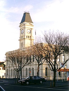
Waitaki District is a territorial authority that is located in the Canterbury and Otago regions of the South Island of New Zealand, and it straddles the traditional border between the two regions, the Waitaki River.

The Waipori River is in Otago in the South Island of New Zealand. Rising in the Lammerlaw Range, it flows southeast for 50 kilometres (31 mi) before joining the Taieri River near Henley, 30 kilometres (19 mi) southwest of Dunedin of which it is officially the southernmost border.
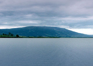
Often incorrectly called The Maungatuas or The Maungatua Range, Maungatua is a prominent ridge which dominates the skyline of the Taieri Plains in Otago, New Zealand. Rising 900 metres above the floodplain of the Taieri River, directly to the west of Dunedin's airport at Momona, it can be clearly seen from much of Dunedin's urban area, 35 kilometres to the east, and from as far south as the outskirts of Balclutha, 65 kilometres to the southwest. Lake Mahinerangi is located on the western side of Maungatua.

The Hakataramea River flows generally south through the Hakataramea Valley, which is separated from the more inland Mackenzie Basin by the Kirkliston Range in Canterbury, New Zealand.

The Godley River is an alpine braided river flowing through Canterbury, in New Zealand's South Island.
The Maerewhenua River, also known as the Marewhenua River, is a small river in the Otago region of New Zealand's South Island. It is located in North Otago and acts as a tributary of the Waitaki River, which forms the border between Otago and Canterbury.
Hakataramea, spelt Hakateramea in some older sources, is a rural village located in the southern Canterbury region of New Zealand's South Island. It is in the Waimate District and sits on the north bank of the Waitaki River at its confluence with the Hakataramea River.

The Whataroa River, sometimes the Wataroa River, is a river in the southern West Coast region of New Zealand's South Island. Its source is in the Southern Alps and it flows north and northwest, passing the township of Whataroa on the eastern side before reaching the Tasman Sea just south of Abut Head. The river is fed by many tributaries, such as the Perth River, and is crossed by State Highway 6 on its route between Whataroa and Te Taho.
The Hinds River is a river in the Canterbury region of New Zealand. Its north and south branches drain the eastern flank of the Moorhouse Range, part of the Southern Alps, and their confluence is near Anama and Mayfield. The river then flows across the Canterbury Plains towards the Pacific Ocean, passing through the small town of Hinds along the way. In Hinds, State Highway 1 and the Main South Line railway cross the river. The river's mouth is located between the localities of Longbeach and Lowcliffe.
Lowcliffe is a lightly populated locality in the mid-Canterbury region of New Zealand's South Island. It is situated on the shore of the Pacific Ocean between the mouths of the Hinds and Rangitata Rivers. Nearby settlements include Coldstream to the west by the Rangitata River, Longbeach to the east on the other side of the Hinds River's mouth, and Hinds to the north. The closest towns of significant size are Ashburton to the northeast and Geraldine to the west.
The Cust River is a river in the Canterbury Region of New Zealand. It flows east across the upper Canterbury Plains from its source north of the town of Oxford, New Zealand, flowing into the Cam River / Ruataniwha close to the town of Rangiora. The small town of Cust lies on the banks of the river. The lower part of the river, to the south-west of Rangiora, is diverted into a channel and called the "Main Drain". The channel was built in 1862 to drain the swampy land between Rangiora and the Waimakariri River, and when it was enlarged in 1868 it accidentally captured the Cust.
The Kurow River is a river of North Otago, New Zealand. A tributary of the Waitaki River, it rises in Saint Marys Range and flows into that river downstream of Kurow.
The Little Awakino River is a river of North Otago, New Zealand. A tributary of the Waitaki River, it flows into that river a short distance downstream of Lake Waitaki.
The North Barlow River is a river in the West Coast Region of New Zealand's South island. It is one of the headwaters of the Barlow River.
The North Opuha River is a river of the south Canterbury Region of New Zealand's South Island. It flows south from its sources in the Sherwood Range, and drains into the northern end of Opuha Lake, 15 kilometres (9 mi) north of Fairlie.
The Otematata River is a river in North Otago, New Zealand. It rises west of Kohurau and flows northward into Lake Aviemore east of Otematata township.
The Otiake River is a river in New Zealand, a tributary of the Waitaki River.
The Pitt River is a river in Fiordland, New Zealand. It rises north-west of Oilskin Pass and flows north-westward into Lake Beddoes.
The White Rock River is a river in the South Canterbury area of New Zealand. It rises south of the 1,525 metres (5,003 ft) Mount Nimrod / Kaumira in the Hunter Hills and flows northeast then north to joint the Pareora River.


