Johan Anthoniszoon "Jan" van Riebeeck was a Dutch navigator, ambassador and colonial administrator of the Dutch East India Company.

Cape Coloureds are a South African group of multiracial people who are from the Cape region in South Africa which consists of the Northern Cape, the Western Cape and the Eastern Cape. Their ancestry comes from the interracial mixing between the White, the indigenous Khoi and San, the Xhosa plus other Bantu people and slaves imported from the Dutch East Indies. People from India and the islands within the Indian Ocean region were also taken to the Cape and sold into slavery by the Dutch settlers. Eventually all these ethnic and racial group intermixed with each forming a group of mixed race people that became the "Cape Coloureds".

The Cape Flats is an expansive, low-lying, flat area situated to the southeast of the central business district of Cape Town. The Cape Flats is also the name of an administrative region of the City of Cape Town, which lies within the larger geographical area.

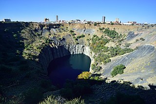
Kimberley is the capital and largest city of the Northern Cape province of South Africa. It is located approximately 110 km east of the confluence of the Vaal and Orange Rivers. The city has considerable historical significance due to its diamond mining past and the siege during the Second Anglo-Boer war. British businessmen Cecil Rhodes and Barney Barnato made their fortunes in Kimberley, and Rhodes established the De Beers diamond company in the early days of the mining town.

The Griquas are a subgroup of mixed-race heterogeneous formerly Xiri-speaking nations in South Africa with a unique origin in the early history of the Dutch Cape Colony. Like the Boers they migrated inland from the Cape and in the 19th century established several states in what is now South Africa and Namibia. The Griqua consider themselves as being South Africa’s first multiracial nation with people descended directly from Dutch settlers in the Cape, and local peoples.

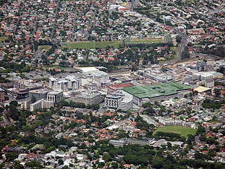
Rondebosch is one of the Southern Suburbs of Cape Town, South Africa. It is primarily a residential suburb, with shopping and business districts as well as the main campus of the University of Cape Town.

District Six is a former inner-city residential area in Cape Town, South Africa. In 1966, the apartheid government announced that the area would be razed and rebuilt as a "whites only" neighbourhood under the Group Areas Act. Over the course of a decade, over 60,000 of its inhabitants were forcibly removed and in 1970 the area was renamed Zonnebloem, a name that makes reference to an 18th century colonial farm. At the time of the proclamation, 56% of the district’s property was White-owned, 26% Coloured-owned and 18% Indian-owned. Most of the residents were Cape Coloureds and they were resettled in the Cape Flats. The vision of a new white neighbourhood was not realised and the land has mostly remained barren and unoccupied. The original area of District Six is now partly divided between the suburbs of Walmer Estate, Zonnebloem, and Lower Vrede, while the rest is generally undeveloped land.

Swartland Municipality is a local municipality located in the Western Cape province of South Africa. Malmesbury is the seat of the municipality. As of 2022, it had a population of 148,331. Its municipality code is WC015.

Worcester is a town in the Western Cape, South Africa. It is the third-largest city in the Western Cape Province of South Africa. It is located 120 kilometres (75 mi) north-east of Cape Town on the N1 highway north to Johannesburg.

Claremont is a suburb of Cape Town, South Africa. It is situated 9 kilometers south of the city, and is one of the so-called "Southern Suburbs", it is situated alongside Lansdowne. It is an important commercial and residential area, which is currently experiencing significant growth and development.

Observatory is a suburb in Cape Town, South Africa, colloquially known as Obs. Bordered by Mowbray to the south and Salt River to the northwest, the area is best known as a student neighbourhood associated with the nearby University of Cape Town and Groote Schuur Hospital. It takes its name from the South African Astronomical Observatory headquarters, built in 1829 by the Royal Observatory.

The system of racial segregation and oppression in South Africa known as apartheid was implemented and enforced by many acts and other laws. This legislation served to institutionalize racial discrimination and the dominance by white people over people of other races. While the bulk of this legislation was enacted after the election of the National Party government in 1948, it was preceded by discriminatory legislation enacted under earlier British and Afrikaner governments. Apartheid is distinguished from segregation in other countries by the systematic way in which it was formalized in law.

Lydbrook is a civil parish in the Forest of Dean, a local government district in the English county of Gloucestershire and is located in the Wye Valley. It is on the north west edge of the Forest of Dean's present legal boundary proper. It comprises the districts of Lower Lydbrook, Upper Lydbrook, Joys Green and Worrall Hill. It has a mile and a half long high street, reputed to be the longest high street of any village in England.

Riebeek-Kasteel is one of the oldest towns in South Africa, situated at 80 km north-east of Cape Town in The Riebeek Valley together with its sister town Riebeek West. They set off in the direction of Paardeberg and on 3 February 1661 they ascended a lonely mountain and came upon the fertile vista of the Riebeek Valley. They named it Riebeek Kasteel, in honor of the Commander.

Riebeek West is a small town situated about 75 km north-east of Cape Town and 5 km north of its twin town Riebeek Kasteel in the Swartland area of the Western Cape, South Africa.

Johannesburg Park Station is the central railway station in the city of Johannesburg, South Africa, and the largest railway station in Africa. It is located between the Central Business District and Braamfontein, in the block bordered by Rissik, Wolmarans, Wanderers, and Noord Streets. Park Station lies on the main Witwatersrand railway line that runs East-West from Krugersdorp to Germiston. The first four stations to the east are Doornfontein, Ellis Park, Jeppe and George Goch Stations.

Harfield Village, also known as Lower Claremont, is a neighbourhood in the south of Cape Town. It is located between the suburbs of Kenilworth and Claremont, Cape Town. The Arderne Gardens are located to the area's immediate north on the other side of Harfield Station. Although it is typically regarded as being part of Claremont, parts of the village overlap with areas commonly regarded as being parts of lower Kenilworth.

The South African Sendinggestig Museum was established in 1977 and is currently situated in the centre of Cape Town, Western Cape, South Africa. It is a province-aided museum which receives support from the Government of the Western Cape Province.
Tesselaarsdal is a dispersed rural settlement in the Theewaterskloof Municipality, Western Cape, South Africa. It is situated on the northern side of the Kleinrivier Mountains, 20 kilometres (12 mi) south of the town of Caledon. The 2011 census recorded a population of 1,395 people in 428 households in Tesselaarsdal and on the surrounding farms.
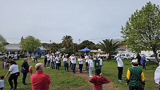
Esterhof is a settlement and housing development in West Coast District Municipality in the Western Cape province of South Africa. Esterhof is located roughly two kilometers to the east of Riebeek-Kasteel, separated by a railway and industrial buildings, and was originally created as part of apartheid initiatives that forcibly displaced Coloured people out of Oukloof in the 1960s.


