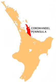
The Thames-Coromandel District is a territorial authority district in the North Island of New Zealand, covering all the Coromandel Peninsula and extending south to Hikutaia.

The Mercury Islands are a group of seven islands off the northeast coast of New Zealand's North Island. They are located 8 kilometres (5 mi) off the coast of the Coromandel Peninsula, and 35 kilometres (22 mi) northeast of the town of Whitianga.

Mercury Bay is a large V-shaped bay on the eastern coast of the Coromandel Peninsula on the North Island of New Zealand. This bay was named by the English navigator Captain James Cook during his exploratory expeditions. It was first named Te-Whanganui-a-Hei, the great bay of Hei, by the Māori.

Whitianga is a town on the Coromandel Peninsula, in the Waikato Region of New Zealand's North Island. The town is located on Mercury Bay, on the northeastern coast of the peninsula. The town has a permanent population of 5,080 as of June 2018, making it the second-largest town on the Coromandel Peninsula behind Thames.

Hahei is a small settlement in Mercury Bay on the eastern side of the Coromandel Peninsula in New Zealand. It is near Cathedral Cove, between the settlements of Cooks Beach and Hot Water Beach. It is approximately 6 km south east of Whitianga and 6 km north of Hot Water Beach.
Coroglen is a locality in the Coromandel Peninsula, New Zealand. It lies on State Highway 25, 18 kilometres south of Whitianga and 26 kilometres north west of Tairua. The "Tapu-Coroglen Road", a windy gravel road, connects it across the Coromandel Range with Tapu on the west coast of the peninsula.
Te Rerenga is a locality on the Whangapoua Harbour, Coromandel Peninsula, New Zealand. State Highway 25 runs through it. Coromandel is 12 km to the west. Whitianga lies to the south east. The Waitekuri and Opitonui Rivers flow from the Coromandel Range in the west and south through the area to drain in the Whangapoua Harbour.
Whenuakite is a locality on the Coromandel Peninsula of New Zealand. State Highway 25 runs through it. Whitianga is north west, Coroglen 8 km west, Cooks Beach and Hahei north, Hot Water Beach north east, and Tairua 18 km to the south east. The Whenuakite River flows from coastal hills in the east through the area to drain in the Whitianga Harbour.
The 309 Road is a 22-kilometre (14 mi) gravel road between the towns of Coromandel and Whitianga in New Zealand. It winds its way from Coromandel, on the west side of the Coromandel Peninsula, over the ranges to Whitianga, on the eastern side. There are two theories as to how it got its name: one is that there are 309 bends in the road, the other is that horse-drawn coaches used to take 309 minutes to travel it.
The Kaimarama River is a river of New Zealand's Coromandel Peninsula. It flows from its source within Coromandel Forest Park, joining with the Mahakirau River to flow into Whitianga Harbour on the peninsula's east coast.
The Kapowai River is a river in the Waikato Region of New Zealand. It is located on the Coromandel Peninsula, and flows north from its source inland from Tairua, reaching the sea at Whitianga Harbour
The Mahakirau River is a river of the Coromandel Peninsula in New Zealand's North Island. It flows east from its source in the Coromandel Range, reaching the sea at Whitianga Harbour southwest of Whitianga.
The Purangi River is a river of the Coromandel Peninsula in New Zealand's North Island. It flows north to reach Mercury Bay to the east of Whitianga.
The Waiwawa River is the longest river on the Coromandel Peninsula, in the Waikato Region of New Zealand's North Island. It flows initially northwest from its sources on the slopes of Mount Rowe before turning northeast to reach the southern end of the Whitianga Harbour.
The Whangamaroro River is a short river of the Coromandel Peninsula, in the Waikato Region of New Zealand's North Island. It flows east to reach a northwestern arm of Whitianga Harbour
The Whenuakite River is one of the longer rivers on the Coromandel Peninsula, in the Waikato Region of New Zealand's North Island. It flows initially north from its sources close to the peninsula's southeast coast north of Tairua, before turning west to reach the southernmost point of the Whitianga Harbour.
Whitianga Aerodrome serves the town of Whitianga, New Zealand. The aerodrome is located 1.5 NM west of Whitianga on the eastern side of the Coromandel Peninsula in the North Island of New Zealand. The aerodrome is operated by the Mercury Bay Aero Club. The aerodrome is popular with model aircraft enthusiasts and glider pilots.

Otama Beach is a beach on the northeast coast of the Coromandel Peninsula, New Zealand, 20 km north of Whitianga.
State Highway 25 is a North Island state highway in New Zealand that loops around the Coromandel Peninsula. It is a major route for holidaymakers and tourists which has access to some of New Zealand's most idyllic beach holiday spots. The summer period around Christmas and New Year's Eve is a particularly busy period for the highway. The road is very scenic, but also windy in many parts as well as single carriage on the entire route, and is prone to accidents. It is New Zealand's third longest two-digit state highway, after SH 35 and SH 94. It is part of the Pacific Coast Highway.