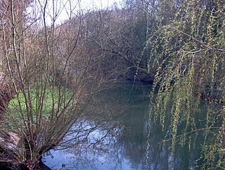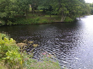
The Don River is a watercourse in southern Ontario that empties into Lake Ontario, at Toronto Harbour. Its mouth was just east of the street grid of the town of York, Upper Canada, the municipality that evolved into Toronto, Ontario. The Don is one of the major watercourses draining Toronto that have headwaters in the Oak Ridges Moraine.

The Calumet River is a system of heavily industrialized rivers and canals in the region between the south side of Chicago, Illinois, and the city of Gary, Indiana. Historically, the Little Calumet River and the Grand Calumet River were one, the former flowing west from Indiana into Illinois, then turning back east to its mouth at Lake Michigan at Marquette Park in Gary. Now the system is part of the Chicago Area Waterway System and through the use of locks flows away from Lake Michigan to the Cal-Sag Channel.

The River Rother, a waterway in the northern midlands of England, gives its name to the town of Rotherham and to the Rother Valley parliamentary constituency. It rises in Pilsley in Derbyshire and flows in a generally northwards direction through the centre of Chesterfield, where it feeds the Chesterfield Canal, and on through the Rother Valley Country Park and several districts of Sheffield before joining the River Don at Rotherham in Yorkshire. Historically, it powered mills, mainly corn or flour mills, but most had ceased to operate by the early 20th century, and few of the mill buildings survive.

Quarry Bank Mill in Styal, Cheshire, England, is one of the best preserved textile factories of the Industrial Revolution. Built in 1784, the cotton mill is recorded in the National Heritage List for England as a designated Grade II* listed building. Quarry Bank Mill was established by Samuel Greg, and was notable for innovations both in machinery and also in its approach to labour relations, the latter largely as a result of the work of Greg's wife, Hannah Lightbody. The family took a somewhat paternalistic attitude toward the workers, providing medical care for all and limited education to the children, but all laboured roughly 72 hours per week until 1847 when a new law shortened the hours.

The River Ryton is a tributary of the River Idle. It rises close to the Chesterfield Canal near Kiveton Park, and is joined by a series of tributaries near Lindrick Common in the Metropolitan Borough of Rotherham, South Yorkshire, England. Most of its course is in Nottinghamshire, flowing through the town of Worksop. It meanders northwards to join the River Idle near the town of Bawtry on the South Yorkshire-Nottinghamshire border.

The Frome, historically the Froom, is a river that rises in Dodington Park, South Gloucestershire and flows southwesterly through Bristol to join the river Avon. It is approximately 20 miles (32 km) long, and the mean flow at Frenchay is 60 cubic feet per second (1.7 m3/s). The name Frome is shared with several other rivers in South West England and means 'fair, fine, brisk'. The river is known locally in east Bristol as the Danny.

The River Ember is a short river in the north of Surrey, England — a channel of the River Mole which splits in two south of Island Barn Reservoir, between East Molesey and Lower Green, Esher. The Ember, the larger channel, flows in an easterly and then northerly direction around the reservoir, past part of Esher; the Mole flows around the other side past West Molesey. The two rivers then flow side by side approximately north east and merge 400 metres before joining the River Thames at the eastern end of East Molesey opposite Hampton Court Palace on the south side of the last non-tidal reach, which is above Teddington Lock.

Taylor-Massey Creek is a tributary of the Don River in Toronto, Ontario. It flows through Scarborough and East York, where it enters the Don River. Taylor-Massey Creek has also been called Silver Creek and Scarboro Creek.

The River Leven in North Yorkshire, England is a tributary of the River Tees. It rises on Warren Moor, part of Kildale Moor, in the North York Moors and flows to the north of the moors to join the River Tees at Yarm.

The River Frome, once also known as the Stroudwater, is a small river in Gloucestershire, England. It is to be distinguished from another River Frome in Gloucestershire, the Bristol Frome, and the nearby River Frome, Herefordshire. The river is approximately 25 miles (40 km) long.

The Old River Control Structure is a floodgate system in a branch of the Mississippi River in central Louisiana. It regulates the flow of water from the Mississippi into the Atchafalaya River, thereby preventing the Mississippi River from changing course. Completed in 1963, the complex was built by the U.S. Army Corps of Engineers in a side channel of the Mississippi known as "Old River", between the Mississippi's current channel and the Atchafalaya Basin, a former channel of the Mississippi.

Mapledurham Watermill is a historic watermill in the civil parish of Mapledurham in the English county of Oxfordshire. It is driven by the head of water created by Mapledurham Lock and Weir, on the River Thames. The mill was built in the 15th century, and further extended in the 17th, 18th and 19th centuries. It is a Grade II* listed building and is preserved in an operational state.

The Blackburn Brook is a stream in Sheffield, South Yorkshire, England which flows through the Blackburn Valley along the M1 and Ecclesfield Road and joins the River Don near the Meadowhall shopping centre. Downstream from the A61 road at Chapeltown the Blackburn Brook is defined as a main river by the Environment Agency, which requires new building development to be at least 26 feet (8 m) from the bank side as a flood defence measure and to allow access to the watercourse for maintenance.

The River Poddle is a river in Dublin, Ireland, a pool of which gave the city its English language name. Boosted by a channel made by the Abbey of St. Thomas à Becket, taking water from the far larger River Dodder, the Poddle was the main source of drinking water for the city for more than 500 years, from the 1240s. The Poddle, which flows wholly within the traditional County Dublin, is one of around a hundred members of the River Liffey system, and one of over 135 watercourses in the county; it has just one significant natural tributary, the Commons Water from Crumlin.

The River Camac is one of the larger rivers in Dublin and was one of four tributaries of the Liffey critical to the early development of the city.

Foston on the Wolds is a village and civil parish in the East Riding of Yorkshire, England. It is situated approximately 8 miles (13 km) south-west of Bridlington town centre and 2 miles (3 km) north of the village of North Frodingham.

The Ablach is a right tributary of the Danube. It rises on the European Watershed, which is only a hint in this area, from the Mindersdorfer Aach in the municipality of Hohenfels in the Landkreis of Konstanz. It is about 32 kilometres (20 mi) long.

Mellor Mill, also known as Bottom's Mill, was a six-story cotton mill in Marple, Greater Manchester built by Samuel Oldknow in 1793. This was a six-storey, 42-foot (13 m) wide and 210-foot (64 m) long mill with additional three-storey wings making it 400 feet (120 m) in all. The mill was built for Samuel Oldknow and used to spin coarse counts. It was originally driven by the Wellington water wheel. The River Goyt, and with it the then county boundary between Derbyshire and Cheshire was diverted and a weir built, the leat fed a millpond that in later times was named the Roman Lakes. This in turn fed a second mill pond along with water from reservoir in Linnet Clough. Supplementary power was provided by a second exterior wheel known as the Waterloo wheel. The Mill reached its peak production in 1804, when 10,080 spindles were operating and around 550 people were employed. It was destroyed by fire in 1892.

The Roman River is a river that flows entirely through the English county of Essex. It is a tributary of the River Colne, flowing into its tidal estuary below Colchester. The lower end of the Roman River is also tidal, with tidal water flowing upstream to just above Fingringhoe.

Painswick Stream is a small river in Gloucestershire, England. It is a tributary of the River Frome, and flows generally southwards, passing around the village of Painswick and through the town of Stroud. It used to join the Frome at its mouth, but was diverted into the then-derelict Stroudwater Navigation as part of a flood relief scheme in the 1950s. Despite its small size, it has been used to power a significant number of mills, many of which were associated with cloth manufacture until the industry was hit by a series of depressions in the 1820s and 1830s. Some found other uses, being used for grinding corn and for the manufacture of walking sticks and umbrella sticks, another prominent local industry. Many were subsequently demolished, but a number survive which have been granted listed building status.


