Related Research Articles

Oyster Bay is a hamlet and census-designated place (CDP) on the North Shore of Long Island in Nassau County in the state of New York, United States. The hamlet is also the site of a station on the Oyster Bay Branch of the Long Island Rail Road and the eastern termination point of that branch of the railroad.

Baltimore Pennsylvania Station is the main transportation hub in Baltimore, Maryland. Designed by New York architect Kenneth MacKenzie Murchison (1872–1938), it was constructed in 1911 in the Beaux-Arts style of architecture for the Pennsylvania Railroad. It is located at 1515 N. Charles Street, about a mile and a half north of downtown and the Inner Harbor, between the Mount Vernon neighborhood to the south, and Station North to the north. Originally called Union Station because it served the Pennsylvania Railroad and Western Maryland Railway, it was renamed to match other Pennsylvania Stations in 1928.

90 West Street is a 23-story residential building in the Financial District of Lower Manhattan in New York City. It is located on a plot bounded by West Street to the west, Cedar Street and the World Trade Center to the north, 130 Cedar Street to the east, and Albany Street to the south.

City Point is an area in what is now The Hill neighborhood of the city of New Haven, Connecticut, located in the southwestern portion of the city. The City Point area was, when settled and through the 18th century, a relatively narrow peninsula extending south into New Haven Harbor, located where the West River empties into the harbor. Areas adjacent to the original peninsula have since been filled in, broadening its shoulders, and Interstate 95 has cut across it. The Oyster Point Historic District is a 26-acre (11 ha) historic district encompassing an area of relatively old buildings in City Point south of I-95.

Washington Park is a neighborhood and public urban park in Denver, Colorado. The Washington Park located in Denver, Colorado, United States is a blend of historic and contemporary styles of architecture. Its historic buildings, lakes, tennis courts, lawns, large flower gardens, and recreation center provide various experiences for visitors. The park was first developed by Architect Reinhard Scheutze in 1899. Its design was influenced by city planner Kessler, the Olmsted Brothers and the famous philanthropist “The Unsinkable” Molly Brown. The park is very popular both as a tourist destination and among Denver locals, with some comparing it to New York City's Central Park. Apart from activities like jogging, walking or biking, the park serves as a center for social activities and encourages community involvement. Due to its welcoming appearance and unique characteristics, the Washington Park was designated as one of the “Great Public Spaces in America” by the American Planning Association in the year 2012.

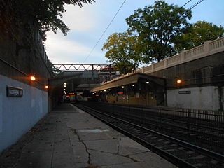
Watsessing Avenue is a New Jersey Transit rail station in Bloomfield, New Jersey, along the Montclair-Boonton Line. It is located beneath the Bloomfield Police Benevolent Association meeting hall near the corner of Watsessing Avenue and Orange Street in Bloomfield. It is one of two stations on the line where the boarding platform is below ground level. The Watsessing station and the Kingsland station in Lyndhurst on the Main Line shared similar designs and were built about the same time.

Mineola is a station on the Main Line of the Long Island Rail Road in the village of Mineola, New York. All trains for the Port Jefferson, Ronkonkoma, and Oyster Bay branches run through this station, as well as a few for the Montauk Branch. As of May 2011, 145 trains stop at this station every weekday, more than any other station east of Jamaica. It is the eighth-busiest station on the LIRR in terms of weekday boardings, with 10,348 boardings per day in 2006.

Harbor Gateway Transit Center is a Metro Silver Line station and a large bus station at southern end of the Harbor Transitway located in the southwest corner of Interstate 110 and State Route 91 in Harbor Gateway, Los Angeles, close to Carson. The station has 12 bus bays and 980 park and ride spaces, and is the southern terminus of the Metro Silver Line. Many passengers connect to this station from other buses to transfer to the Silver Line. Public restrooms for passengers as began installation in October 2012 and opened in February 2013. The nextrip bus screens were installed in November 2012 and became fully functional in April 2013. The large hub is undergoing station improvements.

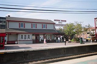
Oyster Bay is the terminus on the Oyster Bay Branch of the Long Island Rail Road. The station is located off Shore Avenue between Maxwell and Larabee Avenues. It is a sheltered concrete elevated platform that stands in the shadows of the original station, which was accessible from the ends of Maxwell, Audrey, and Hamilton Avenues. Both stations exist along the south side of Roosevelt Park.

Syosset is a station on the Long Island Rail Road's Port Jefferson Branch in Syosset, New York, at Jackson Avenue and Underhill Boulevard, south of New York State Route 25A, but north of Jericho Turnpike and the Long Island Expressway. Syosset's downtown was built around the station. There are no public transportation connections at the station, but taxi service is available.

The Sea Cliff is a historic station along the Oyster Bay Branch of the Long Island Rail Road. It is located on Sea Cliff Avenue and Glen Keith Road between Glen Cove Avenue and Cedar Swamp Road in the City of Glen Cove, New York, east of the Town of Oyster Bay hamlet of Sea Cliff, New York. The station was actually named after Sea Cliff Avenue, rather than the hamlet.

Moore's Building is a historic building located in the downtown area of the Hamlet of Oyster Bay and listed on the National Register of Historic Places. First built in 1901, the building gained significance when Theodore Roosevelt had his staff take offices here while he served as U.S. President. The Moore's Building is listed on the National Register of Historic Places, a Town of Oyster Bay Landmark, and a featured site on the Oyster Bay History Walk audio walking tour.

The Main Street Historic District in Medina, New York, United States, is the downtown commercial core of the village. It is a 12-acre (4.9 ha) area stretching south along Main Street from the Erie Canal to the railroad tracks.

Theodore Roosevelt Memorial Park is a park in the hamlet of Oyster Bay, New York, honoring President Theodore Roosevelt, 26th President of the United States.
Theodore Roosevelt spent his first summer in Oyster Bay with his family in 1874. Through the ensuing years as he rose to power, Oyster Bay would frequently serve as backdrop and stage on which many of his ambitions were realized. Several places connected to Theodore Roosevelt in his lifetime remain, while others have been lost. A number of efforts to memorialize Roosevelt in Oyster Bay have been made since his death in 1919.
The Oyster Bay History Walk is a path through downtown Oyster Bay, New York that leads the walker to 30 historic sites. It is a 1-mile loop and is the first certified American Heart Association Start! Walking Path on Long Island.

The U.S. Post Office in Pearl River, New York, is located at the junction of Franklin and Main streets in the hamlet's downtown. It is a brick building from the mid-1930s, serving the ZIP Code 10965, which covers the hamlet of Pearl River.

The W New York Union Square is a 270-room, 21-story boutique hotel operated by W Hotels at the northeast corner of Park Avenue South and 17th Street, across from Union Square in Manhattan, New York. Originally known as the Germania Life Insurance Company Building, it was designed by Albert D'Oench and Joseph W. Yost and built in 1911 in the Beaux-Arts style.

Loew's Theatre is a historic movie theater located on Main Street in the Downtown section of the city of New Rochelle in Westchester County, New York.
Milliron's Westchester, later The Broadway-Westchester, was a department store at 8739 S. Sepulveda Blvd., in Westchester, Los Angeles, designed by architect Victor Gruen. Its original design was considered a landmark in exterior architecture of retail stores, although much of the original design is no longer present. The building now houses a Kohl's.
References
- ↑ "Home Page". Oyster Bay Main Street Association Mission. Oyster Bay Main Street Association. 2009-04-09.
- ↑ Toy, Vivian S. (2002-06-02). "Wang's Recipe for Oyster Bay". New York Times. New York Times. Retrieved 2010-05-20.
- ↑ "Awards". 2008 Awards. American Society of Landscape Architects. 2009-05-15.
- ↑ "Preserve America Community". Oyster Bay Hamlet, New York. Advisory Council on Historic Preservation. 2002-05-01.