Manito is a village in Mason County, Illinois, United States. The population was 1,733 at the 2000 census, and 1,595 at a 2009 estimate.

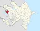
This is a list of the extreme points of Azerbaijan, the points that are farther north, south, east or west than any other location.

Tarsachay is an abandoned village in the Tavush Province of Armenia.

Sarıhəsənli is a village in the Gadabay Rayon of Azerbaijan. The village forms part of the municipality of Şəkərbəy.
Ağdərə is a village in the Tovuz Rayon of Azerbaijan. The village forms part of the municipality of İsakənd.
Gödəkdərə is a village in the Gadabay Rayon of Azerbaijan. The village forms part of the municipality of Şəkərbəy.
Moruxlu is a village in the Gadabay Rayon of Azerbaijan. The village forms part of the municipality of Samanlıq.
Hacılar is a village in the Tovuz Rayon of Azerbaijan.
Totuqlu is a village in the municipality of Qoşabulaq in the Gadabay Rayon of Azerbaijan.
Rəmə is a village in the municipality of Samanlıq in the Gadabay Rayon of Azerbaijan.
Namxoş is a village in the municipality of Çobansığnaq in the Tovuz Rayon of Azerbaijan.
Qaraboyunlar is a village in the municipality of Çobansığnaq in the Tovuz Rayon of Azerbaijan.
Xatıncan is a village in the municipality of Qalaboyun in the Tovuz Rayon of Azerbaijan.
Qarabağlılar is a village in the municipality of İsakənd in the Tovuz Rayon of Azerbaijan.
Qo‘rg‘ontepa District is a district of Andijan Region, Uzbekistan. The capital of the district is Qo‘rg‘ontepa. The district was established on September 29, 1926. The population is 160,400.
Slavyantsi is a village in Sungurlare Municipality, in Burgas Province, in southeastern Bulgaria.
Djaloukou is an arrondissement in the Collines department of Benin. It is an administrative division under the jurisdiction of the commune of Savalou. According to the population census conducted by the Institut National de la Statistique Benin on February 15, 2002, the arrondissement had a total population of 6,490.
Agamé is an arrondissement in the Mono department of Benin. It is an administrative division under the jurisdiction of the commune of Lokossa. According to the population census conducted by the Institut National de la Statistique Benin on February 15, 2002, the arrondissement had a total population of 11,465.
Oğulduruk is a village in the District of Bolu, Bolu Province, Turkey. As of 2010 it had a population of 216 people.
Konšćica is a settlement (naselje) in the Samobor administrative territory of Zagreb County, Croatia. As of 2011 it had a population of 289 people.