
The University District is a major district in Seattle, Washington, comprising several distinct neighborhoods. The main campus of the University of Washington (UW) is located in the district, lending its name to both the district as well as University Way NE.

Alki Point is a point jutting into Puget Sound, the westernmost landform in the West Seattle district of Seattle, Washington. Alki is the peninsular neighborhood on Alki Point. Alki was the original settlement in what was to become the city of Seattle. It was part of the city of West Seattle from 1902 until that city's annexation by Seattle in 1907.

The street layout of Seattle is based on a series of disjointed rectangular street grids. Most of Seattle and King County use a single street grid, oriented on true north. Near the center of the city, various land claims were platted in the 19th century with differently oriented grids, which still survive today. Distinctly oriented grids also exist in some cities annexed by Seattle in the early 20th century, such as Ballard and Georgetown. A small number of streets and roads are exceptions to the grid pattern.

West Seattle is a conglomeration of neighborhoods in Seattle, Washington, United States. It comprises two of the thirteen districts, Delridge and Southwest, and encompasses all of Seattle west of the Duwamish River. It was incorporated as an independent town in 1902 before being annexed by Seattle five years later. Among the area's attractions are its saltwater beach parks along Elliott Bay and Puget Sound, including Alki Beach Park and Lincoln Park. The area is also known for its views of the Olympic Mountains to the west and the Cascade Range to the east. One-third of Seattle's green space and urban forest is located in West Seattle, much of it in the West Duwamish Greenbelt.
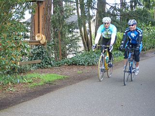
The Burke–Gilman Trail is a rail trail in King County, Washington. The 20-mile (32 km) multi-use recreational trail is part of the King County Regional Trail System and occupies an abandoned Seattle, Lake Shore and Eastern Railway (SLS&E) corridor.

University Village is a shopping mall in Seattle, Washington, United States, located in the south corner of the Ravenna neighborhood to the north of the Downtown area. It is an open-air shopping center which offers restaurants, locally owned boutiques, and national retailers, and is a popular retail destination in the region for home furnishings, popular fashions, gift items, and restaurants. It is currently owned by multimillionaire Stuart Sloan.

Ravenna is a neighborhood in northeastern Seattle, Washington named after Ravenna, Italy. Though Ravenna is considered a residential neighborhood, it also is home to several businesses, many of which are located in the University Village, a shopping mall.
Wedgwood is a middle class residential neighborhood of northeast Seattle, Washington with a modest commercial strip. Wedgwood is located about two miles (3.2 km) north, and slightly east, of the University of Washington; it is about six miles (9.7 km) northeast of Downtown. The neighborhood is further typical of Seattle neighborhoods in having more than one name and having different, overlapping, but well-documented definitions of the neighborhood.

Bryant is a residential neighborhood in northeast Seattle, Washington. According to the City of Seattle's neighborhood maps, it is bounded by 35th Avenue NE and NE 45th Place on the west, beyond which is Ravenna; Sand Point Way NE and 45th Ave NE on the east, beyond which are Laurelhurst and Windermere; and NE 75th Street and NE 65th Street on the north, beyond which are View Ridge and Wedgwood.

Delridge is a district in Seattle, Washington, United States that stretches along Delridge Way, an arterial that follows the eastern slope of the valley of Longfellow Creek, from near its source just within the southern city limits north to the West Seattle Bridge over the Duwamish River. It is generally associated with the neighborhing district of West Seattle, or even considered a sub-district of West Seattle.

There are many outdoor sculptures in Washington, D.C. In addition to the capital's most famous monuments and memorials, many figures recognized as national heroes have been posthumously awarded with his or her own statue in a park or public square. Some figures appear on several statues: Abraham Lincoln, for example, has at least three likenesses, including those at the Lincoln Memorial, in Lincoln Park, and the old Superior Court of the District of Columbia. A number of international figures, such as Mohandas Gandhi, have also been immortalized with statues. The Statue of Freedom is a 19½-foot tall allegorical statue that rests atop the United States Capitol dome.

Me-Kwa-Mooks Park is a 20.2-acre (82,000 m2) public park located in the West Seattle neighborhood of Seattle, Washington, USA. Me-Kwa-Mooks is an Anglicized version of the Lushootseed word for Alki Point, sbaqʷabqs, meaning "prairie point."

The Rochester-Genesee Regional Transportation Authority (RGRTA) is a New York State public-benefit corporation which provides transportation services in the eight-county area in and around Rochester, New York. Currently, RGRTA oversees the daily operation of eleven subsidiaries under the parent company of the RGRTA, including paratransit services. In 2023, the combined system of eleven subsidiaries had a ridership of 9,712,300, or about 35,700 per weekday as of the first quarter of 2024.

Old Town Chinatown is the official Chinatown of the northwest section of Portland, Oregon. The Willamette River forms its eastern boundary, separating it from the Lloyd District and the Kerns and Buckman neighborhoods. It includes the Portland Skidmore/Old Town Historic District and the Portland New Chinatown/Japantown Historic District, which are listed on the National Register of Historic Places. It has been referred to as the "skid row" of Portland.

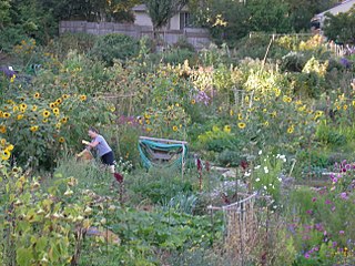
Picardo Farm is a 98,000 sq ft (9,100 m2) parcel of property in Wedgwood, Seattle, Washington, consisting largely of 281 plots used for gardening allotments. It is the original P-Patch : the "P" originally stood for "Picardo", after the family who owned it. The Picardos' land went beyond the present P-Patch; it also encompassed the property of the adjacent Reform Jewish Temple Beth Am and of University Prep, an independent private co-educational, non-sectarian day school for grades six through twelve. The land was part of what had once been known as the Ravenna Swamp.
The geography of Minot, North Dakota, is treated extensively in this article.
The Bend Park & Recreation District is the agency which protects the parks, natural areas, recreational facilities, gardens, and trails of the city of Bend, Oregon.
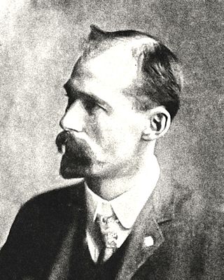
Joseph Jacobberger was an American architect based in Portland, Oregon. He partnered with Alfred H. Smith in the firm Jacobberger and Smith.
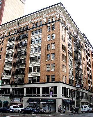
Carl L. Linde was an American architect based in the Pacific Northwest of the United States, particularly in Portland, Oregon. Several of his works are listed on the National Register of Historic Places.


