Related Research Articles

The Columbia River is the largest river in the Pacific Northwest region of North America. The river forms in the Rocky Mountains of British Columbia, Canada. It flows northwest and then south into the U.S. state of Washington, then turns west to form most of the border between Washington and the state of Oregon before emptying into the Pacific Ocean. The river is 1,243 mi (2,000 km) long, and its largest tributary is the Snake River. Its drainage basin is roughly the size of France and extends into seven states of the United States and one Canadian province. The fourth-largest river in the United States by flow, the Columbia has the greatest flow of any river into the eastern Pacific.

The Snake River is a major river in the interior Pacific Northwest region of the United States. About 1,080 miles (1,740 km) long, it is the largest tributary of the Columbia River, which is the largest North American river that empties into the Pacific Ocean. Beginning in Yellowstone National Park, western Wyoming, it flows across the arid Snake River Plain of southern Idaho, the rugged Hells Canyon on the borders of Idaho, Oregon and Washington, and finally the rolling Palouse Hills of southeast Washington. It joins the Columbia River just downstream from the Tri-Cities, Washington, in the southern Columbia Basin.

Whitman County is a county located in the U.S. state of Washington. As of the 2020 census, the population was 47,973. The county seat is Colfax, and its largest city is Pullman.

Bonneville Lock and Dam consists of several run-of-the-river dam structures that together complete a span of the Columbia River between the U.S. states of Oregon and Washington at River Mile 146.1. The dam is located 40 miles (64 km) east of Portland, Oregon, in the Columbia River Gorge. The primary functions of Bonneville Lock and Dam are electrical power generation and river navigation. The dam was built and is managed by the United States Army Corps of Engineers. At the time of its construction in the 1930s it was the largest water impoundment project of its type in the nation, able to withstand flooding on an unprecedented scale. Electrical power generated at Bonneville is distributed by the Bonneville Power Administration. Bonneville Dam is named for Army Capt. Benjamin Bonneville, an early explorer credited with charting much of the Oregon Trail. The Bonneville Dam Historic District was designated a National Historic Landmark District in 1987.

The Walla Walla River is a tributary of the Columbia River, joining the Columbia just above Wallula Gap in southeastern Washington in the United States. The river flows through Umatilla County, Oregon, and Walla Walla County, Washington. Its drainage basin is 1,758 square miles (4,550 km2) in area.

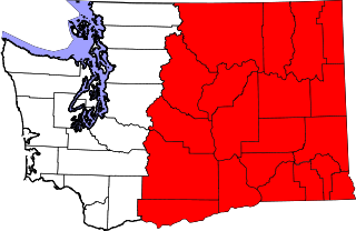
Eastern Washington is the region of the U.S. state of Washington located east of the Cascade Range. It contains the city of Spokane, the Tri-Cities, the Columbia River and the Grand Coulee Dam, the Hanford Nuclear Reservation and the fertile farmlands of the Yakima Valley and the Palouse. Unlike in Western Washington, the climate is dry, including some desert environments.

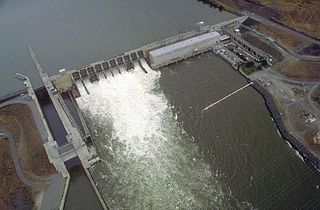
Ice Harbor Lock and Dam is a hydroelectric, concrete gravity run-of-the-river dam in the northwest United States. On the lower Snake River in southeastern Washington, it bridges Walla Walla and Franklin counties. Located eight miles (13 km) northeast of Burbank and twelve miles (19 km) east of Pasco, river mile 9.7, the dam's name comes from a tiny bay in the river where boats once tied up to wait for upstream ice-jams to break up.

The Oregon Railroad and Navigation Company (OR&N) was a rail and steamboat transport company that operated a rail network of 1,143 miles (1,839 km) running east from Portland, Oregon, United States, to northeastern Oregon, northeastern Washington, and northern Idaho. It operated from 1896 as a consolidation of several smaller railroads.

The Oregon Steam Navigation Company (O.S.N.) was an American company incorporated in 1860 in Washington with partners J. S. Ruckle, Henry Olmstead, and J. O. Van Bergen. It was incorporated in Washington because of a lack of corporate laws in Oregon, though it paid Oregon taxes.

The Colonel Wright was the first steamboat to operate on the Columbia River above The Dalles in the parts of the Oregon Country that later became the U.S. states of Oregon, Washington and Idaho. She was the first steamboat to run on the Snake River. She was named after Colonel George Wright, an army commander in the Indian Wars in the Oregon Country in the 1850s. She was generally called the Wright during her operating career.
The Water Resources Development Act of 1986 is part of Pub. L. 99–662, a series of acts enacted by Congress of the United States on November 17, 1986.
Rivers and Harbors Act may refer to one of many pieces of legislation and appropriations passed by the United States Congress since the first such legislation in 1824. At that time Congress appropriated $75,000 to improve navigation on the Ohio and Mississippi rivers by removing sandbars, snags, and other obstacles. Like when first passed, the legislation was to be administered by the United States Army Corps of Engineers (USACE), under its Chief Engineer and the Secretary of War.
Water Resources Development Act of 1976,, Pub. L. 94–587 is a public law enacted on October 22, 1976, by the Congress of the United States of America concerning various water resources and projects.
The Water Resources Development Act of 1992, Pub. L. 102–580, was enacted by Congress of the United States on October 31, 1992. Most of the provisions of WRDA 1992 are administered by the United States Army Corps of Engineers.

The Portland District is one of the five districts within the Northwestern Division of the United States Army Corps of Engineers. The Portland District is made up of some 1,100 civilian and 6 military personnel.

The Inland Waterways Commission was a United States federal agency, created by Congress in March 1907 at the request of President Theodore Roosevelt, to investigate the transportation crisis that recently had affected the nation's ability to move its produce and industrial production efficiently. The immediate crisis centered on insufficient railroad capacity developed by the private sector, and competing but neglected inland shipping, the navigation of which had been deemed under federal purview since 1824. The temporary commission lasted until the end of Roosevelt's presidency, but his conservationist progressive interest was focused more than on transportation alone. The president wanted water projects to be considered for their multiple uses and in relation to other natural resources and asked for a comprehensive plan for the improvement and control of the river systems of the United States.
The transportation system of Oregon is a cooperation of complex systems of infrastructure.

The following outline is provided as an overview of and topical guide to infrastructure of the U.S. state of Washington.
The following is a timeline of the history of the Tri-Cities, an area of the U.S. state of Washington encompassing the cities of Kennewick, Pasco, and Richland.
The following is a timeline of the history of Oregon in the United States of America.
References
- ↑ Bird, P. (May 1989). "Navigation on the Columbia-Snake River System". Transportation Research Circular (350). Transportation Research Board: 55–59. ISSN 0097-8515.
- ↑ Steel, B. S.; Lovrich, N. P.; o’Toole, E. S. (1999). "Public perceptions and preferences concerning Pacific salmon recovery: An Oregon "voluntary and grassroots" perspective". The Social Science Journal. 36 (3): 497. doi:10.1016/S0362-3319(99)00020-8.