Lantau Island is the largest island in Hong Kong, located at the mouth of the Pearl River. Administratively, most of Lantau Island is part of the Islands District of Hong Kong. A small northeastern portion of the island is located in the Tsuen Wan District.
Hong Kong has a long coastline that is full of twists and turns with many bays and beaches. Many of them are well sheltered by mountains nearby, as Hong Kong is a mountainous place. As a result, large waves seldom appear at the bays, making them suitable for human swimming.

Discovery Bay is a mixed, primarily residential, development consisting of upmarket residential development and private and public recreational facilities in Hong Kong. Located on Lantau Island, including the Tai Pak Bay and Yi Pak Bay, Discovery Bay covers a land area of 649 hectares and is a fully integrated resort style residential project comprising garden houses, low-, mid- and high-rise residential developments, a 27-hole golf course, a 262-berth marina, two clubhouses, the first private manmade beach in Hong Kong, international schools, two shopping malls and the largest oceanfront alfresco dining area in Hong Kong.

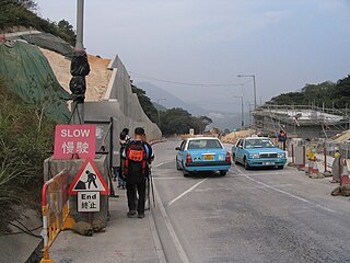
Mui Wo is a rural town on the eastern coast of Lantau Island in Hong Kong. The 2011 Census recorded 5,485 people living in Mui Wo and its environs.

The New Lantao Bus Company (1973) Limited, commonly known as New Lantao Bus or NLB, is a franchised bus company operating in Hong Kong. It mainly operates bus routes on Lantau Island.

Chek Lap Kok is an island in the western waters of Hong Kong. Unlike the smaller Lam Chau, it was only partially leveled when it was assimilated via land reclamation into the 12.48 square kilometres (4.82 sq mi) island for the current Hong Kong International Airport, which opened for commercial aviation in 1998. The airport is popularly referred to as Chek Lap Kok Airport to distinguish it from the former Hong Kong International Airport.

The Airport Express is one of the lines of the Hong Kong MTR system. It links the principal urban areas with the Hong Kong International Airport and the AsiaWorld–Expo exhibition and convention centre.

The Ngong Ping 360 is a gondola lift on Lantau Island in Hong Kong. Intended to improve tourism to the area, the aerial lift was previously known as Tung Chung Cable Car Project before acquiring the Ngong Ping 360 brand in April 2005. It consists of the Ngong Ping Cable Car, formerly known as the Ngong Ping 360 Skyrail, and the Ngong Ping Village, a retail and entertainment centre adjacent to the cable car's upper station. Ngong Ping 360 connects Tung Chung, on the north coast of Lantau and itself linked to central Hong Kong by the Tung Chung Line, with the Ngong Ping area in the hills above. This is home to the Po Lin Monastery and the Tian Tan Buddha, both already significant tourist attractions in their own right. Before Ngong Ping 360's opening, the only access was via a mountain road and bus service.

The MacLehose Trail, opened on 26 October 1979, is a hiking trail that crosses much of the New Territories, starting from Pak Tam Chung, Sai Kung, in the east to Tuen Mun in the west in the territory of Hong Kong. The whole trail is 100 kilometres long, marked by distance posts at 500m intervals along the path. It is named after Sir Murray MacLehose, the longest serving governor of Hong Kong, who established the Country Parks and was himself an enthusiastic hiker. The trail passes through a variety of natural scenery including beaches and mountains.

Tuen Mun Ferry Pier (屯門碼頭), or Tuen Mun Ferry Terminal, is a public pier located in the southern area of Tuen Mun, Hong Kong.

Sunset Peak or Tai Tung Shan is the third highest peak in Hong Kong. It is situated on Lantau Island within Lantau South Country Park and Lantau North Country Park and stands at a height of 869 metres (2,851 ft) above the sea level. The second highest Lantau Peak is on the western part of the island.

Prehistoric Hong Kong is the period between the arrival of the first humans in Hong Kong and the start of recorded Chinese history first appeared during the Han dynasty. The history of the southern region is reckoned to have been first recorded in 214 BC with Qin Shi Huang conquering the Baiyue and creating the Jiaozhou province.
The Civil Aviation Department is the civil aviation authority of Hong Kong, headquartered at Hong Kong International Airport. The department is responsible for providing air traffic control services to all aircraft operating within the Hong Kong Flight Information Region. It reports to the Transport and Housing Bureau of the Hong Kong Government. The current Director-General of Civil Aviation is Simon Li Tin-chui.

The Hong Kong government started developing "New Towns" in the 1950s, in order to accommodate Hong Kong's booming population. At the first phase of development, the newly developed towns were called "satellite town", a concept borrowed from the United Kingdom, of which Hong Kong was then still a colony. Kwun Tong, located at eastern Kowloon, and Tsuen Wan, located at the south-west New Territories, were designated as the first two satellite towns, when the urban area in Hong Kong was still relatively small, restricted to the central and western part of Kowloon Peninsula and the northern side of Hong Kong Island. Wah Fu Estate was also built in a remote corner at the southern side of Hong Kong Island, with similar concepts in a smaller scale.

On 29 April 2016, a CHC Helikopter Service Eurocopter EC225 Super Puma helicopter, carrying oil workers from the Gullfaks B platform in the North Sea, crashed near Turøy, a Norwegian coastal island 36 kilometres (22 mi) from the city of Bergen. The main rotor assembly detached from the aircraft and the fuselage plummeted to the ground, exploding on impact. All thirteen people on board were killed.