Otsego Lake is a 4,046-acre (16.37 km2) lake located in Otsego County, New York and is the source of the Susquehanna River. The Village of Cooperstown is located at the lake's southern end. Glimmerglass State Park is located on the lake's northeastern shore, and includes Hyde Hall, a large mansion constructed in 1817 that overlooks the lake. Glimmerglass Opera is located on the western shore.

The Gulf of Alaska is an arm of the Pacific Ocean defined by the curve of the southern coast of Alaska, stretching from the Alaska Peninsula and Kodiak Island in the west to the Alexander Archipelago in the east, where Glacier Bay and the Inside Passage are found.

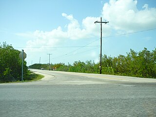
Little Torch Key is an island in the lower Florida Keys. It is a small, quiet Key with easy access to Key West. For divers, the incredible corals of Looe Key National Marine Sanctuary are only a few miles away. The exclusive resort, Little Palm Island, is located just offshore of Little Torch Key. U.S. Route 1, crosses the key at approximately mile markers 28—29. It is immediately preceded to the northeast by Big Pine Key, and is followed by Middle Torch Key to the southwest.

The Cayos Cochinos or Cochinos Cays consist of two small islands and 13 more small coral cays situated 30 kilometres (19 mi) northeast of La Ceiba on the northern shores of Honduras. Although geographically separate, they belong to the Bay Islands department and are part of Roatán municipality. The population numbered 108 at the 2001 census. The total land area measures about 2 km2 (0.8 sq mi).

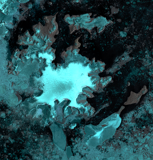
Coronation Island is the largest of the South Orkney Islands, 25 nautical miles (46 km) long and from 3 to 8 nautical miles wide. The island extends in a general east-west direction, is mainly ice-covered and comprises numerous bays, glaciers and peaks, the highest rising to 1,265 metres (4,150 ft).

Lützow-Holm Bay is a large bay, about 220 kilometres (120 nmi) wide, indenting the coast of Queen Maud Land in Antarctica between Riiser-Larsen Peninsula and the coastal angle immediately east of the Flatvaer Islands. It was discovered by Captain Hjalmar Riiser-Larsen in two airplane flights from his expedition vessel, the Norvegia, on February 21 and 23, 1931. The name honours Commander Finn Lützow-Holm of the Royal Norwegian Navy Air Service, a pilot for Captain Riiser-Larsen on the Aagaard in 1935.

Māhukona is a submerged shield volcano on the northwestern flank of the Island of Hawaiʻi. A drowned coral reef at about 3,770 feet below sea level and a major break in slope at about 4,400 feet below sea level represent old shorelines. The summit of the shield volcano was once 800 feet above sea level. It has now subsided below sea level. A roughly circular caldera marks the summit of Māhukona. A prominent rift zone extends to the west. A second rift zone probably extended to the east but has been buried by younger volcanoes. The main shield-building stage of volcanism ended about 470,000 years ago. The summit of the shield volcano subsided below sea level between 435,000 and 365,000 years ago. This makes Māhukona the oldest volcano to build Hawaiʻi island, compared to Kohala to the east and Hualālai to the southeast. The Monterey Bay Aquarium Research Institute investigated the area with a remotely controlled submarine in 2001.

Possession Bay is a bay 2 miles (3.2 km) wide on the north coast of South Georgia, an island in the southern Atlantic Ocean. It recedes southwest for 5 miles (8 km), and is separated from Cook Bay to the north by Black Head promontory. It is connected to King Haakon Bay by Shackleton Gap, a mountain pass.

The Bay of Isles is a bay 9 miles (14 km) wide and receding 3 miles (5 km), lying between Cape Buller and Cape Wilson along the north coast of South Georgia. It was discovered in 1775 by a British expedition under James Cook and so named by him because numerous islands lie in the bay. Of South Georgia's 31 breeding bird species, 17 are found here.

Nadir is a settlement on the island of St. Thomas in the United States Virgin Islands.
Calabash is a neighborhood on the island of St. John in the United States Virgin Islands. It is located in the east of the island on the coast of Coral Bay, to the south of the town of Coral Bay.

Posadowsky Glacier is a glacier about 9 nautical miles long, flowing north to Posadowsky Bay immediately east of Gaussberg. Posadowsky Bay is an open embayment, located just east of the West Ice Shelf and fronting on the Davis Sea in Kaiser Wilhelm II Land. Kaiser Wilhelm II Land is the part of East Antarctica lying between Cape Penck, at 87°43'E, and Cape Filchner, at 91°54'E, and is claimed by Australia as part of the Australian Antarctic Territory. Other notable geographic features in this area include Drygalski Island, located 45 mi NNE of Cape Filchner in the Davis Sea, and Mirny Station, a Russian scientific research station.
Hermitage is an area of Virgin Islands National Park on the island of Saint John in the United States Virgin Islands. It is located along the north side of Coral Bay, between the town of Coral Bay and the island's inhabited East End. The mangroves of Princess Bay, inside the National Park, are a popular kayaking and snorkeling spot.
Johns Folly is a neighborhood on the island of Saint John in the United States Virgin Islands. It is located on the east side of the island, south of Coral Bay and north of Salt Pond Bay.

The Flatvaer Islands, also known as the Ongul Islands, are a group of small islands lying at the east side of the entrance of Lützow-Holm Bay, 4 km from the coastline of Antarctica. They were mapped by Norwegian cartographers from air photos taken by the Lars Christensen Expedition (LCE), 1936–37. Many of the islands and their features were subsequently named by members of the Japanese Antarctic Research Expedition (JARE); unless otherwise noted, features noted in this article were named by JARE.
Moider Glacier is a glacier flowing west into the east side of Dalgliesh Bay, Pourquoi Pas Island, in Marguerite Bay, Antarctica. It was named by the UK Antarctic Place-Names Committee in 1979 in association with nearby Perplex Ridge; the word "moider" can be a synonym for "perplex".
Gibbon Bay is a bay 2 km (1.2 mi) long and wide, entered between Rayner Point and The Turret along the east coast of Coronation Island, in the South Orkney Islands of Antarctica. The bay was first seen in December 1821 by Captain George Powell and Captain Nathaniel Palmer, but was more accurately delineated on a 1912 chart by Captain Petter Sorlle. It was recharted in 1933 by Discovery Investigations personnel on the Discovery II and named for the ship's surgeon, Dr G.M. Gibbon.

Ball Glacier is a small glacier separating Redshaw Point from Hamilton Point, flowing north-east to Markham Bay on the south-east side of James Ross Island. It was named by the UK Antarctic Place-names Committee in 1995 after H. William Ball, Keeper of Paleontology, British Museum, 1966–86, and author of Falklands Islands Dependencies Survey Scientific Report No. 24 on fossils from the James Ross Island area.

East End is an administrative subdistrict of the island of Saint Thomas in the United States Virgin Islands. The largest community here is Red Hook, while smaller communities include Benner, Nazareth, Nadir, Frydendal, and Smith Bay. Some of the offshore islands here include Great Saint James Island, Little Saint James Island, Bovoni Cay, Patricia Cay, Cas Cay, Rotto Cay, Thatch Cay, Shark Island, and Dog Island. The East End subdistrict received 731 new residents between the 2000 U.S. Census and the 2010 U.S. Census, and has a 2010 population of 6,658. The East End region offers a more secluded character and less population density than subdistricts as Charlotte Amalie, Southside, and the Tutu subdistricts. This subdistrict is home to numerous of the islands’ largest resorts, in addition to many shopping areas and entertainment venues, as well as the Coral World Marine Park & Underwater Observatory in Coki Point, which is the most popular tourist attraction on Saint Thomas. East End is located about 7.4 miles east of the territorial capital of Charlotte Amalie, which is an approximately thirty-minute drive on the windy, small and narrow Saint Thomas roads. There are buses and taxis leaving from the East End. A typical fare for a taxi drive to the capital costs $20. The hotels on Saint Thomas are evenly divided between the two subdistricts of Charlotte Amalie, and the more expensive resort-style hotels by their own beachside in East End. The East End resorts are therefore generally more expensive than those found elsewhere on the island. Some of the famous beaches found here are Lindquist- and Sapphire Beaches, while others include Pineapple Beach and Vessup Beach amongst others.

Dungonab Bay or Dongonab Bay a body of water on the coastline of Sudan on the Red Sea.


