The South Bay is a region of the Los Angeles metropolitan area, located in the southwest corner of Los Angeles County. The name stems from its geographic location stretching along the southern shore of Santa Monica Bay. The South Bay contains sixteen cities plus portions of the City of Los Angeles and unincorporated portions of the county. The area is bounded by the Pacific Ocean on the south and west and generally by the City of Los Angeles on the north and east.
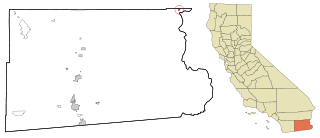
Palo Verde is a census-designated place (CDP) in Imperial County, California. Its name comes from the native desert tree, Palo Verde, which in turn takes its name from the Spanish for stick (palo) and green (verde), sharing its name with the Palo Verde Valley, the valley it is located.

Palos Verdes Estates is a coastal city in Los Angeles County, California, United States, situated on the Palos Verdes Peninsula and neighboring Rancho Palos Verdes and Rolling Hills Estates. The city was master-planned by the noted American landscape architect and planner Frederick Law Olmsted Jr. The city is located along the Southern California coastline of the Pacific Ocean.

Rancho Palos Verdes is a coastal city located in south Los Angeles County, California. Incorporated on September 7, 1973, the city has a population of 42,287 as reported in the 2020 United States Census. Rancho Palos Verdes sits atop the bluffs of the Palos Verdes Peninsula, neighboring three other cities in the Palos Verdes Hills, namely Palos Verdes Estates, Rolling Hills, and Rolling Hills Estates. It is known for its extensive nature preserves and hiking trails, school district, as well as high property values.

Blythe is a city in eastern Riverside County, California, United States. It is in the Palo Verde Valley of the Lower Colorado River Valley region, an agricultural area and part of the Colorado Desert along the Colorado River, approximately 224 miles (360 km) east of Los Angeles and 150 miles (240 km) west of Phoenix. Blythe was named after Thomas Henry Blythe, a San Francisco financier, who established primary water rights to the Colorado River in the region in 1877. The city was incorporated on July 21, 1916. The population was 18,317 at the 2020 census.

Rolling Hills Estates is a city in Los Angeles County, California, United States. On the northern side of the Palos Verdes Peninsula, facing Torrance, Rolling Hills Estates is mostly residential. Incorporated in 1957, Rolling Hills Estates has many horse paths. The population was 8,067 at the 2010 census, up from 7,676 at the 2000 census. In 2018, the population rose to 8,141, and the 2020 census counted 8,280 residents.

The Palos Verdes Peninsula is a peninsular subregion of the Los Angeles metropolitan area, located within southwestern Los Angeles County, California. It is often called simply "Palos Verdes", and is made up of a group of cities in the Palos Verdes Hills, including Palos Verdes Estates, Rancho Palos Verdes, Rolling Hills, and Rolling Hills Estates, as well as the unincorporated community of Westfield/Academy Hill.

The Palo Verde Generating Station is a nuclear power plant located near Tonopah, Arizona, in western Arizona. It is located about 45 miles (72 km) west of downtown Phoenix. Palo Verde generates the most electricity of any power plant in the United States per year, the largest power plant by net generation as of 2021. Palo Verde also has the third-largest rated capacity of any U.S power plant. It is a critical asset to the Southwest, generating approximately 32 million megawatt-hours annually.
Path 46, also called West of Colorado River, Arizona-California West-of-the-River Path (WOR), is a set of fourteen high voltage alternating-current transmission lines that are located in southeast California and Nevada up to the Colorado River.
Palo Verde or palo verde may refer to:
City of Rancho Palos Verdes v. Abrams, 544 U.S. 113 (2005), is a case in which the United States Supreme Court held that the Telecommunications Act (TCA) precluded damages under 42 U.S.C. § 1983 because it provided a comprehensive remedial scheme. Rancho Palos Verdes v. Abrams is a part of the Sea Clammers Doctrine line of cases.
Los Palos Grandes is a residential, tourist and financial district located in the Chacao Municipality in east Caracas, served by the Caracas Metro through the Miranda station of line 1. It has an estimated area of 117 hectares.

East Caracas generally refers to the eastern portions of Caracas, and may refer specifically to the municipalities from the Metropolitan District of Caracas located in Miranda State: Chacao, Baruta, Sucre, and El Hatillo. It concentrates the 34.8% population of the Metropolitan District of Caracas, and the 21.7% population of the Greater Caracas Area. Caracas Country Club, the richest neighborhood of the city, is located between El Recreo and Chacao districts.

Ciudad Universitaria is a Caracas Metro station on Line 3. It was opened on 18 December 1994 as part of the inaugural section of Line 3 from Plaza Venezuela to El Valle. The station is between Plaza Venezuela and Los Símbolos.
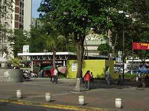
Propatria is a Caracas Metro station on Line 1. It was opened on 2 January 1983 as part of the inaugural section of Line 1 between Propatria and La Hoyada, and is located on Avenida 2 de Propatria. It serves as the western terminus of the line. The following station is Pérez Bonalde. Trains run from the station every three minutes.
Los Dos Caminos is a Caracas Metro station on Line 1. It was opened on 23 April 1988 as the eastern terminus of the extension of Line 1 from Chacaíto. On 10 November 1989, the line was extended further to Palo Verde. The station is between Miranda and Los Cortijos.
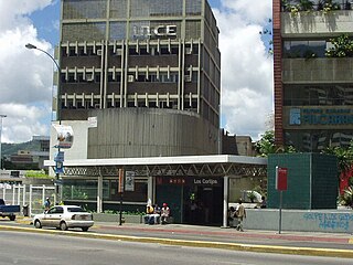
Los Cortijos is a Caracas Metro station on Line 1. It was opened on 10 November 1989 as part of the extension of Line 1 from Los Dos Caminos to Palo Verde. The station is between Los Dos Caminos and La California.
La California is a Caracas Metro station on Line 1. It was opened on 10 November 1989 as part of the extension of Line 1 from Los Dos Caminos to Palo Verde. The station is between Los Cortijos and Petare.

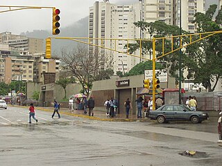
Petare is a Caracas Metro station on Line 1. It was opened on 10 November 1989 as part of the extension of Line 1 from Los Dos Caminos to Palo Verde. The station is between La California and Palo Verde.