Pampa Army Air Field

Last updated
Pampa Army Airfield
Army Air Forces Training Command - Patch.png
Part of Army Air Forces Flying Training Command
Gray County, near Pampa, Texas
Pampa Army Airfield TX 2006 USGS.jpg
2006 USGS Airphoto
USA Texas location map.svg
Airplane silhouette.svg
Pampa AAF
Coordinates 35°32′17″N100°44′58″W / 35.53806°N 100.74944°W / 35.53806; -100.74944
TypeMilitary airfield
Site information
Controlled by United States Army Air Forces
Site history
Built1942
In use1942–1945
Texas Historical marker for Pampa Army Air Force Base Texas Historical marker for Pampa Army Air Force Base.jpg
Texas Historical marker for Pampa Army Air Force Base
World War II Postcard of Pampa AAF Pampaaaf-postcard.jpg
World War II Postcard of Pampa AAF
Pampa Army Air Field 1943 Classbook Pampa Army Air Field Texas 1943 Classbook.pdf
Pampa Army Air Field 1943 Classbook

Pampa Army Airfield is an abandoned airfield located about 11 miles east of Pampa in Gray County, Texas. During World War II, the United States Army Air Forces used Pampa Airfield as a training airfield by the Army Air Forces Flying Training Command, Gulf Coast Training Center.

Contents

History

Construction of the airfield began in June 1942 under the supervision of the Tulsa, Oklahoma, office of the United States Army Corps of Engineers. The immediate construction included three concrete runways, several taxiways, a large parking apron, and a control tower. Four large hangars were also constructed. Most base buildings, not meant for long-term use, were quickly constructed of temporary or semi-permanent materials. Although some hangars had steel frames and the occasional brick or tile brick building could be seen, most support buildings sat on concrete foundations but were of frame construction clad in little more than plywood and tarpaper. Pampa Airfield was activated on 3 August 1942.

Also known as the "Eagles' Nest of the High Plains," Pampa offered advanced twin-engine training in Beechcraft AT-10 Wichita planes. Also stationed at the field were Curtiss-Wright AT-9, North American B-25 Mitchell, and Cessna AT-17 Bobcat aircraft. During the war, Pampa had a total of 4 satellite fields:

During its three years of operation the base graduated 6,292 cadets, trained 3,500 aircraft mechanics, and had one of the best safety records in the United States Training Command throughout the war.

Advanced flight training ended at Pampa on 28 December 1944 and the base was transferred as a sub-base of Liberal Army Airfield, Kansas where it supported the heavy 4-engine training school there. With the end of the war, Pampa AAF was inactivated on 30 September 1945 and transferred to the Army Corps of Engineers. The airfield remained in inactive status until 1948 when it was reopened as Pampa Air Force Auxiliary Field #1. The Pampa airfield remained on the Air Force property rolls until at least 1952, but was then closed again. It was declared excess in 1955, and the last tract of land was sold in 1957 to agricultural interests.

"History of the Pampa Army Air Field" in 1943 classbook "HISTORY OF THE PAMPA ARMY AIR FIELD" from- Pampa Army Air Field Texas 1943 Classbook (page 6 crop).jpg
"History of the Pampa Army Air Field" in 1943 classbook

In 1982 a Texas Historical Commission historical marker was placed near the site, at the intersection of TX 152 & Farm to Market Road 1474. All that remains of Pampa Army Airfield today is the concrete water tower, a single hangar, and a broken parking apron. The runways, taxiways, and most of the streets of the administrative area are gone. The main entrance to the base can be found, and the outlines of the parade ground still exist. A few postwar agricultural buildings use the concrete foundations of their World War II predecessors, and the occasional concrete foundation of a wartime building is found. Most of the administrative area consists of farmers fields or scrubland.

As of 2022, the site was used as a cow dairy.

See also

Related Research Articles

<span class="mw-page-title-main">Pyote Air Force Base</span> Former World War II US Army Air Forces training airbase

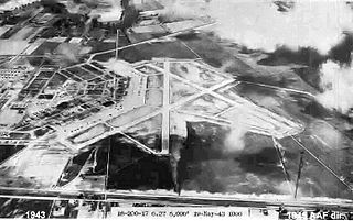
Pyote Air Force Base was a World War II United States Army Air Forces training airbase. It was on 2,745 acres (1,111 ha) a mile from the town of Pyote, Texas, on U.S. Highway 80, 20 miles west of Monahans,` 230 miles (370 km) east of El Paso.

<span class="mw-page-title-main">Gardner Army Airfield</span> World War II United States Army Air Force airfield

Gardner Army Airfield is a former United States Army Air Force World War II Field located 9 miles southeast of Taft, California. It was named for Major John H. Gardner, a World War I aviator hero.

<span class="mw-page-title-main">Walker Army Airfield (Kansas)</span>

Walker Army Airfield is an abandoned airfield located north of Interstate 70 in Ellis County, 1 mile northwest of Walker, Kansas or 3 miles northeast of Victoria, Kansas.
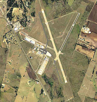
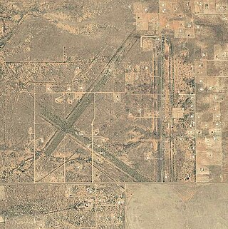
<span class="mw-page-title-main">Eric Marcus Municipal Airport</span> Airport in Pima County, Arizona

Eric Marcus Municipal Airport is a county-owned, public-use airport in Pima County, Arizona, United States. It is located 5.75 miles north of the central business district of Ajo and is about 82 miles southwest of Phoenix. The airport was renamed on February 11, 2006; it was formerly known as Ajo Municipal Airport.

<span class="mw-page-title-main">Hereford Army Airfield</span> Former military airfield in Cochise County, Arizona

Hereford Army Airfield is an abandoned military airfield located about 2 miles west-southwest of Hereford, Arizona, United States.

<span class="mw-page-title-main">Yucca Army Airfield</span> Former airfield in Mohave County, Arizona

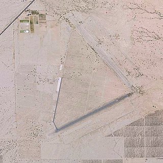
Yucca Army Airfield is a former military airfield located about 1 mile (1.6 km) west of Yucca, in Mohave County, Arizona, United States. It is on the east side of Interstate 40, 25 miles (40 km) south of Kingman. It is now used as a private facility owned by Fiat Chrysler Automobiles named Chrysler Arizona Proving Grounds.

<span class="mw-page-title-main">Lemoore Army Air Field</span> Former military base in Kings County, California

Lemoore Army Air Field, located nine miles (14 km) southwest of Lemoore, California, was a dirt air field usable only in dry weather. It nevertheless was used by the AAF Western Flying Training Command as a processing and training field.

<span class="mw-page-title-main">Dalhart Army Air Base</span> Airport

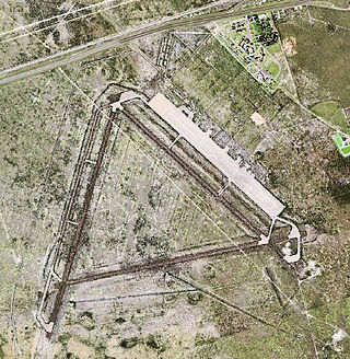
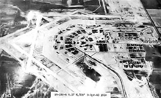
Dalhart Army Air Base is a former World War II military airfield complex near the city of Dalhart, Texas. It operated three training sites for the United States Army Air Forces from 1943 until 1945.

<span class="mw-page-title-main">Garden City Army Airfield</span> Former US Army airfield in Kansas

Garden City Army Airfield was a World War II training base of the United States Army Air Forces Central Flying Training Command (CFTC). It is currently the city-owned Garden City Regional Airport.

<span class="mw-page-title-main">Henry Tift Myers Airport</span> Airport in Tift County, Georgia, US

Henry Tift Myers Airport is a public use airport located two nautical miles (4 km) southeast of the central business district of Tifton, a city in Tift County, Georgia, United States. It is owned by the Tifton & Tift County Airport Authority. This airport is included in the National Plan of Integrated Airport Systems for 2011–2015, which categorized it as a general aviation facility. It does not have scheduled commercial airline service.

<span class="mw-page-title-main">Lowcountry Regional Airport</span> Airport in Colleton County, South Carolina

Lowcountry Regional Airport is a public use airport located two nautical miles (4 km) northeast of the central business district of Walterboro, a city in Colleton County, South Carolina, United States. It is owned by the city and county. This airport is included in the National Plan of Integrated Airport Systems for 2011–2015, which categorized it as a general aviation facility. It does not have scheduled commercial airline service.

<span class="mw-page-title-main">Selman Army Airfield</span> Former US Army Air Forces field

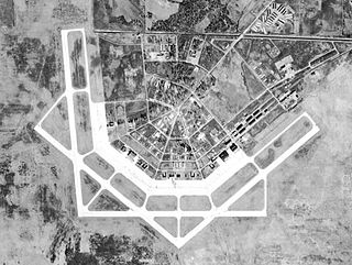
Selman Army Airfield is an inactive United States Air Force base, approximately 7.7 miles east of Monroe, Louisiana. It was active during World War II as an Army Air Forces Training Command airfield. It was closed on 1 September 1945.

<span class="mw-page-title-main">Hesler-Noble Field</span> Airport in Jones County, Mississippi

Hesler-Noble Field is a public airport in Jones County, Mississippi. It is owned by Laurel Airport Authority and is three miles southwest of Laurel, Mississippi.

<span class="mw-page-title-main">Stuttgart Army Air Field (Arkansas)</span> Former airfield in Arkansas, United States

Stuttgart Army Airfield is a former World War II military airfield, located 7 miles north of Stuttgart, Arkansas. It operated as an advanced pilot training school for the United States Army Air Forces from 1942 until 1945.

<span class="mw-page-title-main">San Angelo Army Air Field</span> World War II Army air field in Texas

San Angelo Army Airfield is an inactive United States Air Force base, about 8 miles south-southwest of San Angelo, Texas. It was active during World War II as a training airfield. It was closed on 30 November 1945.

<span class="mw-page-title-main">Independence Army Airfield</span>

Independence Army Airfield was a World War II training base of the United States Army Air Forces Central Flying Training Command (CFTC). It is currently the city-owned Independence Municipal Airport.

<span class="mw-page-title-main">Courtland Army Airfield</span> Former US Army airfield in Alabama

Courtland Army Airfield is a former United States Army facility located two nautical miles northeast of the central business district of Courtland, a town in Lawrence County, Alabama, United States.

<span class="mw-page-title-main">Desert Center Airport</span> Airport in California, United States

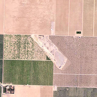
Desert Center Airport is a private-use airport located five nautical miles northeast of the central business district of Desert Center, in Riverside County, California, United States.

<span class="mw-page-title-main">Eagle Pass Army Airfield</span> World War II US military installation

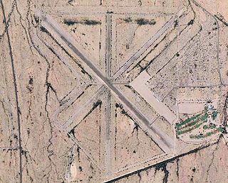
Eagle Pass Army Airfield is a former World War II military airfield complex. It is located 10.6 miles (17.1 km) north of Eagle Pass, Texas. It operated as a training base for the United States Army Air Forces from 1943 until 1945.

<span class="mw-page-title-main">Herington Army Air Field</span>

Herington Army Airfield was a World War II staging base of the United States Army Air Forces Second Air Force. It is currently the city-owned Herington Regional Airport.

References

PD-icon.svg This article incorporates public domain material from the Air Force Historical Research Agency