Related Research Articles

Salem, natively spelt as Selam, is a major city in Salem district, located on the banks of the Thirumanimutharu river in the Indian state of Tamil Nadu. Salem is the fifth largest urban agglomeration in the state, exceeded by Chennai, Coimbatore, Madurai, and Tiruchirappalli, and third largest metropolitan region in the state only after to Chennai and Coimbatore metropolitan regions. The city is 124 km2 (48 sq mi) large. Major products of Salem include silver anklets, sago, mangoes, steel, and textiles.


Erode is a city in the Indian state of Tamil Nadu. Erode is the seventh largest urban agglomeration in the state, after Chennai, Coimbatore, Madurai, Tiruchirapalli, Tiruppur and Salem. It is also the administrative headquarters of the Erode district. Administered by a city municipal corporation since 2008, Erode is a part of Erode Lok Sabha constituency that elects its member of parliament. Located on the banks of River Kaveri, it is situated centrally on South Indian Peninsula, about 400 kilometres (249 mi) southwest of its state capital Chennai, 250 kilometres (155 mi) south of Bengaluru, 100 kilometres (62 mi) east of Coimbatore and 275 kilometres (171 mi) east of Kochi. Erode is an agricultural, textile and a BPO hub and among the largest producers of turmeric, hand-loom and knitwear, and food products.

Thyagaraya Nagar, commonly known as T. Nagar, and historically known as East Mambalam, is a very affluent commercial and residential neighbourhood in Chennai, Tamil Nadu, India. It is surrounded by Nungambakkam in the North, Teynampet in the East, Nandanam in the South-East, C.I.T. Nagar in the South and West Mambalam and Kodambakkam in the West. The stretch between Duraiswamy Road and T. Nagar Bus Stand has some of the costliest real estates in Chennai. It was constructed between 1923 and 1925 by the Madras Presidency government of the Raja of Panagal as a part of town planning activities initiated according to the Madras Town Planning Act of 1920. The town was named after P. Thyagaraya Chetty. The streets, parks and localities in the new neighbourhood were named after important officials in the provincial government.
Panruti is a developing city, municipality and taluk headquarters of Cuddalore district, Tamil Nadu, India. Panruti is located between Cuddalore and Neyveli. Panruti is famous for jackfruits and cashew nuts. The jackfruit grown here is exported worldwide and is very sweet. It is a business capital of Cuddalore district. Kananchavadi one of the villages in panruti taluk, famous for palm juice. It has been a great commercial area for more than 200 years. The name Panruti came from the Tamil words "Pann" and "Urutti" meaning "composing song and music", as the place is where many saints and great religious singers such as nayanmars and vainavas sung. A 150-year-old government school was built here by the British East India Company and a more-than-1000-year-old temple Veerattaneswarar temple is nearby in Thiruvathigai. As of 2011, the town had a population of 60,323.
Aluva is a region in Kochi City in Kerala, India. It is also a part of the Kochi metropolitan area and is situated around 15 km (9.3 mi) from the city center on the banks of Periyar River. A major transportation hub, with easy access to all major forms of transportation, Aluva acts as a corridor which links the highland districts to the rest of Kerala. Cochin International Airport at Nedumbassery is 11.7 km from Aluva. Aluva is accessible through rail, air, metro along with major highways and roadlines. Aluva KSRTC bus station is an important transport hub in Kerala and one of the busiest stations in central part of the state.

Conjeevaram Natarajan Annadurai, popularly known as Anna, also known as Arignar Anna or Perarignar Anna, was an Indian politician who served as the fourth and last Chief Minister of Madras State from 1967 until 1969 and first Chief Minister of Tamil Nadu for 20 days before his death. He was the first member of a Dravidian party to hold either post.
Cumbum, natively spelt as Kambam, is a town and municipality in Theni district, an Indian state of Tamil Nadu.

Anna Salai, formerly known as St. Thomas Mount Road or simply Mount Road, is an arterial road in Chennai, India. It starts at the Cooum Creek, south of Fort St George, leading in a south-westerly direction towards St. Thomas Mount, and ends at the Kathipara Junction in Guindy. Beyond the Kathipara Junction, a branch road arises traversing westwards to Poonamallee to form the Mount-Poonamallee Road while the main branch continuing southwards to Chennai Airport, Tambaram and beyond to form Grand Southern Trunk Road. Anna Salai, which is more than 400 years old, is acknowledged as the most important road in Chennai city. The head offices of many commercial enterprises and public buildings are located along Anna Salai. It is the second longest road in Chennai, after EVR Periyar Salai.

Gandhipuram is a major place of the Coimbatore city in Tamil Nadu, India. It is named after Mahatma Gandhi. It was previously known as "Katoor".
K. K. Nagar or Kalaignar Karunanidhi Nagar is a residential part of Tiruchirappalli City in Tamil Nadu, India. The K.K. Nagar neighbourhood is near the Tiruchirappalli International Airport, and is the most densely populated ward in the city and also the most populous ward in the city of Tiruchirapalli. It is a part of T.C.C since 1994.
EVR Periyar Salai (EVR High Road), earlier known as Poonamallee High Road(NH 48) and originally the Grand Western Trunk Road, is an arterial road in Chennai, India. It is the longest road in Chennai. Running from east to west, the 14-kilometre (8.7 mi) road starts at Muthuswamy Bridge near Madras Medical College at Park Town and ends near Maduravoyal Junction via Kilpauk, Aminjikarai, Anna Nagar Arch, Arumbakkam, Koyambedu. It further continues west towards Poonamallee and traverses Sriperumbudur, Walajapet, and Ranipet.
Tiruppur or Tirupur is a city in the Indian state of Tamil Nadu. Tiruppur is the administrative headquarters of Tiruppur district and the seventh largest city as well as an urban agglomeration in Tamil Nadu. Located on the banks of Noyyal River, it has been ruled at different times, by the Early Pandyas, Medieval Cholas, Later Cholas, Mysore Kingdom and the British. It is about 450 kilometres (280 mi) southwest of the state capital Chennai about 50 kilometres (31 mi) east of Coimbatore 50 kilometres (31 mi) south of Erode and 50 kilometres (31 mi) north of Dharapuram.
Moolapalayam is a neighborhood located in the southern side of Erode, Tamil Nadu. It is one of the major residential locality in the city.
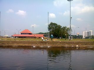
V.O.Chidambaranar Park or VOC Park is a recreational park located in the South Indian city of Erode in Tamil Nadu. The park is owned and maintained by Erode Municipal Corporation. This park was built in British India period by chairman Srinivasa Mudaliar. This park was previously known as Srinivasaa Park
Sivaji Ganesan memorial is a memorial for veteran Tamil actor Sivaji Ganesan, located in Chennai, India. It is located on Durgabai Deshmukh Road in Adyar, a southern neighbourhood of the city. He was born on October 1, 1928, and died on July 21, 2001.
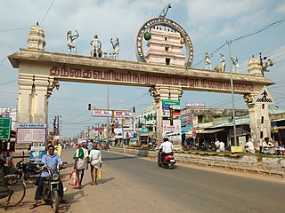
Erode Clock Tower is a clock tower located in Erode, Tamil Nadu, India also known as Manikkoondu.
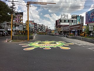
Perundurai Road is one of the major arterial roads in the city of Erode in India. Running from East to West of the city, the road starts from Amma Flyover near Thanthai Periyar Government Hospital and terminates near the western suburb Perundurai. This 17 km stretch of this road further extends to the west connecting SIPCOT Industrial Park and enables further connectivity to Coimbatore and Kochi as NH 544. The commercial and residential establishments along this road make it as the growth identifier of Erode, forecasting the development towards the west. The width of the road is making it four-lane to most of the stretch while few km near the western end is wider to six-lane carriageway.
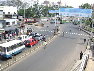
Thanthai Periyar Government Hospital is a public health care facility situated in Erode, Tamil Nadu. Also known as Government Headquarters Hospital (GHQH)-Erode is a District Headquarters Hospital. It is located at the center of the city, off the arterial road connecting Erode Junction with Central Bus Terminus, Erode.
References
- ↑ "பன்னீர்செல்வம் பார்க் பெயர் மாறியது எப்படி?". Dinakaran. Retrieved 7 August 2018.
- ↑ "Periyar, Anna statues to be shifted to a safer place". The Hindu . Retrieved 7 August 2018.
- ↑ "Stalin in Erode tomorrow". The Hindu . Retrieved 7 August 2018.
- ↑ "Deepavali shoppers throng roads in Erode". The Hindu . Retrieved 7 August 2018.
- ↑ "Plea for installing Thiruvalluvar statue". The Hindu . Retrieved 7 August 2018.