Nadolna Karczma is a village in the administrative district of Gmina Tuchola, within Tuchola County, Kuyavian-Pomeranian Voivodeship, in north-central Poland. It lies approximately 11 kilometres (7 mi) north of Tuchola and 65 km (40 mi) north of Bydgoszcz.

Różaniec is a village in the administrative district of Gmina Tarnogród, within Biłgoraj County, Lublin Voivodeship, in eastern Poland. It lies approximately 9 kilometres (6 mi) south-east of Tarnogród, 26 km (16 mi) south of Biłgoraj, and 104 km (65 mi) south of the regional capital Lublin.

Ciołki is a village in the administrative district of Gmina Horodło, within Hrubieszów County, Lublin Voivodeship, in eastern Poland, close to the border with Ukraine. It lies approximately 6 kilometres (4 mi) south-west of Horodło, 8 km (5 mi) north-east of Hrubieszów, and 107 km (66 mi) south-east of the regional capital Lublin.

Łubice is a village in the administrative district of Gmina Wyszki, within Bielsk County, Podlaskie Voivodeship, in north-eastern Poland.

Dziadówek is a village in the administrative district of Gmina Wiżajny, within Suwałki County, Podlaskie Voivodeship, in north-eastern Poland, close to the border with Lithuania. It lies approximately 10 kilometres (6 mi) south of Wiżajny, 26 km (16 mi) north of Suwałki, and 134 km (83 mi) north of the regional capital Białystok.

Dańków is a village in the administrative district of Gmina Biała Rawska, within Rawa County, Łódź Voivodeship, in central Poland. It lies approximately 5 kilometres (3 mi) north-east of Biała Rawska, 21 km (13 mi) east of Rawa Mazowiecka, and 74 km (46 mi) east of the regional capital Łódź.

Poręba is a village in the administrative district of Gmina Gnojno, within Busko County, Świętokrzyskie Voivodeship, in south-central Poland. It lies approximately 3 kilometres (2 mi) north of Gnojno, 20 km (12 mi) north-east of Busko-Zdrój, and 34 km (21 mi) south-east of the regional capital Kielce.

Piasek Mały is a village in the administrative district of Gmina Solec-Zdrój, within Busko County, Świętokrzyskie Voivodeship, in south-central Poland. It lies approximately 6 kilometres (4 mi) north-west of Solec-Zdrój, 12 km (7 mi) south-east of Busko-Zdrój, and 57 km (35 mi) south of the regional capital Kielce.

Zajączków is a village in the administrative district of Gmina Piekoszów, within Kielce County, Świętokrzyskie Voivodeship, in south-central Poland. It lies approximately 9 kilometres (6 mi) west of Piekoszów and 19 km (12 mi) west of the regional capital Kielce.

Sokół is a village in the administrative district of Gmina Grębów, within Tarnobrzeg County, Subcarpathian Voivodeship, in south-eastern Poland. It lies approximately 3 kilometres (2 mi) north-west of Grębów, 11 km (7 mi) east of Tarnobrzeg, and 62 km (39 mi) north of the regional capital Rzeszów.

Podwierzbie is a village in the administrative district of Gmina Żelechów, within Garwolin County, Masovian Voivodeship, in east-central Poland. It lies approximately 5 kilometres (3 mi) west of Żelechów, 19 km (12 mi) south-east of Garwolin, and 75 km (47 mi) south-east of Warsaw.

Króle Małe is a village in the administrative district of Gmina Andrzejewo, within Ostrów Mazowiecka County, Masovian Voivodeship, in east-central Poland. It lies approximately 8 kilometres (5 mi) west of Andrzejewo, 14 km (9 mi) east of Ostrów Mazowiecka, and 102 km (63 mi) north-east of Warsaw.

Mollalar is a village in the Agdam Rayon of Azerbaijan.

Skowronek is a settlement in the administrative district of Gmina Lubichowo, within Starogard County, Pomeranian Voivodeship, in northern Poland. It lies approximately 6 kilometres (4 mi) west of Lubichowo, 19 km (12 mi) south-west of Starogard Gdański, and 61 km (38 mi) south of the regional capital Gdańsk. The name means "lark" in Polish.

Dąbrówka Pruska is a village in the administrative district of Gmina Mikołajki Pomorskie, within Sztum County, Pomeranian Voivodeship, in northern Poland. It lies approximately 3 kilometres (2 mi) west of Mikołajki Pomorskie, 10 km (6 mi) south-east of Sztum, and 66 km (41 mi) south-east of the regional capital Gdańsk.

Białka is a village in the administrative district of Gmina Biały Bór, within Szczecinek County, West Pomeranian Voivodeship, in north-western Poland. It lies approximately 5 kilometres (3 mi) south of Biały Bór, 19 km (12 mi) north-east of Szczecinek, and 158 km (98 mi) east of the regional capital Szczecin.

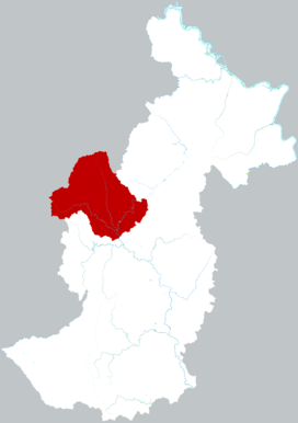
Youhao (help·info) District is a district of the prefecture-level city of Yichun, Heilongjiang province, China.
Sandåkerns IP was a football stadium in Umeå, Sweden and the former home stadium for the football teams Umeå IK and Umeå FC
Azadi is a village in Howmeh-ye Gharbi Rural District, in the Central District of Dasht-e Azadegan County, Khuzestan Province, Iran. At the 2006 census, its population was 45, in 6 families.
The Giswil Tunnel is a tunnel in central Switzerland. The tunnel bypasses the town of Giswil in the canton of Obwalden, and forms part of the A8 motorway. The tunnel was completed in 2004, and is 2,066 metres (6,778 ft) long.


