
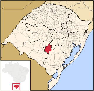
Rio Grande do Sul is a state in the southern region of Brazil. It is the fifth-most-populous state and the ninth largest by area. Located in the southernmost part of the country, Rio Grande do Sul is bordered clockwise by Santa Catarina to the north and northeast, the Atlantic Ocean to the east, the Uruguayan departments of Rocha, Treinta y Tres, Cerro Largo, Rivera and Artigas to the south and southwest, and the Argentine provinces of Corrientes and Misiones to the west and northwest. The capital and largest city is Porto Alegre. The state has the highest life expectancy in Brazil, and the crime rate is relatively low compared to the Brazilian national average. Despite the high standard of living, unemployment is still high in the state, as of 2017. The state has 5.4% of the Brazilian population and it is responsible for 6.6% of the Brazilian GDP.
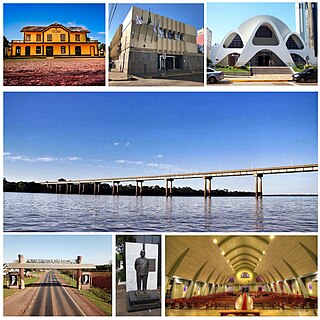
São Borja is a city in the Brazilian state of Rio Grande do Sul. São Borja is the oldest municipality in the Brazilian state of Rio Grande do Sul and was founded in 1682 by the Jesuits as the first of the Seven Points of the Missions, and named São Francisco de Borja, in honor of Saint Francis Borgia.

Rio Grande is a municipality (município) and one of the oldest cities in the Brazilian state of Rio Grande do Sul. It was the state capital from 1835 to 1845. It is the most important port city in the state and has one of the most important maritime ports in Brazil.
Caçapava do Sul is a Brazilian municipality in the state of Rio Grande do Sul, located on the banks of the Camaquã River. As of 2020, the city has an estimated population of 33,548. It was the 2nd capital of the Piratini Republic from 1839 to 1840.

Lavras do Sul is a Brazilian municipality in the southwestern part of the state of Rio Grande do Sul. It is in the Campanha Meridional micro-region and the Sudoeste Rio-Grandense meso-region. The population is 7,444 in an area of 2600.60 km². The Camaquã River flows through the municipality.
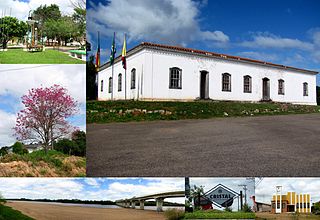
Cristal is a Brazilian municipality in the southeastern part of the state of Rio Grande do Sul. The population is 8,067 in an area of 681.63 km². The Camaquã River flows through the municipality.

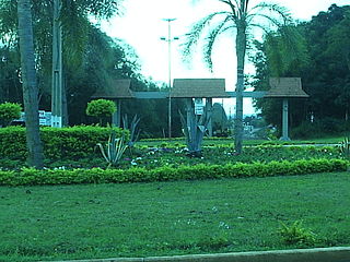
Amaral Ferrador is a municipality in the state of Rio Grande do Sul, Brazil. The population is 7,085 in an area of 506.46 km². It is situated on the Camaquã River.

Cambará do Sul is a municipality in the state of Rio Grande do Sul, Brazil. Its population was approximately 6,406 in 2020. It has an area of approximately 1212 km².

Caraá is a municipality in the state of Rio Grande do Sul, Brazil where Rio dos Sinos' river rises. It was originally part of the city Santo Antônio da Patrulha, emancipated on December 28, 1995.

Charqueadas is a municipality in the state of Rio Grande do Sul, Brazil. It is located on the southern side of the Jacuí River, in the eastern-central part of the state. The city is 57 km (35 mi) west of the state capital and most populous city, Porto Alegre, and belongs to its metropolitan area. The area of the municipality is 214.80 km2 (82.93 sq mi), and it have a population of 41,258, making it the largest municipality by population in the region. It borders to the south Arroio dos Ratos, to the north Triunfo, to the east Eldorado do Sul and to the west São Jerônimo.

Eldorado do Sul is a municipality in the state of Rio Grande do Sul, Brazil. It is located in the metropolitan area of Porto Alegre, the state's capital and largest city, opposite the capital on the right bank of Guaíba River. Population: 41,902.
Guarani das Missões is a municipality in the state of Rio Grande do Sul, Brazil.
Mariano Moro is a municipality in the state of Rio Grande do Sul, Brazil.

Muçum is a small town in the state of Rio Grande do Sul, Brazil.

Nova Palma is a municipality in the state of Rio Grande do Sul, Brazil.

Planalto is a municipality in the state of Rio Grande do Sul, Brazil, located at 27°19′44″S53°03′31″W, at an elevation of 568 meters above sea level. It has a total area of 237.35 km². Its estimated population in 2020 was 10,019 inhabitants.

São Jerônimo is a municipality in the state of Rio Grande do Sul, Brazil.
This page is based on this
Wikipedia article Text is available under the
CC BY-SA 4.0 license; additional terms may apply.
Images, videos and audio are available under their respective licenses.
