Rhosllanerchrugog is a village and community in Wrexham County Borough, Wales. It lies within the historic county of Denbighshire. The entire built-up area including Penycae, Ruabon and Cefn Mawr had a population of 25,362.

The A482 road is in Ceredigion and Carmarthenshire, Wales. It links Aberaeron at the junction with the A487 road with the A40 road at Llanwrda near Llandovery. It is 29 miles (47 km) long.
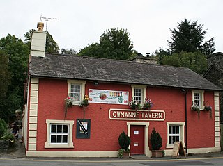
Cwmann is a small village in Carmarthenshire, Wales, in the community of Pencarreg. It is just on the border with Ceredigion and near Lampeter, with Cwmann being on the Carmarthenshire side of the border. The population in 2011 was around 872.

Ystrad Aeron is a small village west of Felinfach on the A482 between Lampeter and Aberaeron, Ceredigion, Wales. It is part of the constituent community of Llanfihangel Ystrad.
Llanfihangel-ar-Arth is a village and community in the county of Carmarthenshire, Wales.

Llanilar is a village and community in Ceredigion, Wales, about 4 kilometres (2.5 mi) southeast of Aberystwyth. It is the eponym of the hundred of Ilar. The population at the 2011 census was 1,085. The community includes Rhos-y-garth.
The Wrexham-Rhos transmitting station is a digital television relay of Moel-y-Parc, and forms part of the Wales television region. Despite its name, the station is situated in Moss Village and serves the city of Wrexham, the northern area of Wrexham County Borough and south-western Flintshire. It is a free-standing lattice tower structure serving around 85,000 homes which are unable to receive broadcasts from Moel-y-Parc due to Hope Mountain.

The A475 road in Wales links Newcastle Emlyn in Carmarthenshire with Lampeter in Ceredigion; a distance of 19 miles (31 km).

Cynwyl Gaeo is a parish and community located in rural Carmarthenshire, Wales, near the boundary with Ceredigion, in the upper Cothi valley about halfway between Lampeter and Llandovery. The population of the village at the United Kingdom Census 2011 was 940. It includes the villages of Caio (Caeo), Crug-y-bar, Cwrtycadno, Ffarmers and Pumsaint.

Pencarreg is a village and community located in Carmarthenshire, Wales, 4 miles (6.4 km) to the south-west of Lampeter.

The River Dulas is a tributary of the River Teifi and has its source near the village of Llangybi, Ceredigion, Wales. Its confluence with the Teifi is near Lampeter.
Lampeter railway station, on the Carmarthen to Aberystwyth Line in Wales, was built to serve the town of Lampeter. It opened in 1866, six years after the line, which reached Aberystwyth in August 1867.
Silian, originally Sulien, is a village in the valley of the River Teifi, Ceredigion, Wales. It is located approximately two miles north-west of Lampeter, on a minor road connecting Pont Creuddun on the A482, and Glan Denys on the A485.
Ffarmers is a village near Lampeter, in the north of Carmarthenshire, Wales. It was named after the old "Farmers' Arms" public house, which is now closed. The double "f" in the name comes from the Welsh language spelling of the "f" sound in "farmers". The village stands on the old Roman road, Sarn Helen, which was used by cattle drovers to take their livestock from Wales to Smithfield market in London.
Lampeter Castle, sometimes known as Stephen's Castle, was built during the Norman expansion into Wales at the end of the eleventh century. The motte is in the grounds of Lampeter University but the precise whereabouts of the bailey is unknown. It was captured by Cadell ap Gruffydd in 1146.

Betws Bledrws, is a village between Lampeter and Llangybi, Ceredigion, Wales that was also known as Derry Ormond when under the influence of Derry Ormond Mansion. Situated on the on the valley floor of the River Dulas, approximately 3 miles (4.8 km) north of Lampeter and a mile or so to the southwest of the village of Llangybi, on the road from Tregaron to Lampeter.