Parish of Cowan

Last updated

Map showing the Parish of Cowan, 1886. County of Cumberland (North) New South wales.png
Map showing the Parish of Cowan, 1886.
Berowra_Park. Berowra Park.jpg
Berowra_Park.

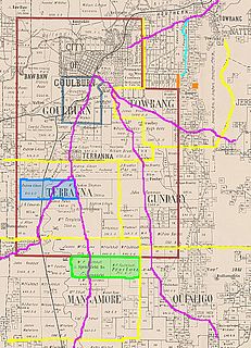
The Parish of Cowan, is a civil parish of the County of Cumberland.

Civil parish Territorial designation and lowest tier of local government in England

In England, a civil parish is a type of administrative parish used for local government, they are a territorial designation which is the lowest tier of local government below districts and counties, or their combined form, the unitary authority. Civil parishes can trace their origin to the ancient system of ecclesiastical parishes which historically played a role in both civil and ecclesiastical administration; civil and religious parishes were formally split into two types in the 19th century and are now entirely separate. The unit was devised and rolled out across England in the 1860s.

The Parish is in the Hundred of Dundas and Hornsby Shire Council. The parish is on the Hawkesbury River. [2]

Hawkesbury River river in New South Wales, Australia

The Hawkesbury River, is a semi–mature tide dominated drowned valley estuary located to the west and north of Sydney, New South Wales, Australia. The Hawkesbury River and its associated main tributary, the Nepean River, virtually encircle the metropolitan region of Sydney.

Cowan is believed to be an Aboriginal word meaning 'opposite', 'other side' [3] or 'big water'. [4] in the language of the Guringgai tribe, a Sydney Aboriginal Clan of the area.

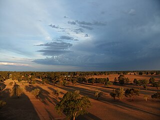
Today much of the parish is National Park, though the towns of Cowan and Brooklyn, New South Wales are in the Parish.

Brooklyn, New South Wales Town in New South Wales, Australia

Brooklyn is a town in the state of New South Wales, Australia, in the local government area of Hornsby Shire with the population of 722 as of the 2016 census. Brooklyn is surrounded by the Muogamarra nature reserve and occupies a strip of waterfront along the southern bank of the Hawkesbury River.

The Sydney to Newcastle Freeway and Central Coast and Sydney to Newcastle Railway Lines pass through the Parish.

Pacific Motorway (Sydney–Newcastle) motorway in New South Wales

The M1 Pacific Motorway, also known by the former names F3 Freeway, Sydney–Newcastle Freeway, and Sydney–Newcastle Expressway; is a 127 km (79 mi) stretch of freeway linking Sydney to the Central Coast, Newcastle and Hunter regions of New South Wales. It is part of the AusLink road corridor between Sydney and Brisbane. The name "F3 Freeway", reflects its former route allocation, but is commonly used by both the public and the government to refer to the roadway long after the route allocation itself was no longer in use.

Central Coast & Newcastle Line rail service in New South Wales, Australia

The Central Coast & Newcastle Line is a NSW TrainLink passenger train service that runs along the Main North railway line in New South Wales, connecting the state's two largest cities, Sydney and Newcastle. The service runs from Central through to Broadmeadow on the Main North railway line to Newcastle Interchange on the Newcastle railway line, and services the Hawkesbury River region, the Central Coast and the city of Newcastle.

See also

Cowan, New South Wales Suburb of Hornsby Shire, New South Wales, Australia

Cowan is a small town and suburb near Sydney, in the state of New South Wales, Australia, approximately 40 kilometres (25 mi) north of the Sydney central business district, in the local government area of Hornsby Shire. It is described by some as part of the loosely defined North Shore region. Cowan shares the postcode of 2081 with Berowra. Brooklyn, which lies 6 kilometres (3.7 mi) to the north-east of Cowan, is considered the northernmost suburb of the Greater Sydney Metropolitan Area.

Related Research Articles

Ku-ring-gai Chase National Park Protected area in New South Wales, Australia

The Ku-ring-gai Chase National Park is a protected national park that is located in New South Wales, Australia. The 14,977-hectare (37,010-acre) national park is situated 25 kilometres (16 mi) north of Sydney located largely within the Ku-ring-gai, Hornsby, and the Northern Beaches Council local government areas. The villages of Cottage Point, Appletree Bay, and Bobbin Head are located within park boundaries. An isolated portion of the park, Barrenjoey Headland, is located to the north of Palm Beach east of the primary park body and is home to Barrenjoey Lighthouse.

County of Cumberland, New South Wales Cadastral in New South Wales, Australia

Cumberland County is a county in the State of New South Wales, Australia. Most of the Sydney metropolitan area is located within the County of Cumberland.

Glenrock Lagoon lagoon in Australia

Glenrock Lagoon, an intermediate freshwater small coastal creek, is located within the Lake Macquarie local government area in the Newcastle and Hunter regions of New South Wales, Australia. The lake is located near the Newcastle suburbs of Adamstown and Dudley and is situated about 153 kilometres (95 mi) north of Sydney.

Pittwater estuary in Sydney, Australia

Pittwater is a semi–mature tide dominated drowned valley estuary, located about 40 kilometres (25 mi) north of the Sydney central business district, New South Wales, Australia; being one of the bodies of water that separate greater Metropolitan Sydney from the Central Coast.

Lyndall Ryan, is an Australian academic and historian. She has held positions in Australian Studies and Women's Studies at Griffith University and Flinders University and was Foundation Professor of Australian Studies and Head of School of Humanities at the University of Newcastle, 1998–2005. She is currently Conjoint Professor in the Centre for the History of Violence at the University of Newcastle.

Lands administrative divisions of Australia

Lands administrative divisions of Australia are the cadastral divisions of Australia for the purposes of identification of land to ensure security of land ownership. Most states term these divisions as counties, parishes, hundreds, and other terms. The eastern states of Queensland, New South Wales, Victoria and Tasmania were divided into counties and parishes in the 19th century, although the Tasmanian counties were renamed land districts in the 20th century. Parts of South Australia (south-east) and Western Australia (south-west) were similarly divided into counties, and there were also five counties in a small part of the Northern Territory. However South Australia has subdivisions of hundreds instead of parishes, along with the Northern Territory, which was part of South Australia when the hundreds were proclaimed. There were also formerly hundreds in Tasmania. There have been at least 600 counties, 544 hundreds and at least 15,692 parishes in Australia, but there are none of these units for most of the sparsely inhabited central and western parts of the country.

Parish of Tarago Cadastral in New South Wales, Australia

The Parish of Tarago is a parish of Argyle County. It does not actually contain the town of Tarago, which is located further to the south-east in the Parish of Mulwaree.

The Parish of Wologorong is a parish of Argyle County, New South Wales, Australia.

Parish of Milbang Cadastral in New South Wales, Australia

The Parish of Milbang is a parish of Argyle County, New South Wales, Australia, located at 34.4954°S 149.2604°E

Parish of Terranna Cadastral in New South Wales, Australia

The Parish of Terrana is a parish of Argyle County, New South Wales, Australia.

Naman, New South Wales New South Wales, Australia

Naman, New South Wales is a bounded rural locality of Coonamble Shire and a civil parish of Gowen County, New South Wales.

Youlbung, New South Wales New South Wales, Australia

Youlbung, New South Wales is a bounded rural locality of Gilgandra Shire and a civil parish of Gowen County, a cadastral division of New South Wales.

Breelong, New South Wales New South Wales, Australia

Breelong, New South Wales is a bounded rural locality of Gilgandra Shire and a civil parish of Gowen County, New South Wales.

Callangoan, New South Wales

Callangoan, New South Wales is a bounded rural locality of Coonamble Shire, and a civil parish of Gowen County, a county of New South Wales.

Nandi, New South Wales

Nandi Parish is a bounded rural locality and civil parish of Gowen County, in New South Wales.

Mullengudgery, New South Wales State suburb in New South Wales, Australia

Mullengudgery Parish, New South Wales is a rural locality of Bogan Shire and a civil parish of Oxley County, New South Wales, a Cadastral divisions of New South Wales.

Beelban Parish, New South Wales

Beelban Parish, New South Wales is a rural locality of Warren Shire and a civil parish of Oxley County, New South Wales, a Cadastral divisions of New South Wales.

Carual, New South Wales Suburb of Warren Shire, New South Wales, Australia

Carual, New South Wales also known as Carval is a civil parish and rural locality of New South Wales located at 31°37'54.0"S 147°44'04.0"E.

Egelabra, New South Wales New South Wales, Australia

Egelabra, New South Wales is a civil parish and rural locality of New South Wales located at 31°47′54″S 147°50′04″E.

References

  1. John Sands, 1886 map.
  2. PL Bemi, Map of the Parish of Gidley, 1822 (Surveyor General's Dept of New South Wales (signed) Edward Knapp LS).
  3. Joan Rowland (2008) ,"Cowan". Dictionary of Sydney. Retrieved 26 September 2015.
  4. "PLACE NAMES". The Australian Women's Weekly . National Library of Australia. 13 May 1964. p. 61. Retrieved 22 February 2011.