Pasur, Coimbatore

Last updated

Pasur is a gram panchayat in the Coimbatore district of Tamil Nadu, India. [1]

A gram panchayat is the only grassroots-level of panchayati raj formalised local self-governance system in India at the village or small-town level, and has a sarpanch as its elected head.

Coimbatore district Place in Tamil Nadu, India

Coimbatore District is a district in the Kongu Nadu region of the state of Tamil Nadu. Coimbatore is the administrative headquarters of the district. It is one of the most industrialized districts and a major textile, industrial, commercial, educational, information technology, healthcare and manufacturing hub of Tamil Nadu. The region is bounded by Tiruppur district in the east, Nilgiris district in the north, Erode district in the north-east, Palghat district and Idukki district of neighboring state of Kerala in the west and south respectively. As of 2011, Coimbatore district had a population of 3,458,045 with a sex-ratio of 1,000 and literacy rate of 84%.

Tamil Nadu State in Southern India

Tamil Nadu, formerly Madras State, is one of the 29 states of India. Its capital and largest city is Chennai. Tamil Nadu lies in the southernmost part of the Indian subcontinent and is bordered by the union territory of Puducherry and the South Indian states of Kerala, Karnataka, and Andhra Pradesh. It is bounded by the Eastern Ghats on the north, by the Nilgiri Mountains, the Meghamalai Hills, and Kerala on the west, by the Bay of Bengal in the east, by the Gulf of Mannar and the Palk Strait on the southeast, and by the Indian Ocean on the south. The state shares a maritime border with the nation of Sri Lanka.

Contents

History

The name Pasur literally means place of cows.[ citation needed ] It is also known as Kovil Nagaram, meaning temple town, because it has more than ten Hindu temples and also a mosque near by Allikulathottam.[ citation needed ]

Pasur has a history dated back to 14th century, when people settled in the area during the time of the Vijayanagara Empire.[ citation needed ]

Vijayanagara Empire Hindu kingdom in Southern India (14th–17th century)

The Vijayanagara Empire was based in the Deccan Plateau region in South India. It was established in 1336 by Harihara I and his brother Bukka Raya I of Sangama Dynasty. The empire rose to prominence as a culmination of attempts by the southern powers to ward off Islamic invasions by the end of the 13th century. It lasted until 1646, although its power declined after a major military defeat in the Battle of Talikota in 1565 by the combined armies of the Deccan sultanates. The empire is named after its capital city of Vijayanagara, whose ruins surround present day Hampi, now a World Heritage Site in Karnataka, India. The writings of medieval European travelers such as Domingo Paes, Fernão Nunes, and Niccolò Da Conti, and the literature in local languages provide crucial information about its history. Archaeological excavations at Vijayanagara have revealed the empire's power and wealth.

The famous Koothu (story of prakalnath- Hindu god vishnu) is performed here during 18th centuries. Koothu (street dramas) by and by disappeared from village due to younger generation failed to continue the age old KOOTHU. Pasur is also famous for its vishnu Bajjans, every Saturday Bajjan's has been performed by famous singers of the village. Bajjans also slowly disappearing from village due to lack of interest among younger generation.[ citation needed ]

Koothu dance

Koothu or Therukoothu (jwalith)(Tamil: கூத்து), is an ancient art, where artists play songs with dance and music in storytelling the epics, performed in Tamil; it is a folk art originated from the early Tamil country. But more precisely Koothu refers to either Terukuttu (Tamil:தெருக்கூத்து) or Kattaikkuttu. The terms Terukkuttu and Kattaikkuttu are often used interchangeably in modern times; however, historically the two terms appear to have distinguished, at least in certain villages, between two different kinds of performance: while Terukkuttu referred to mobile performances in a procession, Kattaikkuttu denotes overnight, narrative performances at a fixed performance space. Koothu as a form of entertainment reached its peak hundreds of years ago in Tamil Nadu, as mentioned in the Sangam texts about the development of iyal (literature), isai (music) and natagam (drama). Going beyond just a means of entertainment, koothu educates the rural people about religion and their history.

Administration

There are six small villages in the Pasur panchayat:

Facilities

Pasur has a government welfare middle school, Indian bank, post office, VAO office, Panchayat office, government funded society, shops, hotels and bakeries. It has connectivity to Coimbatore and Sathyamangalam, via National Highway 209, and Avinashi. The nearest town is Annur from where its easy to commute to places like Ooty (direct buses), Mettupalayam, Thiruppur and others. The nearest railway stations are at Coimbatore and Mettupalayam.

Sathyamangalam Town in Tamil Nadu, India

Sathyamangalam is a town and municipality in Erode district in the Indian state of Tamil Nadu. It lies on the banks of river Bhavani, a tributary of River Cauvery in the foothills of the Western Ghats. It is about 65 km from Erode ,55 km from Tiruppur and 70 km from Coimbatore. As of 2011, the town had a population of 57,814.

Avinashi suburb in Tirupur, Tamil Nadu, India

Avinashi is a Special grade Town Panchayat and taluk headquarter in Tirupur district in the Indian state of Tamil Nadu. It is one of the fastest growing eastern suburb of Coimbatore. Avinashi is one among the seven taluks of Tirupur district. It is one of the popular pilgrim destination in Kongunadu region. Avinashi is located on National Highway NH544, which now bypasses the town. It is a town with rich cultural heritage and also coping up with the fast developments of the adjacent city. The history of the town is centred around the Avinasilingeswarar temple.

Annur Suburb in Coimbatore rural, Tamil Nadu, India

Annur is a town panchayat and taluk headquarters of Annur Taluk of Coimbatore district. It is a suburb of Coimbatore city located north-east about 30 kilometres from the center of the city. Nearest airport is Coimbatore International Airport, which is about 27 kilometres and the nearest railway station is Coimbatore Central, which is about 30 kilometres away. Other cities/towns nearby Annur are Mettupalayam, which is 21 kilometres away in the west, Avanashi, which is 18 kilometres away in the east and Punjai Puliampatti, which is about 18 kilometres in the north.Annur has police station with Karumathampatti sub division.

Nearby panchayaths are

Due to industrialization, Pasur developed rapidly during 2000 to 2010.[ citation needed ] The panchayat has four textile mills, an agriculture seed company and two engineering firms (automobile spares manufacturing companies in Kammala Thotti Palayam).[ citation needed ] There are also a few automobile companies, mainly LGB's (famous auto mobile company) subcontractors, are located in Kammala Thotti Palayam.[ citation needed ]

The people are mostly farmers and hand weavers[ citation needed ] but the younger generation are moving out to cities and abroad for jobs and higher studies.[ citation needed ].

Festivals

Thai Pongal, chithirai kani - Tamil varuda pirappu, Ugadi and Amman kovil festival. Pongal has been celebrated grandly in pasur, during pongal people from pasur gather at kuppayamman temple (200 years old small Amman temple) and do kummi kind of dance with singing song.

Related Research Articles

Arumanai City in Tamil Nadu, India

Arumana is a Panchayat town in Kanyakumari district in the state of Tamil Nadu, India.

Idikarai suburb in Coimbatore, Tamil Nadu, India

Idikarai is a panchayat town in Coimbatore district in the Indian state of Tamil Nadu. It is situated at the banks of Kousika River. The place is easily accessible by Road through public transportation.

Kanadukathan Town Panchayat in Tamil Nadu, India

Kanadukathan is a Town Panchayat in the Karaikudi Taluk of the Indian state of Tamil Nadu.

Kanjikoil Town Panchayat in Tamil Nadu, India

Kanjikoil is a panchayat town in Erode district in the Indian state of Tamil Nadu.The ancient name of the town is "Kanji Kooval" and it is called by the Name Kanji koil or Kanji Kovil.

Karamadai suburb in Coimbatore, Tamil Nadu, India

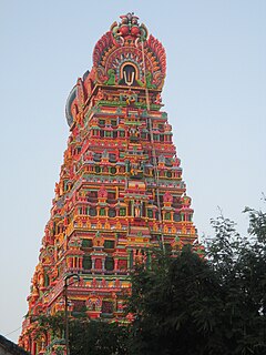
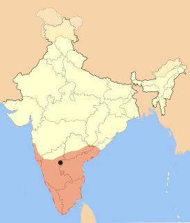
Karamadai is located near Mettupalayam, a suburb of Coimbatore in the Indian state of Tamil Nadu. It is a northern suburb of Coimbatore city, located on Coimbatore-Ooty NH 67. Nearby places are Teachers colony,Press Colony,Jodhipuram and Periyanaickenpalayam. The Ranganathaswamy temple and Nanjundeswarar temple are the most prominent landmarks in the town. The town of karamadai came into limelight due to the presence of ex-steel giant Sri Ramakrishna Steel Industries. Previously agricultural town became industrial due to the presence of Sri Ramakrishna Steel Industry.

Karumathampatti is a Town Panchayat suburb of Coimbatore city in the state of Tamil Nadu, India. It is one of the most developing suburb in Coimbatore about 25 km away from the city centre. It is situated in between NH47 which connects the city of Coimbatore with Salem - Erode - Tirupur and also in between the State Highway 165 connects Annur - Kamanaikenpalayam. Nearby places are Somanur-3 km, Avinashi-10 km, Tirupur-20 km, Sulur-15km, Annur-16km.Coimbatore -27,Mettupalayam-40,Palladam-19. Karumathampatti lies near the junction of two major roads, NH47(Coimbatore - Salem) and Karumathampatti - Annur road.

Kodumudi Taluk headquarters_Town in Tamil Nadu, India

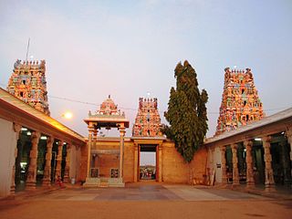
Kodumudi is a panchayat town and taluk headquarters of Kodumudi taluk in erode district at state of Tamil Nadu,India. Kodumudi has an average elevation of 144 metres (472 feet). Also kodumudi is an tourism spot. Holy kaveri river and Magudeswarar temple in Kodumudi attracts thousands of pilgrims daily across South India.

Mettupalayam, Coimbatore Town in Tamil Nadu, India

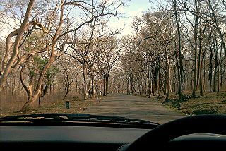
Mettupalayam is a taluk and municipality of Coimbatore Rural district, located to the north of the city of Coimbatore on the way to Ooty. It is located in the foot hills of Nilgiri hills about 35 km north of downtown Coimbatore and about 50 km north of Tiruppur,in the Indian state of Tamil Nadu. Mettupalayam is the third largest township in the district and one of the fast developing suburbs on the northern side of Coimbatore. As of 2011, the town had a population of 66,595.It is important for the nilgiri ghat road. There is a Facebook page in the name of Mettupalayam Memes which is the page which connects people live outside Mettupalayam through Facebook and Instagram and Events are mostly done by the which attracts people of Mtp and This page is said to be Friend of Mtp People to explore the prides of mettupalayam.

Minjur town in Tamil Nadu, India

Minjur is a neighbourhood in the northern fringes of Chennai, India. It is located in the Thiruvallur district in the Indian state of Tamil Nadu. Minjur is called 'Vada Kanchi' meaning North Kanchipuram. The town has two famous temples for Shiva and Vishnu, similar to Kanchipuram. The neighbourhood is served by Minjur railway station of the Chennai Suburban Railway Network.

Pethanaickenpalayam city in Tamil Nadu, India

Pethanaicken Palayam is a taluck in salem district in the Indian state of Tamil Nadu. It is a considered a major pilgrimage spot and tourist center. The population of the town as per 2011 census by population of the town 33,678.

Surandai city in Tamil Nadu, India

Surandai is a panchayat town in Tirunelveli district in the Indian state of Tamil Nadu.

Thenkarai, Coimbatore Suburb in Coimbatore, Tamil Nadu, India

Thenkarai is a suburban area in Coimbatore City Municipal Corporation, in the Indian state of Tamil Nadu. It is in the western suburbs of Coimbatore. It recently merged with the Coimbatore Corporation limits. Thenkarai is one of the town panchayats in Coimbatore and consists of small villages such as Sennanur, Mathipalayam, Karadimadai, Thaneer Panthal, Appachimaar Kovil, Challikkuzhi and Krishnavarayam Pudur.

Kaniyur, Tamil Nadu Panchayat town in Tamil Nadu, India

Kaniyur is a suburb of palani which is also a town panchayat in Tirupur District in the Indian state of Tamil Nadu. Kaniyur is also called Dravida Iyakkathin Thotti. It is one the 'K' village located near to [palani].

Nachandupatti Village in Tamil Nadu, India

Nachandupatti is a small town located 16 kilometres from Pudukkottai. Many members of the Nagarathar and Mutharaiyar groups are among its inhabitants. The town contains historic temples. Various festivals and religious ceremonies take place here. There are many small villages around Nachandupatti including Pudur and Kottur.

Vadamanappakkam village in Tamil Nadu, India

Vadamanappakkam is a village located in Tiruvannamalai district, Tamil Nadu, South India.

Somayanur Village Skyline in Tamil Nadu, India

Somayanur village is part of 22 Nanjundapuram Panchayat located in Coimbatore, Tamil Nadu, India. Somayanur village lies in the outskirts of Coimbatore City. Somayanur village will come under the Coimbatore Corporation, 22 Nanjundapuram panchayat. People in this village are engaged in agriculture business and cultivation of vegetables and coconuts. The brick business is the primary source of income around Chinnathdagam and surrounding areas. There are more than 1000 brick factories running in this area.

Bannari Town in Tamil Nadu, India

Bannari is a small village located at a distance of 12 km from Sathyamangalam town and 35 km from Gobichettipalayam town in Erode District and 82 km from Coimbatore city on Coimbatore-Bangalore NH 209 and it is close to Tamil Nadu and Karnataka border (20 km).

T.Subbulapuram Village in Tamil Nadu, India

T.Subbulapuram is a village in Andipatti Taluk in Theni District, Tamil Nadu State, India. It is located around 5 kilometres from the town of Andipatti, 20 kilometres from Theni, and 57 kilometres from Madurai.

References

  1. Beneficiary Abstract Habitation Level Report, National Social Assistance Programme, Government of India.